My account
Navigation loading…
Your experience on PreventionWeb

Please help us improve PreventionWeb by taking this brief survey. Your input will allow us to better serve the needs of the DRR community.

See the survey

Published on
13 April 2024
Status
Completed

Paving the way for building Resilience in Nepal: An initiative to understand and assess risk through the use of frontier technology

Expected duration
May 2020 - Jun 2021
SFVC commitment ID
20200613_001
Version
6.0
Author
Suraj Gautam
Upload your content

This commitment is implemented by the Institute of Himalayan Risk reduction (IHRR). Drones and geospatial technologies will be used to enhance disaster risk assessments and development planning at Hetauda Sub-Metropolitan City, Capital of Bagmati Province in Nepal.

    Description

    The mission of Institute of Himalayan Risk Reduction (IHRR) is to provide disaster risk reduction services in the communities of Nepal and other parts of the world. IHRR is also part of U-INSPIRE Nepal. This commitment aims to use drones, geospatial and other frontier technologies for enhancing disaster risk assessments and development planning, thus contributing to sustainability.

    To reach the goal of this commitment, IHRR is conducting an Aerial Survey using Unmanned Aerial Vehicles (UAVs) in one of the rapidly urbanizing cities of Nepal, Hetauda Sub-Metropolitan City in the capital of Bagmati Province - Nepal. This survey aims to capture high-resolution images of the city and develop the Digital Elevation Model (DEM) to carry out a number of risk assessments of the city. This will involve local volunteers and engage them with the application of Science, Engineering, Technology and Innovation (SETI) initiatives to implement the Sendai Framework.

    As a result, this commitment will produce 20 community champions (youth and young professionals familiarized with frontier technologies and their use on DRR), knowledge transfer to the Sub-Metropolitan City Office, and a map atlas about hazards, resources and risks.

    Did the Sendai Framework change or contribute to changes in your activities/organization? If so, how?

    Yes, Sendai Framework has helped in setting up a basic framework to set our objective and activities for sustainable risk reduction.
    IHRR believes in Understanding the Disaster Risk. Besides, the engagement of Youth and Young professionals ensures effective, and proactive participation in the preparedness, preparation, response, and recovery phases of the disaster cycle. Similarly, our focus is on the development of institutional capacities to strengthen governance in order to manage disaster risk.

    What led you to make this commitment/initiative?

    What was your position before making this Voluntary Commitment / prior to the Sendai Framework?

    The Coordination and Collaboration approach of our organization with the local government sets this initiative. We are committed to support and strengthen the institutional capacities of the government and organization to respond with potential hazards.

    We were only a research organization in the past. So, it is the time to utilize the learnings and expertise of the researchers and professionals towards the sustainable risk reduction.

    Deliverables and Progress report

    Deliverables

    Deliverables are the end-products of the initiative/commitment, which can include issuance of publications or knowledge products, outcomes of workshops, training programs, videos, links, photographs, etc.

    Sharing of Works in an International Conference
    Intended date of delivery
    1 July 2020

    American GeoPhysical Union (AGU) 2020

    Link
    https://agu.confex.com/agu/fm20/prelim.cgi/Paper/737320
    Video
    Intended date of delivery
    1 July 2020

    The application of high resolution datasets was visualized in the form of the video.

    Link
    https://www.youtube.com/watch?v=kT0hkFqiiM8&t=8s

    Porgress report

    Progress date
    1 April 2024
    Summary

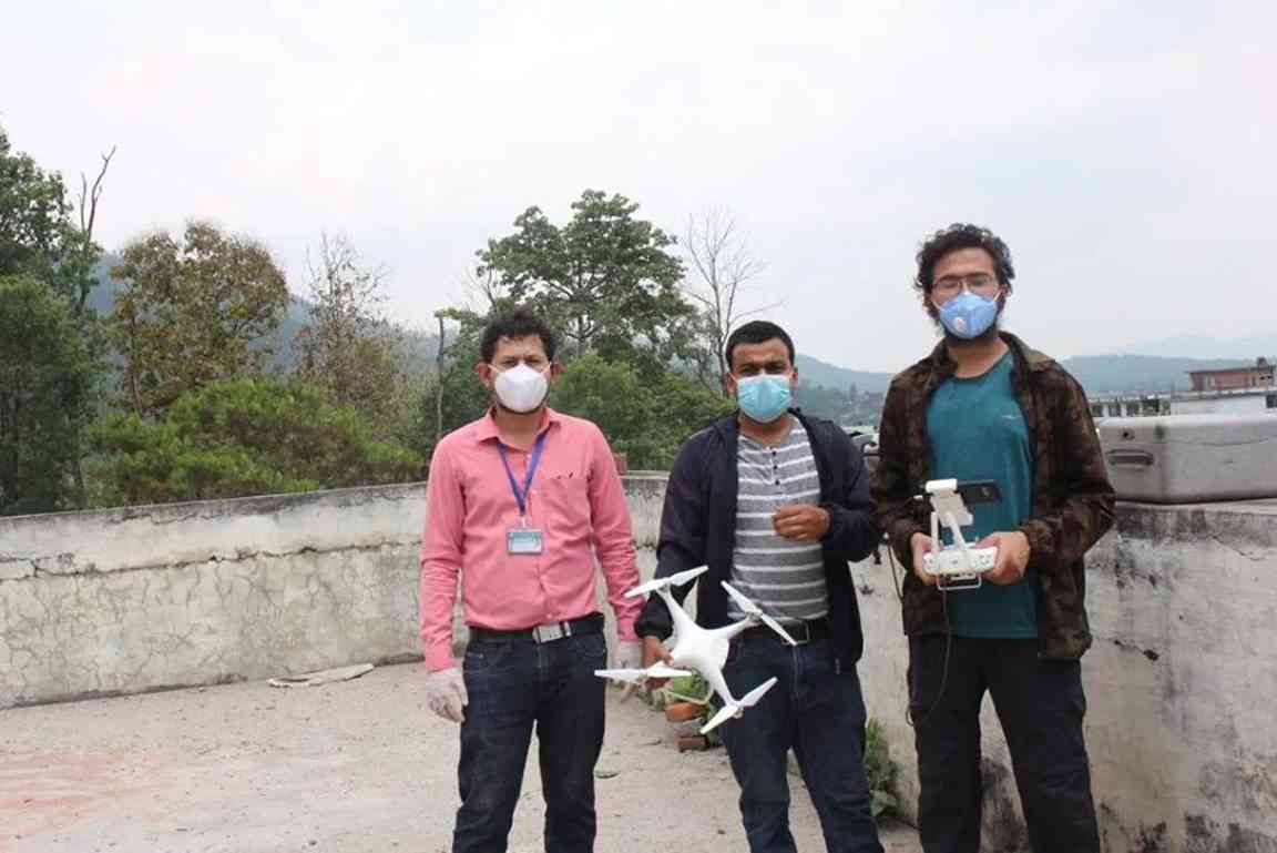
    The team capacitated 10 Local Volunteers for the drone deployment.
    The technical laid out Ground Control Points (GCPs) all over the Metropolitan city and started collecting aerial imageries.
    The team installed 45 GCP at different locations of the city and flew drones for 26 days over 110 km2 area capturing 16244 Images using a single Phantom.

    Achievements at a glance

    Hetauda is the capital of Bagmati province situated 86 km south-west of Kathmandu and another rapidly urbanizing city of the country. With the lead of the Institute of Himalaya Risk Reduction, project Design, and overall supervision from Nepal Flying Labs, data collection by pilots from DroNepal and ING Nepal, GIS & Mapping service provider NAXA and Nepal Engineering Association of Bagmati Province) came together to map the city during this lockdown. The Mayor of the Hetauda Sub-metropolitan City inaugurated the project.

    Organizations and focal points

    Implementing Organization(s)

    • Institute of Himalayan Risk Reduction

    Focal points

    Main focal point
    Suraj Gautam (Executive Director, Institute of Himalayan Risk Reduction)

    Partners

    • U-INSPIRE Nepal

    Explore further

    Sendai priorities
    Priority 1Understanding disaster risk
    Priority 2Strengthening disaster risk governance to manage disaster risk
    Priority 4Enhancing disaster preparedness for effective response, and to «Build Back Better», rehabilitation and reconstruction
    Sendai targets and indicators
    A-1 (Compound)Number of deaths and missing persons attributed to disasters, per 100,000 population
    B-1 (Compound)Number of directly affected people attributed to disasters, per 100,000 population
    B-3Number of people whose damaged dwellings were attributed to disasters
    D-1 (Compound)Damage to critical infrastructure attributed to disasters
    D-2Number of destroyed or damaged health facilities attributed to disasters
    D-3Number of destroyed or damaged educational facilities attributed to disasters
    D-4Number of other destroyed or damaged critical infrastructure units and facilities attributed to disasters
    E-2 (Compound)Percentage of local governments that have adopted and implemented local disaster risk reduction strategies in line with national strategies
    G-1 (Compound)Number of countries that have multi-hazard early warning systems
    G-3Number of people per 100,000 that are covered by early warning information through local governments or through national dissemination mechanisms
    G-4Percentage of local governments having a plan to act on early warnings
    Hazards Cold Wave Earthquake Epidemic and Pandemic Flood Heatwave and Extreme Heat Landslide Technological hazard Wildfire and Bushfire
    Themes Capacity development Civil Society/NGOs Climate change Preparedness Early warning GIS and mapping Governance Risk identification and assessment Science-policy-practice interface Social impacts and social resilience Earth Observation (EO) Urban risk and planning
    Country and region Nepal
    Sustainable Development Goals SDG9: Industry, innovation and infrastructure SDG11: Sustainable cities and communities SDG13: Climate action SDG17: Partnerships for the goals
    Budget scale
    USD 10,000 to < 50,000
    Scope
    National (or local) - Nepal
    Scale of beneficiaries
    More than 10,000 people
    Estimated number of beneficiaries
    50,000 people
    Secured budget size
    50%
    Donors
    Institute of Himalayan Risk Reduction, IHRR
    DRONEPAL
    NAXA P. Ltd.
    Nepal Flying Labs
    Hetauda Submetropolitan City
    Umbrella initiative(s)
    U-INSPIRE Alliance; Science & Technology Roadmap
    X (Twitter)
    https://twitter.com/IHRRNepal
    Related links
    Institute of Himalayan Risk Reduction

    Is this page useful?

    Yes No
    Report an issue on this page

    Thank you. If you have 2 minutes, we would benefit from additional feedback (link opens in a new window).

    PreventionWeb is the global knowledge sharing platform for disaster risk reduction (DRR) and resilience.

    • Newsletter
    • Submit your content
    • Blog pitches
    • Submission and publishing policy
    • About PreventionWeb
    • Contact us

    Hazards

    • Avalanche
    • Cold Wave
    • Cyclone, Hurricane and Typhoon
    • Drought and Desertification
    • Earthquake
    • Epidemic and pandemic
    • Flood
    • Heatwave, extreme heat and heat stress
    • Insect infestation
    • Land subsidence
    • Landslide
    • Nuclear, biological, chemical (NBC)
    • Sea level rise
    • Technological hazard
    • Thunderstorm
    • Tornado
    • Tsunami
    • Volcano
    • Wildfire

    Regions

    • Africa
    • Americas
    • Asia
    • Europe
    • Oceania

    Themes

    Understanding & managing risk

    • Preparedness
    • Early warning
    • GIS and mapping
    • Data and information management
    • Risk identification and assessment
    • Small Island Developing States
    • Earth Observation

    Natural environment

    • Climate change
    • Environment and ecosystems
    • Food security and agriculture
    • Water

    Cross-cutting

    • Systemic risk
    • Recovery

    Human development

    • Capacity development
    • Children and youth
    • Civil society / NGOs
    • Community-based DRR
    • Cultural heritage
    • Gender
    • Human mobility
    • Inclusion
    • Social impacts and resilience

    Science, knowledge & advocacy

    • Disaster risk communication
    • Traditional and Indigenous knowledges
    • Science-policy-practice interface

    State, governance & economy

    • Financing DRR
    • Fragility and conflict
    • Governance
    • Insurance and risk transfer
    • Private sector

    Infrastructure & critical services

    • Critical infrastructure
    • Education and school safety
    • Health and health facilities
    • Structural safety
    • Urban risk and planning
    Loading