1. Home
  2. Knowledge Base | PreventionWeb
  3. Hazards

Landslide

Landslide is the downslope movement of soil, rock and organic materials under the effects of gravity, which occurs when the gravitational driving forces exceed the frictional resistance of the material resisting on the slope. Landslides could be terrestrial or submarine (Varnes, 1978).

Landslides can be triggered by geological and physical causes such as glacier or snow melts, heavy rains and water pressure, earthquakes, volcanic eruptions and overly steep slopes. Landslides can also be triggered by human action, the most common being building on unstable slopes. Submarine landslides, or massive slides and rock falls hitting the sea can also cause tsunamis.

Landslides can reach speeds of over 50 km/h and can bury, crush or carry away people, objects and buildings. Landslides cannot be predicted but warning systems measuring rainfall levels can provide warning to people living in landslide-prone areas.

Instrumental monitoring to detect movement and the rate of movement can be implemented, for example, extensometers, global positioning system (GPS), seismometers, aerial photography, satellite images, LiDaR (Highland and Bobrowsky, 2008), with varying degrees of success. Increasingly, the science of landslide physics is allowing the nature of these hazards to be understood, which is leading to better techniques through which they can be managed and mitigated (HIP).

Risk factors

  • Population growth
  • Rapid urbanisation
  • Environmental degradation (deforestation and inappropriate use of lands and slopes)
  • High population density, heavy rainfall and rapid land use changes increase the instability of slopes

Risk reduction measures

  • Early warning systems to observe and alert before landslides happen
  • Hazard maps to identify landslides risk and vulnerabilities
  • Integrate landslide risk assessment into urban planning strategies
  • Building codes and standards for materials that reinforce landslide resilience
  • Improve drainage, building tunnels and trenches to stabilise slopes
  • Protect forest cover and regulate logging
  • Raise awareness of landslide risk
  • Regular drills and community evacuation exercises
  • Establish national, regional, and local evacuation plans
Latest Land Slide additions in the Knowledge Base

Uploaded on
Social protection challenges: The exposure of Social Assistance Reference Centers to flood and landslide risks thumbnail
Documents and publications

Study assessing the exposure of Brazil’s Social Assistance Reference Centers (CRAS) to flood and landslide risks. By integrating IDCRAS and BATER data, it identifies vulnerable facilities and supports preparedness, contingency planning and DRR.

Brazilian Journal of Environmental Sciences (Revista Brasileira de Ciências Ambientais)
Update

Exceptionally high temperatures preceded the August mountain collapse that triggered deadly floods in Nepal and China. Scientists say heat may have contributed to permafrost thaw and glacier instability, but no direct causal link has yet been established.

Phys.org
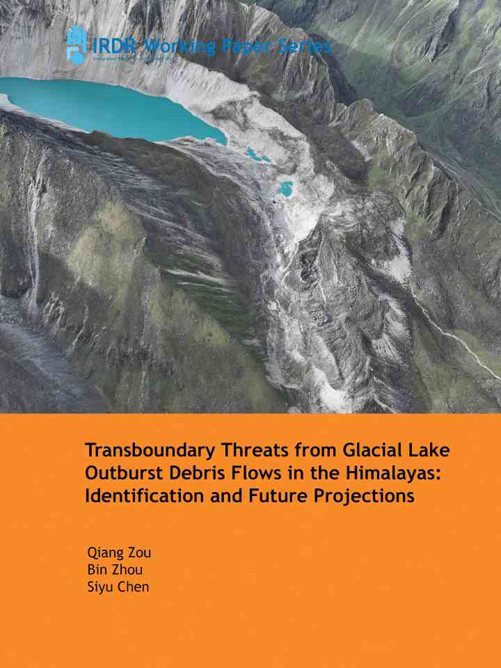
Transboundary threats from glacial lake outburst debris flows in the Himalayas: Identification and future projections thumbnail
Documents and publications

This paper identifies transboundary GLODF threats across the Himalayas and projects their future evolution under climate change, highlighting growing risks, hotspots along the China–Nepal border, and the need for stronger monitoring and early warning.

Integrated Research on Disaster Risk
When climate risks become evident: A natural experiment on risk perceptions in the housing market thumbnail
Documents and publications

Study uses the 2020 Gjerdrum landslide as a natural experiment to examine how climate risk salience affects housing markets. Exposed properties experienced temporary price declines of 1–1.5 per cent, while new residential development in risk zones fell.

Journal of Environmental Economics and Management
Update

A glacier collapse near the China-Nepal border triggered a catastrophic mudslide in just seven minutes, exposing gaps in monitoring and early warning as climate change raises the risk of extreme Himalayan disasters.

ThinkChina
Update

A deadly Nepal-Tibet border flood highlights how limited cross-border data sharing, restricted access to Tibet and weak early warning systems can hinder disaster preparedness. The article calls for greater regional cooperation on climate and flood risks.

Conversation Media Group, the
Risk assessment of debris flows along the China-Nepal transportation corridor thumbnail
Documents and publications

This study assesses debris-flow hazards and risks along the China-Nepal transportation corridor. It identifies high-risk road sections and hazard hotspots, providing evidence to support recovery, early warning systems and transboundary DRR.

Integrated Research on Disaster Risk
Update

Scientists used seismic data, satellite imagery and drone surveys to rapidly identify a massive landslide as the cause of the deadly Nepal-Tibet flood. The event highlights cascading hazards, glacier instability and the need for stronger early warning.

Science
Uploaded on