Flood
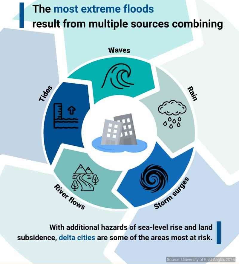
Flooding is an overflowing of water onto land that is normally dry (NOAA). There are various categories of floods. Coastal flooding is most frequently the result of storm surges and high winds coinciding with high tides (WMO, 2011).
A flash flood is a flood of short duration with a relatively high peak discharge in which the time interval between the observable causative event and the flood is less than four to six hours (WMO, 2006). A fluvial flood is a rise, unusually brief, in the water level of a stream or water body to a peak from which the water level recedes at a slower rate (WMO, 2012). A ‘glacial lake outburst flood’ is a phrase used to describe a sudden release of a significant amount of water retained in a glacial lake, irrespective of the cause (Emmer, 2017).
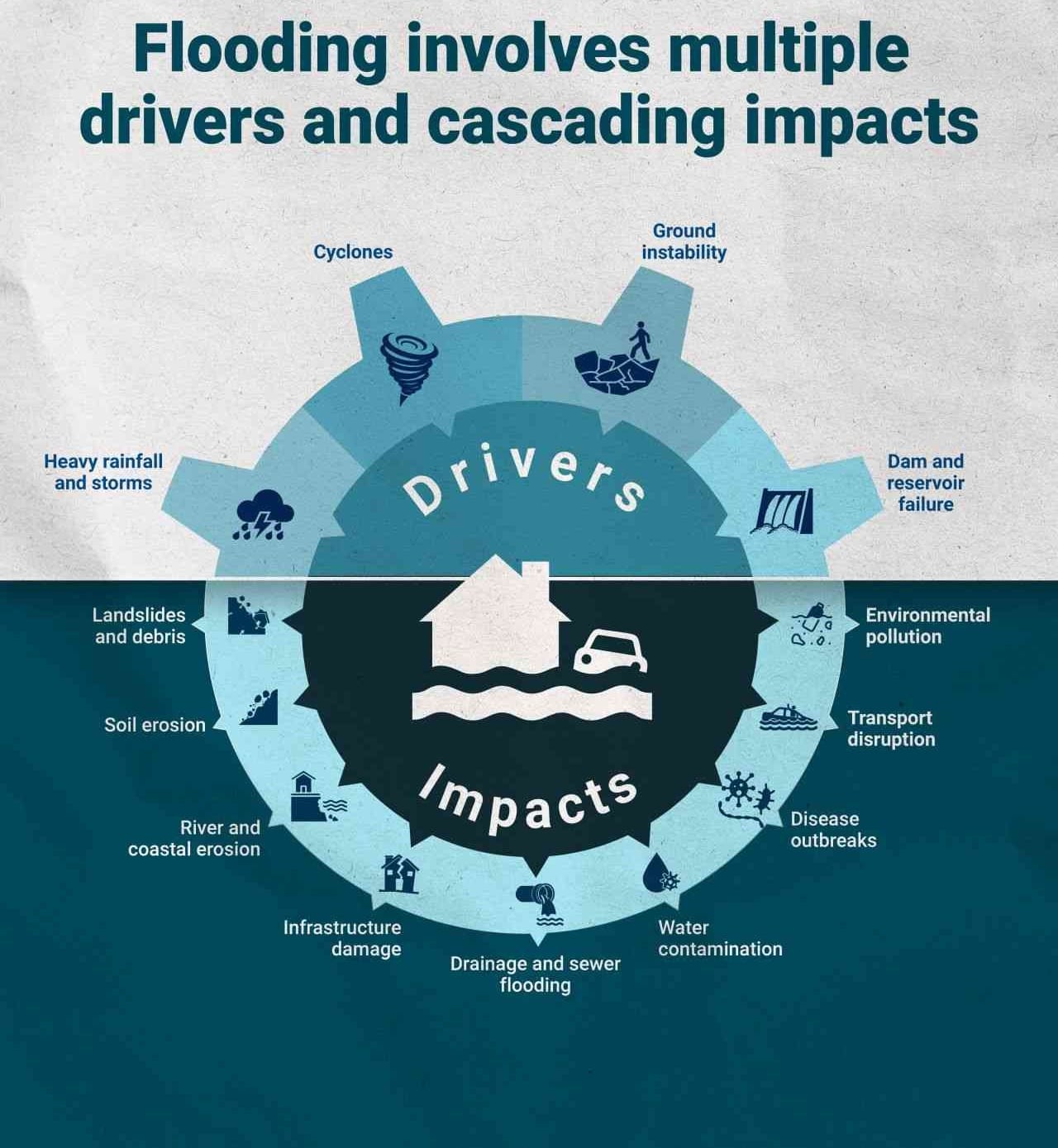
Floods affect more people than any other hazard. Worldwide, nearly 200 million live in coastal zones at risk of flooding. Flooding is usually the result of heavy or continuous rain that exceeds the absorptive capacity of the soil and the flow capacity of rivers, streams and coastal areas. Floods can be triggered by thunderstorms, tornadoes, tropical cyclones, monsoons, melting snow and dam breaks. The most common floods are flash floods, snowmelt floods, coastal floods and river floods. Flash floods and sudden floods are the most dangerous, especially when they occur at night.
Integrated Flood Management (IFM) is a process that promotes an integrated, rather than fragmented, approach to flood management. It integrates land and water resources development in a river basin, within the context of Integrated Resources Management, with a view to maximising the efficient use of floodplains and to minimising loss of life and property. IFM, like Integrated Water Resources Management, should encourage the participation of users, planners and policymakers at all levels (APFM).
This page refers to different types of floods, such as:
- Coastal flood: Coastal flooding is most frequently the result of storm surges and high winds coinciding with high tides. The surge itself is the result of the raising of sea levels due to low atmospheric pressure.
- Fluvial flood: A fluvial flood is a rise, usually brief, in the water level of a stream or water body to a peak from which the water level recedes at a slower rate (WMO, 2012).
- Flash flood: A flash flood is a flood of short duration with a relatively high peak discharge in which the time interval between the observable causative event and the flood is less than four to six hours (WMO, 2006).
- Glacial Lake Outburst Flood: A ‘glacial lake outburst flood’ is a phrase used to describe a sudden release of a significant amount of water retained in a glacial lake, irrespective of the cause (Emmer, 2017).
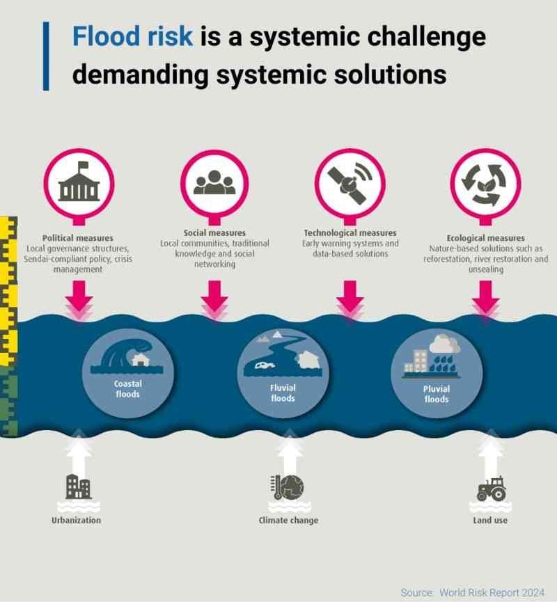
Risk factors
- Rapid population growth.
- Rapid urbanization.
- Environmental degradation: loss of forests and natural flood buffers.
- Climate change will expose more people to future floods.
- Melting glaciers and rising sea levels will bring floods to places not previously at risk.
Vulnerable areas
- Developing countries are most at risk.
- Although Asia remains the continent most hit by floods, Africa and Latin America are also heavily affected.
- The poor, with the least means to adapt are often forced to live in high-risk places: slopes, flood plains, ravines, or in crowded, urban low-lying areas in mega-cities.
Risk reduction measures
- Integrate flood risk assessment into urban planning strategies.
- Avoid building on flood-prone land.
- Develop new building codes to reinforce flood resistance.
- Create more space for rivers, floodplains and wetlands.
- Ensure health of coastal reefs and mangrove plantations.
- Maintain early warning systems, backed up by regular drills and evacuation exercises.
- Have an evacuation plan for those at risk, including the elderly, disabled and very young.
- Catalyse finance and insurance schemes to protect assets and livelihoods.
- Protect and evacuate animals.