
Hazard

What is a hazard?
A process, phenomenon or human activity that may cause loss of life, injury, property damage, social and economic disruption or environmental degradation.
Hazards may be natural, anthropogenic or socionatural in origin (UNDRR Terminology, 2017). They are often grouped by whether they are natural (sometimes termed physical) or technological (sometimes called man-made or human-induced). The insurance industry often uses the term "peril" instead.
Natural events are only termed hazards when they have the potential to harm people or cause property damage, social and economic disruption. Where natural hazards occur depends mainly on natural processes: tectonic plates, weather systems, waterways and slopes.
But urbanization, environmental degradation and climate change can also influence the location, frequency and intensity of natural hazards. These processes are known as risk drivers.

Components of risk
Disaster risk is the product of hazard, exposure and vulnerability. Hover any element to see what it means, or click to open its reference page.
Adapted from Components of risk on PreventionWeb.
What is a natural hazard?
One that arises from natural processes, such as the movement of tectonic plates or weather systems.
What is a technological hazard?
One that is man-made or human-induced, arising from industrial conditions or human activities.
Effective disaster risk reduction considers not just what has occurred, but what could occur. Most disasters that could happen have not yet happened.
What types of hazards are there?
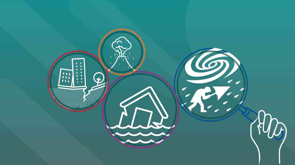
Classification schemes vary across institutions and governments, but hazards can be grouped into six families.
The groupings below follow the Hazard definition and classification review.
Biological hazards
Of organic origin or conveyed by biological vectors, including pathogenic microorganisms, toxins and bioactive substances.
Examples: bacteria, viruses, parasites, venomous wildlife, insects, poisonous plants, mosquitoes carrying disease.
Environmental hazards
Arise from the degradation of natural systems and ecosystem services, or from pollution of air, water and soil. Many are drivers of hazard and risk rather than hazards in themselves.
Examples: wildfires, soil degradation, loss of permafrost, deforestation, biodiversity loss, salinisation, sea-level rise.
Geohazards
Originate from internal Earth processes: seismogenic, volcanogenic and shallow geohazards from surface or near-surface processes.
Examples: earthquakes, ground shaking, subsidence, tsunamis, volcanic eruptions, lava flows, ashfall, mass movement.
Meteorological and hydrological hazards
Of atmospheric, hydrological or oceanographic origin. These conditions can also drive landslides, wildland fires, locust plagues and epidemics.
Examples: tropical cyclones, floods, flash floods, drought, heatwaves, cold spells, storm surges.
Technological hazards
Arise from technological or industrial conditions, hazardous procedures, infrastructure failures or human activities, and can follow a natural hazard event.
Examples: industrial pollution, nuclear radiation, toxic wastes, dam failures, factory explosions, cyberhazards, chemical spills.
Chemical hazards
Linked to the dramatic increase in chemical use across industry, agriculture and transport, with exposure to chemicals of natural and human origin.
Examples: chemicals of public health concern, organic chemicals, chemical fires.
Understanding hazards is the first step toward reducing disaster risk. Video: UNDRR
One hazard rarely comes alone
Each hazard often triggers a sub-set of hazards. Tropical cyclones bring intense winds, storm surge and heavy rainfall, and can trigger secondary hazards such as landslides.
A series of triggering relationships can cause a domino or cascading effect, as in the tsunami-earthquake-nuclear crisis in Japan in 2011.
How do hazards differ from one another?
By their magnitude or intensity, speed of onset, duration and the area they cover.
Hazards occur at different intensities over different time scales (temporal scales). Scientists describe how often hazards of a given intensity occur in terms of probabilities or return periods, within the context of uncertainty.
Hazards also occur at different geographical (spatial) scales. See the differences between intensive and extensive risk.
How strong a hazard event is. Hazards occur at different intensities over different time scales.
How often an event of a given intensity is expected. The longer the return period, the greater the intensity.
Tornado impacts tend to be localised, whereas droughts can cover tens of thousands of kilometres.
The longer the return period, the greater the intensity, so some communities have no memory of a high-intensity threat. The eruption of Mt Pinatubo in 1991, the second largest of the 20th century, displaced 20,000 Indigenous people living in its foothills and triggered mudslides (lahars) that affected people for years.
How do hazards interact?
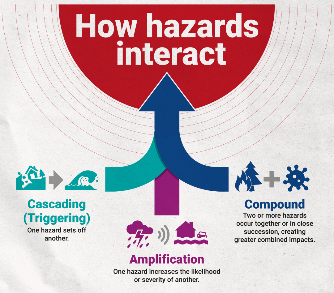
Communities rarely face hazards one by one.
Source: UNDRR
Multi-hazards take several forms:
- Cascading: one hazard sets off another.
- Amplification: one hazard changes the likelihood or severity of another.
- Compound: impacts coincide in time and space.
- Consecutive: back-to-back events before recovery is complete.
A multi-hazard approach helps us understand these connections and take action early.
Many countries are exposed to multiple hazards, so it is essential to consider the full range of hazards that might affect people or assets. When hazards interact, the overall impact can be greater than if they had occurred at separate times, which has major implications for risk assessment.

Multi-hazard events in practice
Amplification · Volcano and typhoon
Mt Pinatubo, Philippines, 1991
The eruption was accompanied by Typhoon Yunya, which soaked the accumulating volcanic ashfall with rainfall.
The heavy wet ash collapsed the roofs of homes and businesses, causing most of the 300 deaths directly associated with the eruption (Wolfe, 1992).
Overlooked hazards · Tsunami and flood
Aceh, Indonesia, after 2004
Following the devastating 2004 Indian Ocean tsunami, the full range of hazards was not considered during recovery.
Some housing was reconstructed in flood-prone areas, leaving families exposed to future hazard events.
How do we measure hazards?
By building a hazard catalogue: a record of the events that have happened and those that could.
Hazard assessment starts by identifying the relevant hazards and collecting hazard-related data. The most essential data define the date, location and extent, and maximum intensity of historical events.
The spatial, intensity and temporal characteristics of events in an event set form a hazard catalogue, used with risk models in a deterministic or probabilistic manner. This can involve difficult decisions, such as whether to include secondary hazards (for example a fire after an earthquake) and interactions between hazards.
What is a historical event set?
Records of past events, often used in deterministic analyses that assess the impact of past events with current exposure.
What would happen if this event struck again today?
What is a computer-generated event set?
Thousands or tens of thousands of potential events, consistent with the historical record, that define the full range of what could occur.
What is the probability of loss from every possible event?
High-intensity hazards have long return periods, so historical records do not show the true picture, particularly for geological hazards. A probabilistic risk model compiles all possible impact scenarios for a hazard and area. Hazard catalogues are mostly used for rapid-onset hazards; slow-onset hazards such as drought are typically assessed with deterministic approaches.

Can we reduce hazards?
Not fully, but the scale or severity of their impacts can be substantially lessened.
Mitigation measures include engineering techniques and hazard-resistant construction, as well as improved environmental and social policies and public awareness. In climate change policy, "mitigation" is defined differently: it refers to reducing the greenhouse gas emissions that cause climate change.
Tuvalu has mapped all nine of its atoll systems, including the islands and surrounding reefs and lagoons, using airborne LiDAR: about 500 square kilometres in total.

Warning systems must go hand in hand with disaster risk reduction strategies that reduce vulnerability and strengthen people's capacity to respond and recover. For slow-onset hazards, early indicators of a crisis make warning a key tool for building resilience, as food security early warning systems show.
The four components of an effective early warning system
Detection, monitoring and forecasting of the hazards
Analysis of the risks involved
Dissemination of timely and authoritative warnings
Activation of emergency preparedness and response plans
These components must be coordinated across many agencies at national and community levels. Multi-hazard early warning systems (MHEWS) should also account for how hazards and risks interact.
Failure in one component, or a lack of coordination, can lead to the failure of the whole system.
Which hazards can we warn for?
Earthquakes
We cannot warn when they will occur, but we know with some reliability where. Strict building codes and awareness of how to respond mitigate their impact. Earthquake early warning systems can detect earthquakes as they begin.
Volcanic eruptions
Monitored precursors can indicate when an eruption might occur and inform alert levels. These precursors do not always lead to an eruption and its timing and magnitude remain uncertain. Some high-exposure volcanoes remain unmonitored.
Landslides
Predictable sometimes from triggers we can warn for, such as heavy rainfall, but not from sudden triggers such as earthquakes. Predicting exactly when and where individual landslides will occur remains challenging.
Tsunamis
Seismic monitoring, ocean buoys and sea-level sensors help assess the threat and issue alerts, sometimes within minutes. Warning times depend on the tsunami's source and the distance to coastlines.
Cyclones
Can be tracked and forecast several days in advance using satellite observations, weather models and meteorological monitoring. Associated hazards such as storm surges remain difficult to predict precisely.
Floods
Can often be forecast by monitoring rainfall, river levels and soil moisture, combined with weather forecasts and hydrological models. Warning lead times vary depending on the type of flood and local conditions.
Most warning systems rely on predefined procedural thresholds: alert levels, activation protocols and emergency plans that kick in once specific criteria are met. And, since response measures are tied to procedural thresholds, early signals cannot translate into anticipatory action.

How to communicate on hazard risk?
Beyond issuing official warnings, emergency management agencies can work with communities to strengthen existing networks for sharing disaster-related information.
In the short term, this means identifying local information intermediaries and established communication networks. Recording their contact details and preferred communication channels enables emergency management agencies to connect directly with trusted community members when a disaster occurs.
This benefits both sides: agencies gain access to timely, on-the-ground information, while local intermediaries can verify and relay information from official sources through networks that communities already trust. Over the longer term, emergency management agencies should recognise community leaders as valuable partners in local disaster preparedness and response.

Success should be measured not only by how many people receive official warnings, but also by whether accurate, timely and actionable information reaches trusted local intermediaries and the wider community through the networks they rely on.
Additionally, effective risk communication requires proactively managing information risks and countering harmful information during emergencies. Because confusion and fear make disaster contexts fertile ground for rumours, misinformation, and misinterpretation of official statements, risk communication must go beyond top-down announcements.
Engaging trusted local intermediaries—such as community leaders, digital volunteers, and local media—helps establish strong two-way feedback loops and rapid verification channels. Rather than attempting to strictly control the information environment, agencies should focus on mitigating harm by providing time-stamped, actionable, and transparent updates, empowering community networks to relay accurate guidance and counter false narratives from the ground up.
Related sections on PreventionWeb


Last updated: 9 November 2026