Exposure
The situation of people, infrastructure, housing, production capacities and other tangible human assets located in hazard-prone areas.
UNDRR Terminology, 2017
Exposure is one of the defining components of disaster risk.


Disaster risk is the consequence of the interaction between a hazard and the characteristics that make people and places vulnerable and exposed. This is the fourth section of Components of risk: exposure.
Why does it matter?
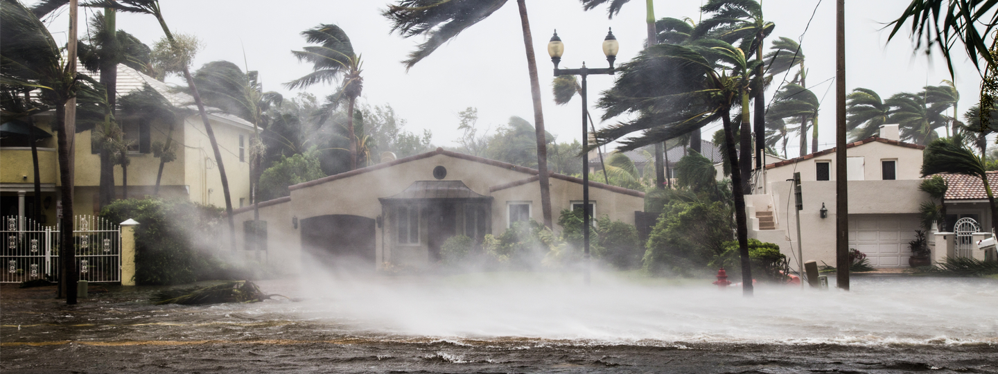
If a hazard occurs in an area of no exposure, then there is no risk. Take the example of typhoons (tropical cyclones that occur in the Pacific Ocean). In October 2013 a Category 5 super typhoon (known as Lekima) hit the North West Pacific Ocean. Its winds reached peaks of around 240 kilometres per hour, but caused no impact on people or assets. In November 2013 another Category 5 Super Typhoon Haiyan (Yolanda) hit the region, with winds peaking at 315 kilometres per hour. Haiyan affected 11 million people, causing more than 6000 casualties and the loss of more than 1.5 billion US dollars. The difference in impact was because there were no people or property in the path of Lekima; in other words, there was no exposure (see the map comparing the paths of the two typhoons).
The extent to which exposed people or economic assets are actually at risk is generally determined by how vulnerable they are, as it is possible to be exposed but not vulnerable. However, increasing evidence suggests that the case of extreme hazards the degree of disaster risk is a consequence of exposure more than it is a result of vulnerability. For instance, in the case of the 26 December 2004 Indian Ocean tsunami all those exposed to tsunamis were at risk, no matter their income, ethnicity or social class. See a related story: What if Typhoon Jebi had been stronger and taken a different path?

Typhoon Lekima and Typhoon Haiyan (Yolanda) comparison Source: UNITAR (2014)
What drives exposure?
People and economic assets become concentrated in areas exposed to hazards through processes such as population growth, migration, urbanization and economic development. Previous disasters can drive exposure by forcing people from their lands and to increasingly unsafe areas. Consequently, exposure changes over time and from place to place.
Many hazard prone areas, such as coastlines, volcanic slopes and flood plains, attract economic and urban development, offer significant economic benefits or are of cultural or religious significance to the people who live there. As more people and assets are exposed, risk in these areas becomes more concentrated. At the same time, risk also spreads as cities expand and as economic and urban development transform previously sparsely populated areas.
Large volumes of capital continue to flow into hazard-prone areas, leading to significant increases in the value of exposed economic assets. If global exposure continues to trend upwards, it may increase disaster risk to dangerous levels.
How do we measure exposure?
Measures of exposure can include the number of people or types of assets in an area. These can be combined with the specific vulnerability and capacity of the exposed elements to any particular hazard to estimate the quantitative risks associated with that hazard in the area of interest.
Exposure modelling has a critical role to play in risk assessment. The information used to develop exposure data sets can be derived from various sources and methods. Resolution of data sets refers to how thoroughly defined the data are; for instance, exposure data over a large geographical area (low resolution) may hide the true picture at the local level.

At the local scale high resolution exposure data have been developed, but only for specific projects. Common data sources are council and local government agencies, household surveys, aerial photos, and individual architectural/structural drawings. Crowd-sourcing (obtaining information or input into a task by enlisting the services of a large number of people typically via the Internet) has become a common and valuable tool for collecting local level data, as well as validating global-scale data, but this approach is limited by the type and quality of data.
At the national scale complete geospatially linked inventories (databases) that include public infrastructures are rare and not publicly available in most developing countries, so there is a great need to develop these inventories. State-based agencies, statistical offices, census data, investment and business listings, employment figures, and existing geographic information system (GIS) data are common sources of exposure information at a regional scale and above.
At the global scale efforts to generate globally consistent exposure data sets in terms of the quality and resolution have increased. Methodologies need to consider the dynamic nature of exposure because it evolves over time as a result of (unplanned) urbanisation, demographic changes, modifications in building practice, and other factors. At the lowest (coarsest) level of resolution, national statistical agencies, census data, global databases, and remote sensing are used for developing exposure data.

How do we reduce exposure?
Economic exposure in high-hazard areas is trending upwards. If we do not reverse this trend, disaster risk is set to increase. We need to act now to reduce exposure and build capacity and resilience in these areas of growing exposure.
When it is not possible to avoid exposure to events, land use planning and location decisions must be accompanied by other structural or non-structural methods for preventing or mitigating risk. In the case of the Boxing Day 2004 Indian Ocean tsunami, for instance, the only possible strategy to save lives would have been to reduce exposure through timely evacuation, which depends on the existence of reliable early warning systems and effective preparedness planning, and then to compensate for loss through insurance of other risk financing instruments.
Last updated on: 9 December 2025
Related Sections on PreventionWeb


