Report: Coastal flood risk to affordable housing projected to triple by 2050
EXECUTIVE SUMMARY
- A new analysis conducted by scientists at Climate Central and published in Environmental Research Letters highlights the equity implications of sea level rise in the first nationwide assessment of risk to the country’s affordable housing supply.
- The number of affordable housing units at risk from coastal flooding and sea level rise is expected to more than triple over the next three decades.
- By 2050, virtually every coastal state is expected to have at least some affordable housing exposed to more than one “coastal flood risk event” per year, on average—up from about half of coastal states in the year 2000. (A flood risk event occurs when local coastal water levels reach higher than a building’s ground elevation, and any known barriers do not provide full protection.)
- New Jersey, New York, and Massachusetts have the largest share of affordable housing stock and number of units at risk; projections for New York City, Atlantic City, and Boston show that each city could have thousands of units exposed to chronic coastal flooding by 2050.
- Climate Central has introduced a new interactive online mapping tool showing the vulnerability of affordable housing to coastal flood risk now and in the future.
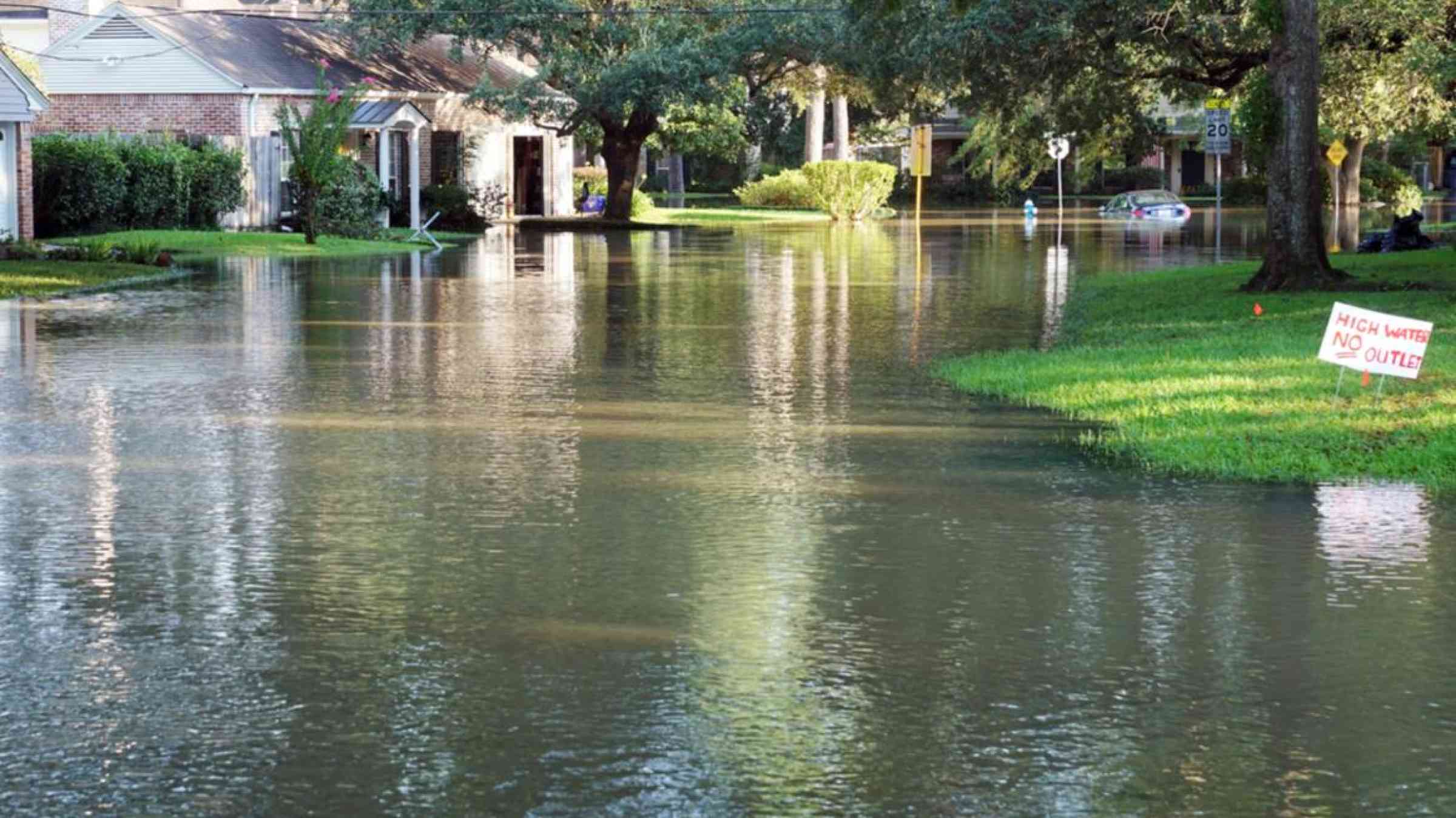
A ffordable housing serves as a lifeline for millions of individuals and families in the United States. Stable, secure housing is known to support better health outcomes, economic mobility, and employability. But there is a severe shortage of homes that are affordable or available to low-income renters. Scientists at Climate Central analyzed the risk coastal flooding poses to affordable housing—both subsidized and naturally occurring—as sea levels rise. They found that more than 7,600 apartments, townhomes, and houses nationwide are currently exposed to at least one “coastal flood risk event” in a typical year, and more than 24,500 units may be so threatened by 2050.
The combination of physical vulnerability of affordable housing, socioeconomic vulnerability, and more frequent flooding due to sea level rise presents a triple threat within the next 30 years to residents and owners of the country’s already scarce affordable housing.
 |
| Estimate of affordable housing units in the Boston area at risk in 2050 if annual global climate pollution continues at current rate (RCP 8.5) by State House Legislative District. See https://coastal.climatecentral.org > Choose Map > Affordable Housing |
Climate change is increasingly afflicting the most vulnerable communities
The frequency of coastal floods has risen sharply in recent decades due to a warming planet. Rising seas will continue to aggravate both tidal flooding (also called nuisance or chronic flooding) and flooding from extreme weather events in the years ahead. By 2050, with unchecked carbon emissions, the 100-year flood level (or the flood level with a 1% annual chance of occuring, defining the floodplain), could occur about at least 40 times more often at half of U.S. locations studied. Tidal flooding that now occurs once a year may occur on a weekly basis in some coastal communities.
Of particular concern is the exposure of housing that is considered affordable to low-income households: housing that is federally subsidized or “naturally occurring,” meaning it is unsubsidized but rents below local market rates or for less than 30% of local median household incomes. This housing is an exceedingly scarce resource across the country. Nationwide, there are only an estimated 35 affordable rental units available for every 100 extremely low-income renters—a national shortfall of over 7 million units. These homes are also particularly vulnerable to flooding, as affordable housing tends to be older and is rarely equipped with resilience-enhancing features (such as flood proofing, off-grid energy, or backwater valves), due to the cost of such measures. Additionally, residents of affordable housing often lack the financial resources to repair, rebuild, or retreat from their housing after it is damaged by flood waters.
Flood-damaged affordable housing can have long-term consequences for residents, owners, and communities, including increased homelessness, loss of rental income that can make it difficult for housing owners to provide affordable housing, and neighborhood-level economic downturns.
New ways of measuring risk to affordable housing
Scientists at Climate Central aimed to quantify the current and future coastal flood risk to the nation’s affordable housing inventory so that local, state, and federal stakeholders could understand the overall exposure of this already scarce resource. By focusing on the year 2050, the analysis reveals the threats that could affect residents and allows stakeholders an opportunity to plan for resiliency.
This study advances upon prior methods for characterizing the impacts of coastal flooding and sea level rise in a number of ways. Using high-resolution data, it uses individual building footprints and assesses threats that integrate across a wide range of potential sea level rise amounts and flood severities on top of them, instead of choosing a small number of scenarios (more detail available in original study).
Data was collected from the National Housing Preservation Database’s dataset of federally subsidized affordable housing buildings. Data on naturally occurring affordable housing was collected through the CoStar Building Rating System (see Terminology).
 |
| Estimate of affordable housing units in New Jersey at risk by 2050,if annual global climate pollution continues at current rate (RCP 8.5) by county. See https://coastal.climatecentral.org > Choose Map > Affordable Housing |
Findings: Thousands of units are at risk now, and that number will multiply over the next three decades
Using the year 2000 as a baseline for comparison with future risks, the analysis shows that 7,668 affordable housing units were recently exposed to at least annual flood risk in the United States. New Jersey has the highest number of units and percentage of its affordable housing stock exposed, followed by New York and Massachusetts. Many fewer units are at risk in California, but these units face a high risk of repetitive flooding, similar to affordable housing in Maine, Maryland, Alabama, and Texas.
By 2050, under a continued high-carbon emissions scenario, the risk increases significantly, with the aggregate number of affordable housing units exposed annually more than tripling to 24,519 units. New Jersey could see nearly 7,000 units exposed, a four-fold increase; and New York and Massachusetts would continue to rank among the top three states for absolute and relative number of units exposed. Pennsylvania (792%), Florida (774%), and South Carolina (669%) face the largest percentage increase over the 2000 baseline in units exposed.
The researchers also ranked the top 20 cities in terms of annual numbers of units exposed by 2050. These 20 cities account for three-quarters of all the affordable housing units at risk of coastal flooding across the United States, showing that coastal flood risk is highly concentrated. Cities in the Northeast and California are the most vulnerable, with New York City remaining the most exposed, with over 4,000 units at risk per year by 2050. Five cities in New Jersey ranked in the top 20, four of which (Atlantic City, Camden, Penns Grove, and Salem) are among the poorest urban areas in the country, with an average median household income of just $28,618 (in 2018 dollars). In a number of cities, more than half of the affordable housing stock is at risk in 2050, including Foster City, Calif. (100%), Crisfield, Md. (92%), Hoquiam, Wash. (72%), and Atlantic City (52%).
TABLE 1 - Affordable housing units at risk now and in 2050, under high carbon emissions scenario (RCP 8.5)
| State | Expected number of units exposed per year, 2000 baseline | Expected number of units exposed per year in 2050 |
| Alabama | 59 | 64 |
| California | 526 | 738 |
| Connecticut | 156 | 695 |
| Delaware | 60 | 78 |
| Washington D.C. | 69 | 90 |
| Florida | 110 | 963 |
| Georgia | 149 | 151 |
| Hawaii | 0 | 2 |
| Louisiana | 214 | 685 |
| Maine | 126 | 150 |
| Massachusetts | 1,530 | 4,817 |
| Mississippi | 32 | 56 |
| New Hampshire | 29 | 215 |
| New Jersey | 1,640 | 6,825 |
| New York | 1,574 | 5,293 |
| North Carolina | 185 | 435 |
| Oregon | 20 | 52 |
| Pennsylvania | 20 | 175 |
| Rhode Island | 2 | 4 |
| South Carolina | 62 | 474 |
| Texas | 200 | 332 |
| Virginia | 395 | 1,473 |
| Washington | 258 | 385 |
| U.S. | 7,669 | 24,518 |
TABLE 2 - Future threat of coastal flooding to the top 20 cities exposed (in absolute terms) for 2050, under high carbon emissions scenario (RCP 8.5)
| City | Expected number of units exposed per year, 2050 | Percentage of affordable housing in city |
| New York, NY | 4,774 | 1.3% |
| Portsmouth, VA | 220 | 3.6% |
| Boston, MA | 3,042 | 4.0% |
| Charleston, SC | 349 | 5.5% |
| Stamford, CT | 337 | 6.2% |
| Camden, NJ | 632 | 6.7% |
| Norfolk, VA | 710 | 6.7% |
| Cambridge, MA | 510 | 7.7% |
| Quincy, MA | 668 | 11.7% |
| Miami Beach, FL | 317 | 22.8% |
| Revere, MA | 266 | 23.5% |
| Salem, NJ | 208 | 30.3% |
| Penns Grove, NJ | 222 | 32.5% |
| Hoboken, NJ | 1,118 | 38.6% |
| Stamford, CT | 217 | 42.2% |
| Freeport, NY | 275 | 43.9% |
| Atlantic City, NJ | 3,167 | 52.1% |
| Hoquiam, WA | 220 | 71.7% |
| Crisfield, MD | 283 | 91.8% |
| Foster City, CA* | 279 | 100% |
*Exposure may be overstated in Foster City, CA where new levees may not have been included in a national levee inventory used in the analysis. See paper for details.
Conclusion
“A rising tide lifts all boats” is a phrase often used to articulate the idea that a prosperous economy will benefit all its participants. But the rising tides driven by global warming are increasing flood threats for thousands of residents in low-income communities and neighborhoods. Flooding can wreak havoc on buildings and the residents who live in them, threatening public health and causing profound disruption to families struggling to make ends meet. Chronic or “nuisance” flooding can also damage cars and keep residents from getting to work, school, or medical care.
Understanding current and future exposure of affordable housing to flood-risk events, including the number of units that could be affected and how often, can support strategic resilience planning. In the cities and states with the greatest threats, flood-threat reduction measures, such as building retrofits or flood-proofing, and land-use regulatory policies are tools for stakeholders to protect affordable housing stock, and the lives and livelihoods of those who live there.
|
Enhancing Resilience in Affordable Housing Through our partnership with the National Housing Trust, Climate Central interviewed coalitions and nonprofits focused on affordable housing about steps they are taking to make affordable housing more resilient to coastal floods. Below are a few examples of some of the climate adaptation solutions being implemented by housing organizations in coastal states. Florida Housing Coalition. Forty percent of all U.S. hurricanes have hit Florida. Since 1851, more than 120 hurricanes have made landfall there, more than in any other state. Facing this reality, the Florida Housing Coalition, a statewide membership organization for affordable housing stakeholders, has a dedicated staff member focused on resilience and recovery. They host a weekly one-hour webinar for their members on hurricanes and have developed toolkits for disaster management and local housing disaster recovery strategies. Enterprise Community Partners. Enterprise Community Partners, a national nonprofit focused on growing the supply of affordable housing, has created an online tool that allows owners, operators, and developers of affordable housing to identify properties at risk from climate disasters such as flooding and wildfire. Enterprise also collaborated with a number of partners to produce guidance to help shape housing construction and retrofitting in Puerto Rico, the U.S. Virgin Islands, and the Florida Keys. Their Keep Safe guide offers ways to make homes being rebuilt after major storms more resilient to hurricanes, earthquakes, and flooding. New Ecology. New Ecology is a nonprofit that advances sustainable building and retrofitting practices, including energy efficiency, renewable energy, and resiliency, with a focus on underserved populations. They have developed a resiliency assessment audit package for developers and owners of low-income or multi-family housing. New Ecology assessed the Villages of East River, a 202-unit affordable housing complex in Anacostia, Washington, D.C. for a range of climate hazards, including hurricanes, flooding, ice, snow, and extreme heat and cold events, as well as the potential for energy and water efficiencies. Recommendations from the audit included elevating HVAC equipment, planning for stormwater management, and energy efficiency upgrades. Energy Efficiency for All. Energy Efficiency for All (EEFA) is a nonprofit that connects climate, health, and equity and works to bring energy efficiency to multifamily and affordable housing through coalitions in 12 states. |
Terminology
A coastal flood-risk event at a building is defined as a day when local coastal water levels rise higher than the lowest point of the building’s ground elevation. Different combinations of tides, storm surges, and sea level rise drive these water levels. An event is counted only when a building is hydrologically connected to the coast at the water level achieved; in other words, barriers such as ridges or levees are not known to protect the building at that level .
Whether a flood actually occurs also depends on other factors as well, including how much higher the water gets, how long it stays high, how close the building is to the coast, how rough the terrain is, and meteorological details such as wind strength and direction and amount of rainfall, if any, and how far inland floodwaters reach during a particular high tide or storm.
Estimated Annual Exposure denotes the average number of affordable housing units in a given area exposed to coastal flooding in a typical year. This provides counts of the number of units that could potentially flood based on water and land elevations, not predictions of how many units will actually flood, which also depends on the same factors that distinguish actual floods from flood-risk events.
Subsidized affordable housing stock data used in this analysis comes from a comprehensive dataset of federally subsidized affordable housing buildings as of November 2018. Those data were collected through the National Housing Preservation Database, managed by the Public and Affordable Housing Research Corporation and the National Low Income Housing Coalition, and analyzed by the National Housing Trust (NHT). For purposes of this analysis, any housing supported by any federal program is considered subsidized; housing subsidized by known state-funded subsidies is also included (such housing makes up 2% of the National Housing Preservation Database).
Naturally occurring affordable housing includes apartments or houses that rent at levels below the local median market rent rates without subsidies, and was identified through the national CoStar Building Rating System, which rates commercial real estate properties.
Methodology
Each affordable housing building’s footprint was assessed for the annual probability of experiencing at least one coastal flood risk event in a given year. Sea level rise projections were based on Kopp et al. 2014, and coastal flood risk statistics were based on Tebaldi et al. 2012 . These building-level probabilities were integrated to estimate the total expected annual exposure at zip code, city, county, and state levels. For more detail, see the paper online. To explore affordable housing vulnerability given a range of sea level rise projections and storm surge events, see the online tool.