Image: AJP/Shutterstock
By Deepa Padmanaban
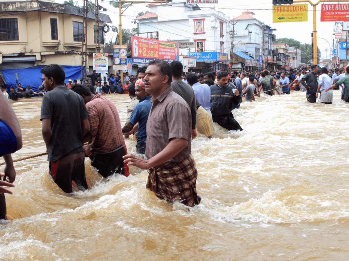
Urban floods in India have caused fatalities, injuries, displacement, and enormous economic losses. Cities across the country are now investing in high-tech tools to better model and forecast these natural hazards.
In 2015, the metropolis of Chennai faced devastating floods responsible for the deaths of more than 500 people and displacement of more than a million more. Financial losses reached around $3 billion. The extent of the damage prompted the Indian government to approach scientists to develop a flood forecasting system for the city.
Subimal Ghosh, a professor of civil engineering at the Indian Institute of Technology Bombay, led the efforts. Chennai’s topography makes it particularly vulnerable, Ghosh said. In addition to being a coastal city, Chennai has many rivers and an upstream catchment area from which water flows when there is heavy rainfall.
Forecasting in Chennai
The city’s topography determines where inundation occurs and made the development of a flood forecasting system complex. The system had to include the hydrology of the upstream region; river, tidal, and storm surge modeling; and a high-resolution digital elevation map of the city, Ghosh said.
A consortium of scientists from 13 research institutes and government organizations worked on these separate aspects and together developed India’s first fully automated real-time flood forecasting system, launched in 2019.
“We generated 800 scenarios of flood and tide conditions,” Ghosh said. “When the model receives a weather forecast from the National Centre for Medium Range Weather Forecasting, it will search and find the closest scenario. If there is a chance of flood, the model will predict the vulnerable sites for the next 3 days.”
Sisir Kumar Dash is a scientist at the National Centre for Coastal Research (NCCR) in Chennai, which is responsible for the operation of the model. “We analyze daily rainfall data, and if there is a probability of inundation, the model is run, and alerts are sent to the state disaster management department,” he said.
Since the tool was implemented, however, Chennai has not experienced heavy rainfall, so it has not been put to a strong test.
Forecasting in Bengaluru
Bengaluru, formerly known as Bangalore, has seen some success with its own flood forecasting system, according to scientists at the Indian Institute of Science (IISc) in Bengaluru and the Karnataka State Natural Disaster Monitoring Centre. The organizations developed the system together.
P. Mujumdar, a professor of civil engineering at IISc who led the work, said that “short-duration rainfall forecasts from various weather agencies were combined with our hydrology model (which has high-resolution digital elevation maps of the city) and information on drainage systems and lakes.”
Real-time rainfall data are obtained through a network of 100 automatic rain gauges and 25 water level sensors set up on storm water drains at various flood-vulnerable areas across Bengaluru. The model, however, is unable to make reliable predictions if the rainfall is sudden and didn’t appear in the forecast, Mujumdar added.
Scaling Up
Raj Bhagat Palanichamy is a senior manager at the Sustainable Cities initiative of the World Resources Institute who was not involved in flood forecasting in Chennai or Bengaluru. He had a sober view of the projects. “A good model is not about the tech or visualization that come with it,” he said. Instead, it’s “about the ability to help in the decisionmaking process, which hasn’t been successfully demonstrated in India.”
Shubha Avinash, scientific officer at the Karnataka State Natural Disaster Monitoring Centre, said the forecasting model was still an effective tool: “The forecast model has served as a better decision support system for administrative authorities in disaster preparedness, postflood recovery, and response actions in heavy rain events faced by the city in recent years.” Avinash oversees the operation of the Bengaluru flood model.
Avinash added that the alerts help city officials take timely, location-specific action. For instance, the city power company (Bangalore Electricity Supply Company Limited, or BESCOM) makes use of the wind speed and direction forecasts to ascertain which areas would have a probability of fallen electric lines and shuts down power supply to ensure safety.
The tool also has a mobile application, Bengaluru Megha Sandesha (BMS), which can be accessed by officials and residents for real-time information of rainfall and flooding.
Mujumdar added that “short-duration, high-intensity floods are increasing in Indian cities and happen very quickly (within 15–20 minutes) due to climate change and urbanization. Similar models should be developed for all cities.”
Last year, India’s Ministry of Earth Sciences developed a flood warning system, iFLOWS-Mumbai, for Mumbai, which is likely to be operational this year.
“Cities need to have a proper road map,” Bhagat said, “with not just the model as the target but an integrated response plan (both short term and long term). It should start with the creation and seamless sharing of related data in the public domain.”