U.S. high tide flooding breaks records in multiple locations
Coastal communities in three locations along the Atlantic and Pacific coasts saw record high tide flooding last year — a trend that is expected to continue into 2023 and beyond without improved flood defenses, according to NOAA.
The newly released information documents changes in high tide flooding patterns from May 2021 to April 2022 at 97 NOAA tide gauges along the U.S. coast. It also provides a flooding outlook for these locations through April 2023 and projections for the next several decades.
“High tide flooding is becoming more common and damaging in many parts of the U.S.,” said Rick Spinrad, Ph.D., NOAA Administrator. "As part of NOAA’s work to build a Climate-Ready Nation, we will continue to provide coastal communities with the information needed to anticipate, prepare for and respond to increasingly frequent high tide flooding.”
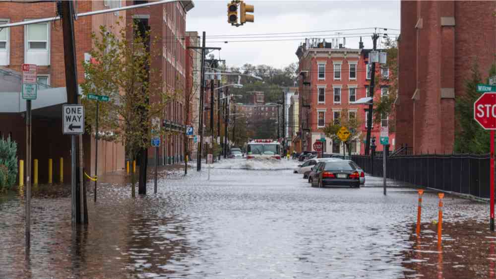
High tide flooding, often referred to as “nuisance” or “sunny day” flooding, is increasingly common due to decades of sea level rise and driven, in part, by climate change. It occurs when tides reach anywhere from 1.75 to 2 feet above the daily average high tide and start spilling onto streets or bubbling up from storm drains. As sea level rise continues, damaging floods that, decades ago, happened only during a storm, are expected to happen more regularly, such as during a full moon or with a change in prevailing winds or currents.
U.S. coastal communities saw a record-breaking number of high tide flooding days in 2022 at two stations. On the Atlantic coast, Reedy Point, Delaware, saw six high tide flooding days in 2022, one more event than 2021. In the Pacific, Kwajalein Island in the Marshall Islands observed four high tide flooding days, which increased by one event from 2021. Also on the Atlantic Coast, the water level station at Springmaid Pier, South Carolina, near Myrtle Beach, tied its 2021 record with 11 high tide flooding days observed.
While no records were set along the Gulf Coast this past year, scientists say high tide flooding conditions along both the East and Gulf coasts are accelerating. Coastal flood warnings for significant potential risks to life and property are projected to become much more commonplace as we approach 2050.
“The East and Gulf coasts already experience twice as many days of high tide flooding compared to the year 2000, flooding shorelines, streets and basements and damaging critical infrastructure,” said Nicole LeBoeuf, director of NOAA’s National Ocean Service. “As sea levels continue to rise, NOAA is committed to working with coastal communities to provide the tide gauge information and tools they need to tackle the problem, both now and in coming years.”
NOAA projects that the high tide flood frequency between May 2022 and April 2023 will average 3-7 days, the same as the previous year, but an increase from the 2-6 days expected between 2019 and 2020.
Similar to 2022 meteorological conditions, the 2023 outlook predicts high tide flooding frequencies along the West Coast and in Hawaii and the U.S. Pacific Islands will be lower, likely related to the ongoing effects of La Niña: a periodic meteorological event affecting coastal storm tracks and bringing cooler than normal ocean surface temperature and lower than normal sea surface heights along parts of the Pacific Ocean, including the western U.S.
By 2050, national scale high tide flooding is expected to occur an average of between 45-70 days per year. Long-term projections are based on the ranges of expected relative sea level rise of about a foot, on average, across the United States by 2050. Data specific to each NOAA tide gauge can be found on The State of High Tide Flooding and Annual Outlook website.
NOAA is continuing to improve its ability to predict high tide flooding. This year’s outlook is enhanced by methods outlined in the U.S. Federal Sea Level Rise and Coastal Flood Hazard Task Force’s 2022 Sea Level Rise Technical Report. This is an inter-agency effort to update sea level rise scenarios to emphasize the amount of expected rise by 2050 to inform community planning initiatives.
NOAA maintains ocean observing infrastructure, including more than 200 permanent water level stations on the U.S. coasts and Great Lakes, and has been the nation’s authoritative source for historic and real-time data, forecasts, predictions and scientific analyses that protect life, the economy and the environment on the coasts for more than 100 years.