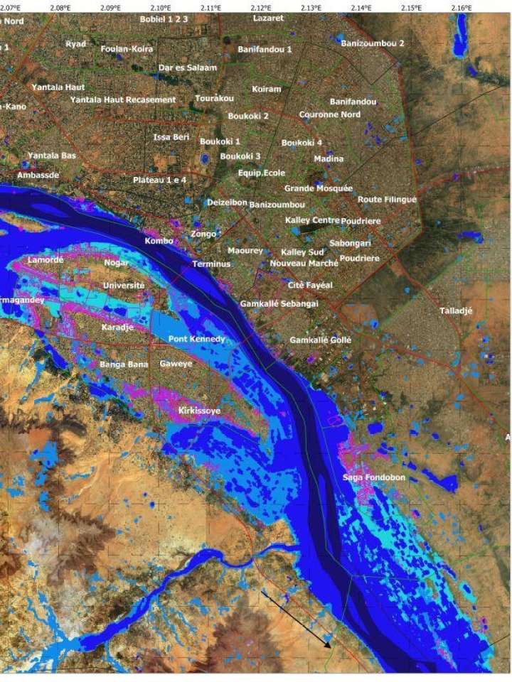
Map of flooded areas in Niamey, Niger - August - September 2020
Title in original language
Zones inondées de Niamey suite à la crue du Fleuve Niger de août-septembre 2020
The flooded areas map has been produced by the ANADIA2 project from Sentinel 2 satellite images at a resolution of 10 meters acquired on the dates of August 16, September 5 and September 10, 2020. The classification of the flooded areas was carried out using the NDFI index (Normalized Difference Flooding Index).
Explore further
Hazards
Flood
Country and region
Niger
Publication year
2020