Worst impacts of sea level rise will hit earlier than expected
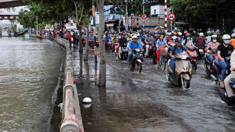
Updated, precise elevation models of coastal areas reveal the inundated land area in the first 1 to 2 meters of sea level rise could be double previous estimates.
WASHINGTON — Current models of sea level rise suggest the most widespread impacts will occur after sea level has risen by several meters. But a new study finds the biggest increases in inundation will occur after the first 2 meters (6.6 feet) of sea level rise, covering more than twice as much land as older elevation models predicted.
The study used high-resolution measurements of land elevation from NASA’s ICESat-2 lidar satellite, launched in 2018, to improve upon models of sea level rise and inundation. Previous assessments typically relied on radar-based data, which are less precise.
“Radar is unable to fully penetrate vegetation and therefore overestimates surface elevation,” said Ronald Vernimmen, a researcher at the Dutch research firm Data for Sustainability who led the study. Many coastal areas are lower than scientists thought they were.
The study was published in AGU’s Earth’s Future, which publishes interdisciplinary research on the past, present and future of our planet and its inhabitants.
The underestimates of land elevation mean coastal communities have less time to prepare for sea level rise than expected, with the biggest impacts of rising seas occurring earlier than previously thought. After those first few meters of sea level rise, the rate at which land area falls below mean sea level decreases.
Vernimmen, who works on flood protection and spatial planning advisory projects, started using these more accurate measurements of land elevation when he realized that existing land elevation estimates were not suitable for quantifying coastal flooding risk.
Using the new measurements of land elevation, Vernimmen and co-author Aljosja Hooijer found coastal areas lie much lower than older radar data had suggested. Analyses of the new lidar-based elevation model revealed 2 meters of sea-level rise would cover up to 2.4 times the land area as observed by radar-based elevation models.
For example, the lidar data suggest a 2-meter (6.6 feet) increase in sea level could put most of Bangkok and its 10 million residents below sea level, while older data suggested that Bangkok would still be largely above mean sea level under that same amount of sea level rise. In total, after 2 meters (6.6 feet) of sea level rise, Vernimmen and Hooijer estimate that 240 million more people will live below mean sea level. After 3 and 4 meters (9.8 and 13 feet) of sea level rise, that number increases by 140 million and by another 116 million, respectively.
Cities below future sea level may not necessarily be submerged because levees, dikes and pumping stations can protect some areas from rising seas; Amsterdam and New Orleans are modern examples of this. However, such protection measures can be expensive and take decades to implement. If vulnerable communities want to mitigate the most damage, they need to act before the sea rises those first few meters, according to Vernimmen.