New forecast model provides earliest ever awareness of floods and droughts globally
Predicting when rivers across the world are likely to flood months before they do could soon be possible thanks to a unique new forecasting system.
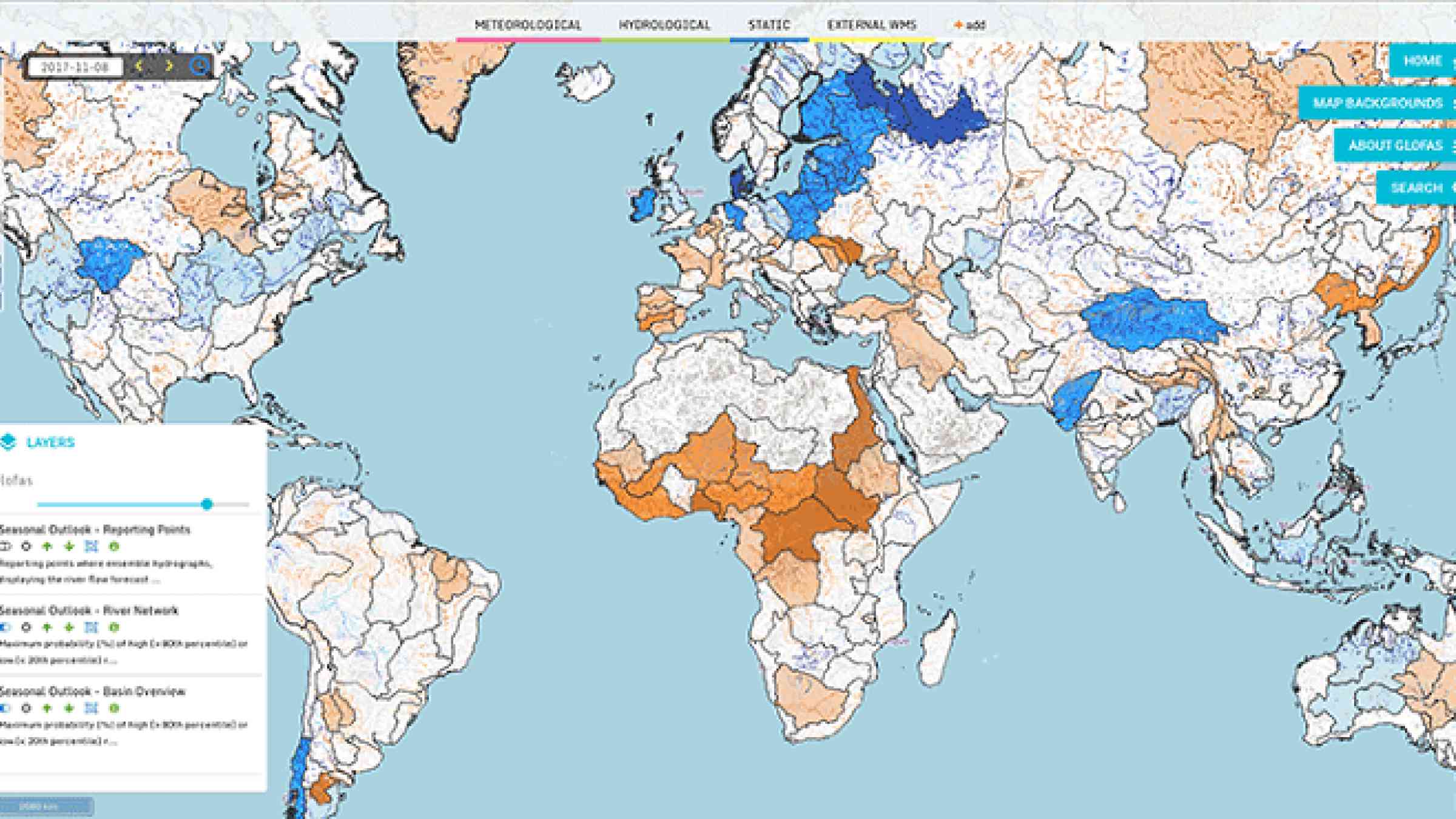
Researchers at the University of Reading have worked with the European Centre for Medium-Range Weather Forecasts (ECMWF) to create the first ever global, long-range river flow forecasting model. It indicates where and when rivers are likely to have unusually high or low flow, up to four months in advance. This could mean much earlier awareness of floods and droughts than has previously been possible.
The forecasts will be publicly available from 10 November as an addition to the Global Flood Awareness System (GloFAS), which is co-developed by ECMWF and the Joint Research Centre of the European Commission as part of the Copernicus Emergency Management Service. GloFAS currently offers flood forecasts up to 30 days in advance and is used by governments around the world and aid organisations like the Red Cross.
“It has the potential to provide earlier indications of both floods and droughts, which could be invaluable for disaster risk reduction efforts around the world" - Rebecca Emerton, University of Reading
'Game-changer'
The new model is currently undergoing a rigorous evaluation, but tests indicate it has the potential to save lives by allowing authorities and aid agencies around the world to plan and prepare flood relief efforts earlier than ever before. Other potential uses include water resource management, agriculture and disaster risk reduction.
Rebecca Emerton, a flood forecasting PhD researcher in the University of Reading’s Water@Reading team and project lead, said: “This new model could be a game-changer in that it provides hydrologically relevant forecasts out to several months for the whole globe – something that has never been possible before.
“It has the potential to provide earlier indications of both floods and droughts, which could be invaluable for disaster risk reduction efforts around the world, helping vulnerable communities become more resilient to the threat of flooding.”
Communities around the world are vulnerable during and after flooding events, which put lives at risk, impact livelihoods and affect food production. The new forecasting model takes long-range forecasts from the latest version of ECMWF’s seasonal prediction system (SEAS5) and, crucially, runs a hydrological model to simulate how this will impact river flow.
Development continues
Professor Christel Prudhomme, Environmental Forecast Team leader at ECMWF, added: “This is a turning point for the world’s environmental services as, for the first time, state-of-the-art long-range hydro-meteorological forecasts are freely available to communities across the globe. This would not have been possible without the strong support of the EU Copernicus programme to make the data open.”
Tim Stockdale, ECMWF’s project lead for SEAS5, said: “The newly launched SEAS5 represents six years of model development. Extensive tests have confirmed that SEAS5 brings consistent improvements in the tropics, in particular for El Niño and La Niña events. Predictions of near-surface temperature in the northern hemisphere are also improved, notably as a result of including an interactive sea-ice model.”
Until now, the necessary computational power has not been available to run models such as this for the whole globe. However, the computing facilities at ECMWF allowed the teams from the University of Reading and ECMWF to develop the new model, which is now running operationally at ECMWF.
The results of the model evaluation will be published in 2018, and will show whether the forecasts are more accurate at certain times of the year or in different parts of the world, and how they are affected by other climate events like El Niño. The system will continue to undergo development, with the aim to make forecasts even further in advance in the future.
The global seasonal river flow forecasting model follows research carried out by the team which analysed El Niño and La Niña global flood hazard. The team produced sophisticated maps illustrating the likelihood of flooding around the world during El Niño, taking into account river flow for the first time.