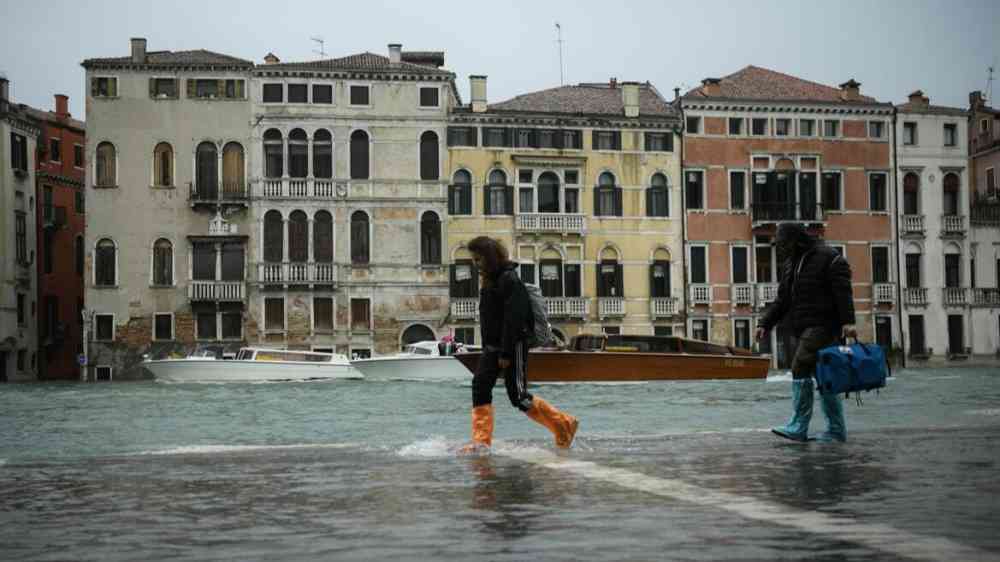
Venice: the risk maps of the flood-prone areas
Machine Learning for local adaptation to climate change. The recent study by CMCC@Ca’Foscari identifies the areas of the Metropolitan City of Venice most at risk of flooding.
Over the past decades, floods in the Metropolitan City of Venice during heavy rainfall events have highlighted the inadequacy of sewer and drainage systems in this highly urbanized area.
Given the future climate scenarios and the urbanization rate, worsening conditions and extreme events are expected in the next decades, posing rising threats to properties, people and productive assets.
With the aim to identify suitable measures to be included in the definition of the emergency and adaptation plan for the area, currently under development, a recent study conducted by researchers of CMCC@Ca’Foscari – the strategic partnership between the CMCC Foundation and Ca’ Foscari University of Venice – provides an assessment of pluvial flood risks in the Metropolitan City of Venice through an innovative Machine Learning methodology that considers spatio-temporal variables.
Output of the study is a suite of risk maps of the flood- prone areas in the area, useful to support local climate change adaptation processes.
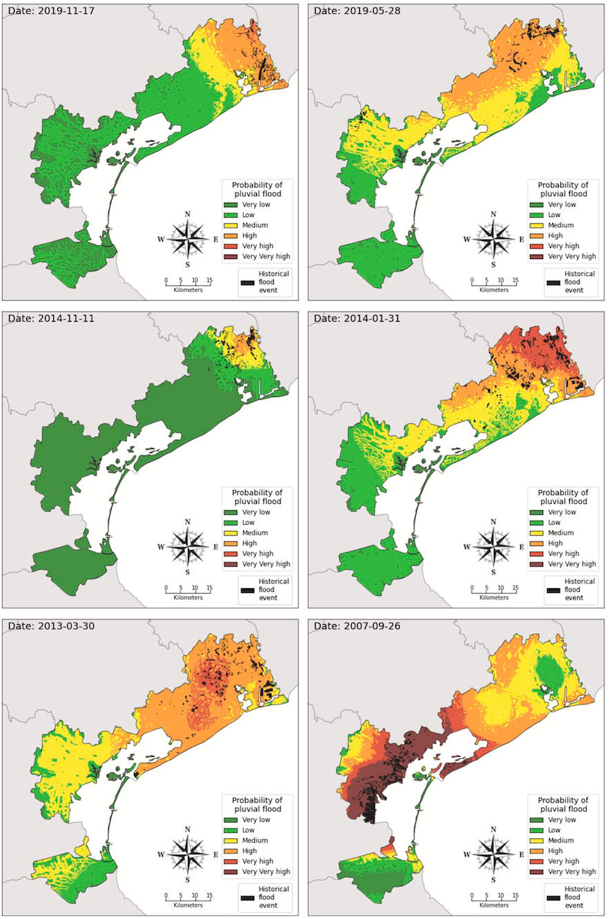
Comparison between model predictions and pluvial flood areas for the 6 historical events with the largest pluvial flood areas reported.
To build them, researchers investigated the performances of three machine learning models built on data from 60 historical pluvial floods (1995-2020) and a set of triggering factors representative of the territorial characteristic. Out of 12 triggering factors, distance to rivers and distance to road resulted as the most important features of an area contributing to pluvial flood risk.
“As the frequency and intensity of intense rainfall increases, certain Machine Learning techniques, such as the “spatio-temporal cross-validation” that we used, help to better predict the areas most exposed to the risk of flooding,” explains Elena Allegri, PhD student at CMCC@Ca’Foscari.
“This study paves the way for developing targeted adaptation strategies to protect the territory of the Metropolitan City of Venice in the context of climate change” says Andrea Critto, Professor at Ca’ Foscari University of Venice and Senior Scientist at CMCC, scientific leader of the research line on climate impacts, vulnerability and risk in the Venezia2021 project.
The proposed model, validated to reproduce historical events, will be applied for predicting future pluvial flood events in the area. The model demonstrates to be a useful tool for decision-makers to identify adaptation measures to be incorporated in spatial planning and disaster risk reduction strategies.