
From soil to space: Building flood-resilient cities
If you live in Asia, you may have experienced some of the worst floods in recent history this year. The ongoing floods in Hat Yai in southern Thailand have been reported as the worst in 300 years. Other cities in Asia have also recently experienced the worst flooding on record, such as Huế, Viet Nam, where the national meteorological agency has reported the rainfall as the highest in volume ever recorded. Flooding is a region-wide threat to urban environments, with each new year bringing record-breaking and previously unimaginable events. Demonstratively, the Asia-Pacific Disaster Report 2025reports floods as causing the highest economic losses of any disaster in Asia.
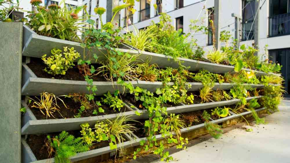
This year's World Soil Day theme, "Healthy Soils, Healthy Cities", is a timely call to incorporate healthy soils into the arsenal of tools which cities can utilize to tackle increasing flood risks. Healthy soils function as natural sponges, for example; nutrient-rich soils encourage plant growth, and these roots create seepage paths, encouraging drainage. This reduces flood risk while also producing co-benefits, such as cooling, improving water quality, providing food security and enhancing biodiversity.
Soil's ability to absorb floodwater in our cities has been degraded by increasing urbanization. Flood plains and forests have been replaced by car parks and offices. The increase in impervious surfaces associated with urban development blocks the absorption of water by soils. However, World Soil Day 2025 serves as a reminder that urban development can be complemented by sustainable practices to enable and promote the positive functions of soils in our cities.
Related content: Five fascinating ways that trees help prevent flooding
Did you know trees play a vital role in reducing flood risks? 🌲💧
Reliable soil data is essential to establish baselines, monitor changes or identify emerging threats. As the adage goes, "you can't improve what you can't measure". Traditional methods are constrained by sparse sampling and high spatio-temporal variability. Earth observation technologies offer a powerful solution by providing continuous spatio-temporal data that can cover vast areas that would otherwise be prohibitively resource-intensive to monitor. These tools enable tracking of indicators such as soil salinity, moisture, contamination and degradation. For example, under the Asia-Pacific Plan of Action on Space Applications for Sustainable Development (2018-2030), ESCAP and partners are supporting UzbekSpace Agency in developing a satellite-based system for mapping soil salinity. Another initiative in Indonesia, Malaysia, and the Philippines is assessing crop biodiversity through integrated satellite, UAV (unmanned aerial vehicle) and ground observation data to improve understanding of the ecosystem services provided by soils in supporting sustainable food production systems and healthy diets.
Satellite-derived soil data can also be used to map urban soil properties and therefore guide urban planners on where to install sustainable drainage systems such as rain gardens, tree corridors, permeable pavements, stormwater systems and urban farms that match local soil conditions. Rising soil moisture, detectable from space, often precedes flooding, highlighting the potential of soil moisture monitoring to strengthen flood warning systems. This potential was demonstrated by research on Bangkok's 2011 flood, also known as the "Great Flood". Additionally, hyperspectral imaging can detect heavy metals and pollutants without excavation, enabling soil contamination management. This is of the utmost importance in cities, where industry and commerce often sit adjacent to residential areas and water supplies.
It is essential to recognize that monitoring soil data alone is insufficient. For data to drive transformative policymaking, soil health must be approached as a cross-sectoral responsibility. Through establishing comprehensive geospatial infrastructures, soil health can be embedded within sectoral plans and strategies for climate action, forest and water management, agriculture and food security and human health. For example, Mongolia's centralized online land information portal consolidates geospatial data from national databases to improve land management and standardize data practices across sectors. Similarly, Indonesia's BRIN, supported by ESCAP, is developing Crop-Bio Datahub, a platform for storing, sharing, and accessing crop biodiversity data to support policymakers in formulating effective strategies and provide the public with convenient access to relevant and timely data. Even at this early stage, the effort to develop the Datahub is laying the foundation for more effective inter-agency coordination.
Finally, cities are contested spaces marked by socio-economic divides. These disparities create vulnerabilities which do not lend themselves readily to satellite-based measurements. Satellite-based indicators should therefore be used in conjunction with socio-economic data in designing policy interventions aimed at improving soil health. Only in this way, we can ensure their alignment with leaving no one behind and poverty eradication goals.
From space to sidewalks, innovative solutions can help cities restore their soils. Now is the time to turn this potential into reality. Happy World Soil Day!