Please help us improve PreventionWeb by taking this brief survey. Your input will allow us to better serve the needs of the DRR community.
Soil saturation dictates Africa’s flood severity
By Ellis Avallone
In the summer of 2020, deadly floods ravaged Africa, affecting nearly a million people and killing hundreds. However, the physical causes of floods across the continent’s diverse climate and terrain are gravely understudied. Lacking a broad network of water gauges, researchers have focused primarily on specific countries or single bodies of water. “The large extension of ungauged areas [has prevented] significant studies [from being conducted both] quantitatively and qualitatively,” said Mohamed El Mehdi Saidi of Cadi Ayyad University in Morocco.
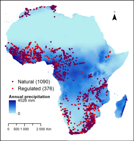
That has now changed, thanks to a 2-year project by an international team to curate the most complete hydrological data set for the African continent to date. This massive compilation combines on-the-ground and remote sensing measurements covering nearly 400 stream gauges and more than 11,000 flood events spanning at least 3 decades. The team’s analysis, the first continent-wide study of flood drivers in Africa, suggested that the largest yearly floods are more strongly linked to regions’ annual peaks in soil moisture than to annual peaks in precipitation. The findings, the first of their kind, were published in June in Water Resources Research.
An 11,000-Piece Puzzle
Other research teams have conducted several continent-wide studies of flood drivers across the United States, Europe, and Australia. Higher data coverage of stream flows and flooding patterns across these landmasses has led to a stronger understanding of when and why damaging floods occur. These continents, however, differ drastically from Africa climatically and geographically, leading scientists to suspect that the triggers of African floods are unique.
Africa’s largely arid climate, with the Sahara covering 25% of the landmass, is part of that equation. “You additionally have this ability to study a climate largely free of snow, which is a complicating factor when studying floods,” said infrastructure engineer Conrad Wasko of the University of Melbourne in Australia who was not involved in the study. With deadly floods becoming increasingly frequent in Africa as climate change worsens, hydrologists felt compelled to improve their data collection across the continent’s widely varying river basins.

The team’s African Database of Hydrometric Indices (ADHI), published in Earth System Science Data, includes hydrological parameters from watersheds across Africa spanning 33 years on average. Given the sparseness of data across the continent, the team took laborious steps to ensure that the records from different sources were of similar quality. “The most important thing was to manually and visually check each [measurement] independently,” said Yves Tramblay, a hydrologist at the French National Research Institute for Sustainable Development and lead author of the study.
For regions lacking in ground observations, the scientists incorporated Climate Hazards group Infrared Precipitation with Stations (CHIRPS), a series of remote sensing estimates from a hybrid satellite and ground data set, to obtain a homogeneous average of precipitation across all of Africa. They validated these measurements with gauged data when possible. The team’s thorough approach impressed Wasko: “Within engineering, we have a predisposition to collect [on-the-ground] data. New technologies, like remote sensing, are becoming essential to understanding hydrology in remote areas,” he said.
A New Flood Driver Takes the Stage
The ADHI data set allowed the team to compare the timing of several parameters relevant to floods. To determine which ones aligned most strongly with the largest floods each season, they isolated the dates when floods occurred and rigorously compared them to the timing of heavy rainfall and soil moisture conditions using directional statistics—a method that accounts for the direction data follow (in this case, the timing). The analysis revealed that high soil moisture levels showed a stronger correlation to the onset of flooding than to other parameters, most notably rainfall.
When ground already contains a lot of water, heavy rainfall mostly runs off the surface rather than absorbing into soils—greatly increasing the chances that even modest precipitation will create floods. “It was kind of surprising because we always thought that soil moisture in arid catchments was not a strong driver, but we find that overall it’s still a valuable one,” Tramblay said. “A common assumption is that floods are driven by extreme precipitation events. That’s true: Floods are always caused by precipitation. But the difference in soil moisture conditions before a flood event can strongly modulate its magnitude.”
The new approach invites further research on floods across Africa, Tramblay noted. The team plans to continue conducting targeted studies across many sites to “get a much clearer picture of the differences [in flood drivers] at a regional scale,” he said.
Tramblay also hopes the work will help future scientists and emergency planners across Africa prepare for each year’s flood season by having a better grasp of whether a region might be particularly susceptible. “[This is] an incentive to not look only at extreme rainfall when you’re doing flood projections, but to look at other land surface variables, including soil moisture, vegetation coverage, and change in land use,” said Tramblay. “There’s more recognition that if we’re going to be forecasting floods and designing infrastructure [to mitigate them], it’s not just rainfall we need to be thinking about, but all the other factors that affect flooding.”
Explore further
Please note: Content is displayed as last posted by a PreventionWeb community member or editor. The views expressed therein are not necessarily those of UNDRR, PreventionWeb, or its sponsors. See our terms of use
Is this page useful?
Yes No Report an issue on this pageThank you. If you have 2 minutes, we would benefit from additional feedback (link opens in a new window).