Mobility and resilience: A global assessment of flood impacts on urban road networks
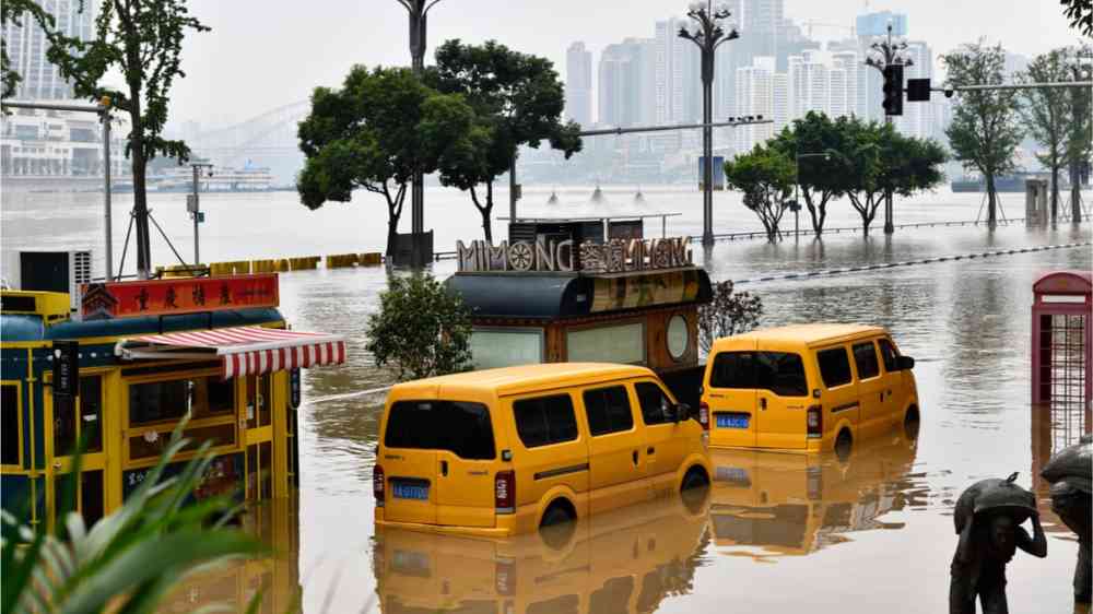
Road transportation networks are the arteries of modern societies, connecting people to goods, critical public services, jobs, and each other. Yet, the growing density and connectivity of these networks make them more vulnerable to environmental shocks— heightened by a changing climate. So how exposed and vulnerable are transportation networks around the world?
In a new Working Paper, we provide the first global evaluation of urban road networks in terms of both direct exposure to flood hazard, and indirect impacts due to city-wide travel disruptions and cascading failures. We created a dataset of topological road networks for 2,564 cities in 177 countries, covering over 14 million kilometers of roads, and considered ten probabilistic flood scenarios (1:5 year to 1:1000-year return periods).
1 in 7 kilometers of urban roads is exposed to flood hazards
Our global exposure evaluation shows that 2 million kilometers (or 14.7 percent) of all urban road networks are directly exposed to some level of flooding in the 1-in-100-year flood scenario . More than 1 million kilometers of roads experience flooding greater than 1 meter. Also, in some high-exposure cities, almost the entire road network could be affected. For more intense flood scenarios (i.e., higher return periods) the extent of the exposed road network increases systematically.
Figure 1. Network exposure and mobility: Road network inundation for different flood scenarios (left) and associated mobility disruptions (right)

Note: Percentage failed routes indicate the share of urban trips that cannot be completed in a flood scenario. Each dot in the scatterplot represents a city.
Even limited network exposure can result in drastic urban mobility disruptions
Flooding in certain road segments can disrupt mobility patterns across the whole city. In our study, we conducted thousands of travel simulations for each city to assess how local flood disruptions along roads could propagate across the network, impacting urban mobility. Our results show that these indirect mobility impacts, such as failed trips, travel delays, and travel distance increases, can far exceed direct network exposure.
On average, about 14.7 percent of urban road networks are estimated to be inundated by over 0.3 meters during a 1-in-100-year flood, but 44.8 percent of simulated trips fail in this flood scenario . For the remaining trips that are still possible, flood disruptions add, on average, 1.50 kilometers of detours, costing 3 minutes in additional travel times. Because of the interconnectivity of road networks, local floods can disrupt travel, with impacts on mobility that go far beyond the initially affected area.
Figure 2. Country-level summaries of direct and indirect impacts of flood hazard (1000-year scenario) on road networks and mobility: average travel delay (top-left), average percentage of failed routes (top-right), average percentage of road inundation (bottom-right), and average travel distance increase (bottom-left)

But the relationship between road network exposure and mobility disruption patterns differs significantly across countries and regions. Our research shows that generally, more intense flood scenarios lead to higher exposure and more urban travel disruptions. Yet, several countries show that even floods of lower intensities can induce trip failure rates of over 50 percent–this includes countries in central Africa (Mali and Sudan), southeast Asia (Bangladesh, Cambodia, China, Laos, Malaysia, Myanmar, the Philippines, Thailand, and Vietnam), and Latin America (Colombia, Costa Rica, Ecuador, Guyana, Honduras, Suriname, and Venezuela). In these countries urban mobility is particularly sensitive to flood hazards.
What determines the vulnerability of urban mobility?
Building on past studies on network topology and transport resilience, our study also examines the factors contributing to the high routing failure rates observed in the travel simulations. For example, we show that higher road density (as a proxy for network redundancy) can significantly reduce the risk of mobility disruptions, such as trip failures. Although road density can contribute positively to overall network resilience, it becomes less effective in more intensive flood scenarios.
This means that in practice, baseline investments in densifying urban road networks can strengthen the resilience of urban mobility. But targeted measures, starting at the most critical bottlenecks of the network, such as improving drainage, are also needed to protect against smaller local hazards. More systemic protection measures that mitigate large-area hazards are also needed, such as building seawalls or preserving natural wetlands. The data and results of this study help us to better understand flood risks to urban road networks and mobility patterns in 177 countries, allowing us to identify and prioritize urban resilience measures.