Flood and vulnerability map validation efforts in Lao PDR
The Asian Disaster Preparedness Center (ADPC) together with the Geoneon, People In Need (PIN), Swiss Agency for Development and Cooperation (SDC), and the Department of Meteorology and Hydrology (DMH) Lao PDR successfully conducted the validation of flood susceptibility and vulnerability data under the Addressing Climate and El Niño-related Risks in Southeast Asia (ACER-SEA) project in Attapeu province, Lao PDR.
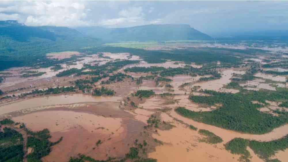
The ACER-SEA project aims to enhance disaster risk reduction and climate change adaptation capacities in Lao PDR by providing operational, high-resolution maps of flood susceptibility and climate vulnerability. Advanced geospatial modeling and hydrological analysis are integrated in those maps, which allows more accurate identification of flood-prone areas critical for early warning systems and preparedness planning. The ACER-SEA project is supported by the SDC.
The collected data from the maps can guide evidence-based decision-making at national and subnational levels, empowering authorities and communities to better prepare for and respond to floods.
The expert teams were engaged with local authorities and community representatives in Sanamxay, Phouvong, and Samakhixay districts of Attapeu province. They conducted ground truth verification of flood susceptibility maps by comparing mapped flood extents with observed flood marks and local experiences. Experts interviewed villagers to collect insights on social, economic, and physical vulnerabilities, ensuring that vulnerability maps accurately reflected on-the-ground realities. Moreover, they worked with district and provincial officials to explore practical use cases for the data in DRR and CCA planning, including integration into early warning systems and local adaptation measures.
Dr. Peeranan Towashiraporn, Director of ADPC's Risk Analytics and Climate Services, emphasized "Ground validation is a critical step to ensure our data matches the realities faced by local communities. We can provide information and support relevant stakeholders in Lao PDR to target adaptation efforts through combining flood susceptibility maps with detailed vulnerability data."
The results of the collaboration include validated flood and vulnerability datasets, increased awareness among provincial stakeholders, and strengthened collaboration between national agencies, development partners, and communities.
These outcomes will support the development of targeted DRR and CCA measures in Lao PDR, contributing to the ACER-SEA project's vision of building climate resilience across Southeast Asia.
The ACER-SEA project is expected to significantly improve the availability and accessibility of reliable high-resolution data on floods, landslides, climate, exposure, and vulnerability. This enhancement will pave the way for the creation of science-based early warning systems, anticipatory action, and forecast-based financing. Ultimately, these advancements will empower communities and decision-makers to respond proactively to climate-related risks.