By Ana Campos Garcia and Ankur Nagar
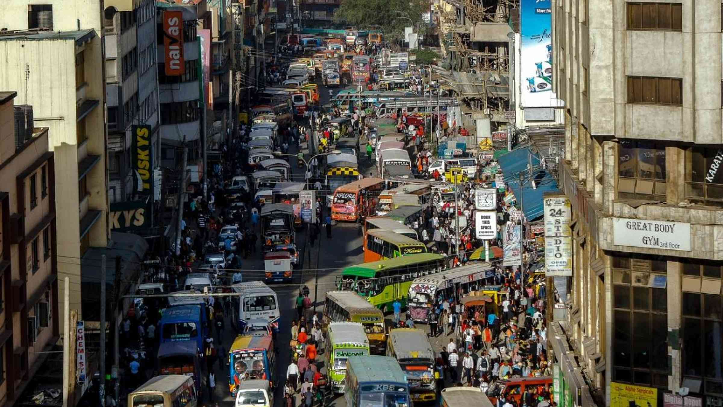
If you were asked to name the fastest urbanizing region on the planet, you should answer “Sub-Saharan Africa.” Currently, the region has 31 large cities, each with over 2 million people. By 2035, the number of such cities will be 49. The top 10 fastest growing large cities of the world are in the region, with Kampala and Dar es Salaam expected to double their populations by 2035.
The region also has 148,000 square kilometers of low-elevation coastal zones, 17 large trans-boundary river systems, and 160 major freshwater lakes.² As cities expand without adequate urban planning, many have sprawled into river deltas, low-elevation coastal zones, wetlands, or hill slopes — areas that are highly prone to natural hazards such as floods, landslides, and cyclones. Even in cities where adequate plans exist, the lack of enforcement and investment means that the challenges of sprawl into high-risk areas remain.
As migrants are pushed to cities from the countryside, they are often forced to settle in hazard-prone areas due to their proximity to jobs and the intense competition for urban land. With a lack of affordable housing, many end up living in structures that cannot withstand natural hazard shocks.
Across the region, 62% of city dwellers live in slums,² where drainage canals, solid waste management, and sewage systems are usually inadequate. The disaster risk in slums is exacerbated by poor infrastructure and encroachment along watercourses, wetlands, low-elevation coastal zones, and steep slopes.
With a lack of resilience measures, floods caused by heavy rains are common in the region’s cities. Global climate change and local land subsidence substantially increase the flooding risk in coastal cities associated with storms and sea-level rise. On the southeastern African coast, cities have been regularly hit by cyclones. The 6,000 kilometer–long East African Rift System also threatens many cities with earthquake risk.
The contours of the World Bank’s core Disaster Risk Management (DRM) agenda for Africa take shape within the context of the continent’s growing population and rapid urbanization. Currently, 50% of Sub-Saharan Africa’s GDP (US$0.5 trillion) is generated by 143 of its cities.³
While rapid urbanization is creating economic growth, it is also changing the disaster risk profile of countries from predominantly rural — with drought and food security challenges — to predominantly urban, with floods, cyclones, landslides, and earthquakes.⁶
The Global Facility for Disaster Reduction and Recovery (GFDRR) and the World Bank have systematically supported vulnerable countries in Sub-Saharan Africa to achieve disaster-resilient and climate-smart development at the city, national, and regional levels. The strategy is structured around four pillars:
- Understanding urban disaster risk
- Strategic planning to reduce urban disaster risk
- Investments in infrastructure and capacity for long-term urban resilience
- Responding to and recovering from disasters
A future-ready approach for disaster resilience
This approach has helped strengthen efforts to upstream resilience planning and infrastructure investments in cities through the World Bank’s climate and disaster resilience projects across Sub-Saharan Africa.
Cities covered by these projects include Abidjan, Accra, Antananarivo, Bamako, Beira, Cotonou, Dakar, Dar es Salaam, Douala, Freetown, Ibadan, Kampala, Kinshasa, Maputo, Nairobi, Saint-Louis, and many others.
To lay the analytical and strategic groundwork for the ongoing and upcoming climate and DRM projects of the World Bank, GFDRR has been supporting several cross-cutting initiatives that work with cities across the region.
Current approaches to disaster and climate risk assessment range from global, open-source tools to more detailed risk information at resolutions appropriate to analyzing the potential inundation from flood, storm surge, sea-level rise, tsunami, and other hazards. Some examples of these initiatives include:
City Resilience Program
City Resilience Program’s (CRP) vision is resilient cities with the capacity to plan for and mitigate adverse impacts of disasters and climate change, enabling them to save lives, reduce losses, and unlock economic and social potential. To achieve this vision, CRP pursues three strategic objectives:
- Planning for Resilience: Cities have increased access to tools and technical support to effectively plan for resilience.
- Finance for Resilience: Cities have increased access to multiple sources of financing to implement planned investments in resilience.
- Partnerships for Resilience: Cities can leverage global partnerships to support their resilience objectives.
As a starting point for engaging with cities on Planning For Resilience, CRP has developed the City Resilience Scan, which provides a package of data, maps, visualizations, and analyses that offer a rapid assessment of the critical development challenges that cities face and their relation to climate and disaster risks, using the best publicly available data and open-source tools.
CRP has so far engaged with 92 cities around the globe, with upstream project engagements in 28 African cities. For six of these engagements, World Bank task teams and their city clients have identified a potential for private sector involvement in an aspect of the urban resilience engagement. African cities were the first to benefit from City Resilience Scans and, so far, CRP has produced a total of 20 City Resilience Scans for African Cities.
The program also organized a Resilience Investment Planning Workshop in Durban for 11 African cities and two Financial Solutions for City Resilience Conferences in Bangkok. In July 2019, the program hosted the first Resilience Investment Planning Workshop in Madrid with representatives from 24 cities around the world, including 14 from Africa.
CityCORE Africa
Beginning with 16 coastal cities, the City Coastal Resilience in Africa (CityCORE) initiative is using disruptive technology — including remote sensing and machine learning — to collect information on institutional capacity and existing hazard, exposure, and vulnerability mapping analysis to generate rapid risk screenings of coastal cities and to inform investments.
Open Cities Africa
The Open Cities Africa project is working with mappers, technologists, and risk experts across 22 cities in the region to collect open spatial data, develop tools to utilize risk information, and build local capacity for evidence-based urban resilience interventions. The work was financed by GFDRR through two initiatives: the Africa Caribbean and Pacific — European Union (ACP-EU) and the Africa Disaster Risk Financing Initiative (ADRF).
Making cities resilient to climate and disaster risks
So how does the World Bank and GFDRR’s approach make cities in the region resilient to climate and disaster risks? Here are answers from seven cities within Sub-Saharan Africa.
The Greater Accra Region (GAR) is home to 4.6 million people — 16% of Ghana’s population. GAR’s economy contributes almost 25% of the country’s GDP, yet about 4 in 10 GAR residents live in slums.
Importantly, about 60% of GAR’s population live in the Odaw river basin, which is prone to floods during the rainy season. One of the worst flooding events in GAR’s history occurred on June 3, 2015. The floods caused major damage and losses in the housing, transport, water, and sanitation sectors — amounting to US$55 million, with an estimated US$105 million needed for reconstruction cost.
Understanding Risk and Strategic Planning
Open Cities Africa builds on the city-scale approach to understand and use flood data at the neighborhood level as an input for investment planning. During 2016–17, the Government of Ghana and the World Bank jointly implemented the City Strength Diagnostic to understand GAR’s exposure to risks, its level of resilience, and the performance of its urban systems. The resulting report identified root causes of risks and suggested priority actions.
Investments for Resilience
In the aftermath of the 2015 flood, the World Bank supported various studies to inform evidence-based decision making for strengthening urban resilience in Greater Accra, bringing together key stakeholders from many ministries, departments, and municipalities over the course of two years (2016–18).
The analytical work informed the design of the Greater Accra Resilient and Integrated Development (GARID) Project, approved in May 2019. Supported by the World Bank’s International Development Association (IDA), this multi-phase, multi-sectoral, and integrated operation is providing US$200 million to finance a set of actions to improve flood resilience, including drainage infrastructure improvements, nature-based flood mitigation measures, solid waste management, and local government capacity building, among others.
Beira, Mozambique
In 2001, the port city of Beira was home to 143,000 people.¹⁰ By 2019, its population had reached 530,000 and its built-up area expanded six times. Storms and rains regularly flooded its massive informal settlements.
When Cyclone Idai struck the city of Beira on March 14, 2019, the port of Beira was paralyzed for a few days, and transportation and communications services were interrupted. However, thanks to the improved drainage system and flood protection measures financed by the World Bank, parts of the city were protected from the floods and experienced limited impact.
Understanding Risk
In early 2019, supported by the EU (through the Africa Disaster Risk Financing Initiative, or ADRF, part of the wider ACP-EU Building Disaster Resilience in Sub-Saharan Africa program), the World Bank and GFDRR furthered the flood resilience effort with a Rapid Screening and Evaluation of Flood Risk Reduction Strategy for the city. The report evaluates the urban and coastal flood risks, and explores the effectiveness of interventions, such as upgrading drainage, coastal defense, and early warning.
Investments for Resilience
The World Bank, alongside other development partners, has been providing support to improve the resilience to flooding in Beira over the past seven years (see Helping Mozambique Cities Build Resilience to Climate Change).
The Mozambique Cities and Climate Change Project (3CP, 4/2012–6/2020), funded by a US$120 million IDA credit, financed the rehabilitation and first-phase extension of the city’s stormwater drainage system. The stormwater drainage system — which comprises 11 kilometers of primary drainage canals, 6 flood control stations, and a 170,000 cubic meter retention basin — covers roughly one-third of key central areas of the city.
With these advances in drainage and flood resilience measures, Beira was put to the test during Cyclone Idai and able to recover quickly from its impacts.¹¹ It reduced flood risk for about 2,630 hectares, benefiting an estimated 250,000 people.
Disaster Response
In order to support reconstruction and recovery and help people in Mozambique affected by Cyclone Idai, the World Bank has activated the International Development Association Crisis Response Window to provide US$390 million to Mozambique channeled through existing projects and a new Cyclone Idai and Kenneth Emergency Recovery and Resilience Project (CERRP, 9/2019–9/2024).
Building on the rehabilitation of Beira’s drainage system financed under the Mozambique Cities and Climate Change Project, the CERRP will finance the second-phase extension of the drainage system (estimated at around US$60 million) and improvements in coastal protection, with co-financing from the Dutch and potentially German government.
The World Bank also supports strengthening of disaster preparedness and response under the Mozambique Disaster Risk Management and Resilience Program (US$90m IDA, 03/2019–06/2024). For more information on the Cyclone Idai response, see Cyclone Idai: Building climate and disaster resilience in Mozambique and beyond.
Dakar, Senegal
Within just 0.3% of Senegal’s area, the Dakar region holds 24% of the country’s population (2.7 million) and generates 80% of its economic activity. However, 90% of the population in peri-urban Dakar still lives in slums or unplanned settlements, where 4 in 10 people are exposed to floods.¹²
In 2009, intense rainfall led to serious flooding in Senegal, with the total cost of damage and losses amounting to US$104 million across the country — US$82 million within the peri-urban areas of Dakar alone, according to the Post Disaster Needs Assessment (PDNA). Subsequently, floods caused by heavy rains in 2012 displaced thousands of families in the city. This disaster also resulted in the Government of Senegal adopting a 10-year Flood Management Program (PDGI 2012–2022).
Derived from the PDNA action plan and in alignment with PDGI, the Stormwater Management and Climate Change Adaptation Project, known more commonly in Senegal as PROGEP (the French acronym for Projet de Gestion des Eaux Pluviales et d’adaptation au changement climatique), was developed to reduce the flood risks in peri-urban areas of Dakar through capacity building, strategic planning, and investments.
Understanding Risk and Strategic Planning
Some of the immediate activities implemented under PROGEP consisted of increasing the knowledge of flood risk and integrating this information into urban planning and management. To this end, drainage masterplans were undertaken for the flood-prone areas of Pikine and Guediawaye. These were then used as inputs to develop detailed Local Urban Development Plans for the respective areas that account for and incorporate strategies for flood risk mitigation.
Investments for Resilience
Implemented over an eight-year period from 2012 to 2020, the US$96.1 million PROGEP, which includes US$5.5 million in co-financing from the Global Environment Facility’s Sustainable Cities Program and US$9 million in parallel financing from the Nordic Development Fund, has made substantial contributions to investments in resilience across the peri-urban areas of Dakar.
The project has helped develop drainage canals and reservoirs, which now protect 167,000 people and more than 900 hectares from floods in Dakar’s poorest neighborhoods of Pikine and Guediawaye.¹⁴ In addition to the investments in infrastructure, the project has strengthened the capacity of communities in urban flood risk reduction and climate change adaptation through the establishment of Local Committees for Stormwater Management and Climate Change Adaptation Project (COLIGEPs), which bring together neighborhood associations and municipal authorities to support monitoring and the preservation of drainage networks.
Dar es Salaam, Tanzania
In Dar es Salaam, the commercial capital of Tanzania, 70% of urban development is estimated to be unplanned. The city of over 4 million hosts approximately 7% of the country’s population.
About 1 in 4 residents of the city live in the Msimbazi river basin, which is prone to severe and recurrent flooding. During the rainy season, the river changes its character dramatically. On April 15, 2018, for instance, a state of flood emergency was declared in Dar es Salaam as heavy rains inundated urban roads, destroyed critical infrastructure, paralyzed the urban hub, and caused 15 reported deaths.
Many of the deaths occurred in Jangwani, an unplanned neighborhood near the city center that straddles the Msimbazi River.¹⁵ An analysis on the role of poverty in exposure, vulnerability, and resilience to floods in Dar es Salaam demonstrated that the April 2018 flood resulted in economic losses of over US$100 million to citizens over a three-day period.¹⁷ This type of event has become the norm, however, as seen in the 12 floods impacting the city between October 2017 and January 2020.
Supported by the United Kingdom’s Department for International Development (DFID) and the World Bank, the Tanzania Urban Resilience Program (TURP) has advanced preparation of a comprehensive, integrated approach to rehabilitation in the Msimbazi basin and a strengthened emergency management system for Dar es Salaam. Here are some highlights from TURP’s work:
Understanding Risk
The Ramani Huria (Swahili for “open map”) project builds the capacity of university students and local community members in Dar es Salaam to create accurate maps of the city’s flood-prone areas. During 2018, Ramani Huria trained over 960 people in basic mapping skills using locally accessible tools.
Strategic Planning
In 2018, a participatory design process known as the Msimbazi Charrette provided a platform for over 200 people from 59 institutions and communities to match scientific evidence with local insights to develop a Flood Mitigation Plan and Framework for Action for the Msimbazi basin.
Investments for Resilience
Beginning in 2015, the Dar es Salaam Metropolitan Development Project has invested over US$300 million to improve the city’s infrastructure and public services. The project has rehabilitated 16 major drains across the river basins in the city and has finalized the development of the Dar es Salaam Drainage and Sanitation Development Plan 2018–2035. The Government of Tanzania and the World Bank are currently discussing complementary investments of approximately US$120 million to support the implementation of the Msimbazi Opportunity Plan.
Freetown, Sierra Leone
Freetown is one of the most crowded coastal cities in the world, with 8,450 people per square kilometer. The city’s population has increased roughly 10-fold in the last 50 years.
Freetown’s 1.2 million residents constitute 15% of Sierra Leone’s population while occupying less than 0.5% of the national land mass. Freetown is also the nerve center of the Sierra Leone economy, generating 30% of its GDP. A large part of Freetown’s built-up area is located either on steep slopes or below sea level.
Because of unregulated construction along slopes and natural waterways, floods are common every rainy season. In August 2017, following three days of intense rains, a side slope in the Regent area of Freetown collapsed. This caused a massive landslide that devastated everything in its path: over 6,000 people were affected and 349 buildings were destroyed according to the Rapid Damage and Loss Assessment.
Understanding Risk
During 2017–18, a detailed Multi-City Hazard Review and Risk Assessment for Sierra Leone was developed by the World Bank. The assessment informs the understanding of natural hazards for Freetown, Makeni, and Bo (including landslides, coastal erosion, and flooding) and recommends solutions to reduce disaster risk.
Investments for Resilience
Building on the findings of the Damage and Loss Assessment the World Bank prepared the Freetown Emergency Recovery Project (FERP), investing US$10 million over three years to (i) restore and improve public infrastructure and stabilize the area around the slope in Freetown where the landslide initiate; (ii) improve the government’s capacity to manage disaster risk and support community drainage schemes in Freetown. The landslide slope has been remediated, channelized and re-planted.
Building on the achievements of the FERP, an Urban Resilience Project is under preparation, with a funding envelope of US$56.7 million, including a US$50 million IDA grant and US$6.7 million in co-financing from the Sustainable Cities Program of GEF-7. The Project will support all seven city councils in Sierra Leone, including Greater Freetown, the country’s economic engine. It is being designed to support an integrated spatial approach to address the multi-sectoral urban development challenges of the country including urban planning, revenue enhancement, infrastructure upgrading, solid waste management, and disaster risk management.
Strategic Planning
In 2018, the World Bank conducted an Urban Sector Review for Freetown, which provides the local administration with a clear understanding of Freetown’s resilience challenges, a thorough analysis of issues linked to the built-up environment, and options available to address the underlying issues.
Kampala, Uganda
Kampala is the capital and most populous city of Uganda, with a nighttime population of 1.5 million. It is one of the fastest growing African cities with annual growth rates of over 4%. It is also the country’s economic hub, accounting for 80% of the country’s industrial and commercial activities and 31.2% of its national GDP.
However, Kampala faces a wide array of hazards that are hindering its economic growth. Floods, fires, epidemics, air pollution, environmental degradation, building collapse, earthquakes, erosion, and landslides pose shocks and stresses to Kampala’s people, livelihoods, and economy.
Rising temperatures and changing climate patterns will probably increase the frequency and intensity of such hazard events, putting further strain on the coping capacity of the city and its residents.
Understanding Risk
With the support of CRP’s City Resilience Scan to assess the challenges that Kampala faces and their relation to climate and disaster risks, the Kampala Capital City Authority (KCCA) found that its built-up area located in flood-prone areas increased at a rate of 6% between 1975 and 2014. Approximately 63 kilometers of Kampala’s major roads, 4% of its schools, and 6% of its hospitals are in areas at risk from river and rainwater floods. More than 10% of all jobs and 10% of main roads lie in such flood-prone areas. Furthermore, KCCA worked with the World Bank to develop an inventory of historical events and a high-resolution flood assessment, based on LIDAR (Laser Imaging Detection and Ranging).
Investments for Resilience
Because of the continuous increase in the built-up surface and growing settlements in low-lying areas, the existing infrastructure in Kampala cannot cope with the run-off and water volumes it faces — leading to frequent, localized flooding. The Second Kampala Institutional and Infrastructure Development Project has supported the updating of the Kampala Drainage Master Plan, which is now guiding the re-design, reconstruction, and investment for several drainage and flood management systems in the city.
Strategic Planning
The Kampala Drainage Master Plan focused on hard infrastructure solutions, which highlighted the need to develop a resilience strategy for an integrated approach to overall flood risk management and the need to cover key soft measures such as risk-informed land-use planning or green infrastructure. In turn, the KCCA recently developed the Kampala Disaster Risk and Climate Change Resilience Strategy for such an integrated approach to (1) avoid creating risks, (2) reduce existing risks, (3) respond more efficiently to disasters, and (4) mitigate climate change and build climate resilience.
KCCA has begun to enhance its emergency preparedness and response (EP&R) capacity and build resilience in local communities. To do this, KCCA and relevant response agencies identified gaps in local EP&R policy, planning, and capacity — in addition to formalizing the multi-agency planning and coordination structures at city-, division-, and ward-levels — to ensure that all available resources can be harnessed effectively during an emergency.
Mahé, Seychelles
Of the 115 islands in the Seychelles, 100 are low-lying. About 80% of the country’s population of about 96,000 lives on the island of Mahé, in urban centers like Victoria. However, total arrivals of tourists per year triple the archipelago’s population.
Mahé and the inner islands of the Seychelles experience nearly US$2.8 million in losses from floods, cyclones, and earthquakes every year — with Mahé facing over 75% of the losses. In 2013, Mahé was struck by cyclone Felleng, which caused damage of US$8.4 million according to the ADRF and World Bank–supported Damage, Loss, and Needs Assessment. And in 2016, it was affected by cyclone Fantala.
Strategic Planning
In 2017, the Seychelles became the first African country to receive US$7 million in financing from the World Bank to improve its disaster risk management planning and to be able to “draw down” funds in the immediate aftermath of any disaster. To increase resilience and in response to COVID-19 through the Disaster Risk Management Development Policy Loan with a Catastrophe Deferred Drawdown, the Seychelles is strengthening its:
- National Integrated Emergency Management Plan
- Standard Operating Procedures for District Response
- National Coastal Management Plan
- National Spatial Data Policy
The Coastal Management Plan (CMP) 2019–2024, in particular, outlines priority interventions in coastal infrastructure, ecosystem restoration, and land planning to tackle erosion and secure a resilient coastline. The total investment amount for the five-year period is estimated at US$15 million, which includes US$2.6 million for capacity development.
Understanding Risk
Recently, Open Cities Africa trained 34 government agencies and nongovernmental organizations in the Seychelles to collect and process high-resolution imagery from drone flights, which help improve the understanding of coastal flood and erosion risk.
On the islands of Mahé, Praslin, and La Digue, Open Cities Africa is also working with local communities to collect data on tourism establishments and public buildings located below 10 meters elevation.