1. Home
  2. Knowledge Base | PreventionWeb
  3. Hazards

Landslide

Landslide is the downslope movement of soil, rock and organic materials under the effects of gravity, which occurs when the gravitational driving forces exceed the frictional resistance of the material resisting on the slope. Landslides could be terrestrial or submarine (Varnes, 1978).

Landslides can be triggered by geological and physical causes such as glacier or snow melts, heavy rains and water pressure, earthquakes, volcanic eruptions and overly steep slopes. Landslides can also be triggered by human action, the most common being building on unstable slopes. Submarine landslides, or massive slides and rock falls hitting the sea can also cause tsunamis.

Landslides can reach speeds of over 50 km/h and can bury, crush or carry away people, objects and buildings. Landslides cannot be predicted but warning systems measuring rainfall levels can provide warning to people living in landslide-prone areas.

Instrumental monitoring to detect movement and the rate of movement can be implemented, for example, extensometers, global positioning system (GPS), seismometers, aerial photography, satellite images, LiDaR (Highland and Bobrowsky, 2008), with varying degrees of success. Increasingly, the science of landslide physics is allowing the nature of these hazards to be understood, which is leading to better techniques through which they can be managed and mitigated (HIP).

Risk factors

  • Population growth
  • Rapid urbanisation
  • Environmental degradation (deforestation and inappropriate use of lands and slopes)
  • High population density, heavy rainfall and rapid land use changes increase the instability of slopes

Risk reduction measures

  • Early warning systems to observe and alert before landslides happen
  • Hazard maps to identify landslides risk and vulnerabilities
  • Integrate landslide risk assessment into urban planning strategies
  • Building codes and standards for materials that reinforce landslide resilience
  • Improve drainage, building tunnels and trenches to stabilise slopes
  • Protect forest cover and regulate logging
  • Raise awareness of landslide risk
  • Regular drills and community evacuation exercises
  • Establish national, regional, and local evacuation plans

Latest Land Slide additions in the Knowledge Base

Uploaded on
Update
NZ: rising house insurance premiums warn of a system under strain

Rising home insurance premiums in New Zealand highlight growing pressure on the country’s natural hazards insurance system as climate change, increasing disaster risks, and higher reinsurance costs challenge its long-term affordability and sustainability.

Conversation Media Group, the
Toward a standard for landslide data: Bridging gaps in landslide susceptibility modeling and early warning systems thumbnail
Documents and publications

This report outlines the urgent need for a unified global standard for landslide data to strengthen disaster risk reduction, particularly in susceptibility modelling and early warning systems.

World Bank, the
Update
Colombia: Collaboration on early warnings for vulnerable communities

Pacific Disaster Center (PDC) has announced a groundbreaking technology and risk-reduction collaboration with Twilio.org and the City of Cali, Colombia to strengthen disaster early warning communications and landslide risk awareness.

Pacific Disaster Center
Risk awareness characterisation in multi-hazard, high-tourist-interest sites: the case of Stromboli volcano during the 2019 eruptive crisis (Aeolian islands UNESCO site, Italy) thumbnail
Documents and publications

This study investigates risk awareness among the local population and tourists on the island of Stromboli, a permanently inhabited volcano in Italy, during the July–August 2019 eruptive crisis.

Natural Hazards (Springer)
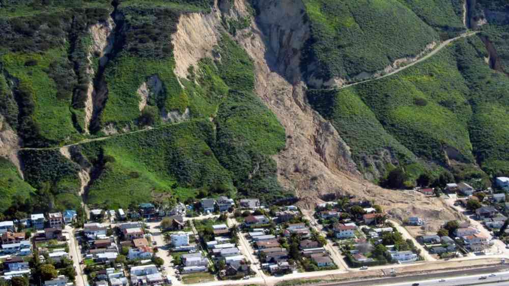
Rock and soil cover destroyed houses in La Conchita, California after a landslide tore through the community in 2005.
Update
Why urban and rural landslides should not be considered together

There is a quiet assumption built into many landslide susceptibility maps: that landslides occurring in cities and those happening in surrounding rural areas follow the same rules.

European Geosciences Union
Incorporating compound temporal precipitation dynamics to enhance landslide susceptibility modeling thumbnail
Documents and publications

This study presents an advanced landslide susceptibility assessment for China by integrating compound temporal precipitation (the combined effects of long‑term antecedent rainfall and short‑term triggering precipitation) into machine‑learning models.

npj Natural Hazards (Nature)
Border Roads Organization clear the road to Leh affected by landslide on August 29, 2012 in Manali, India. Landslides are regular phenomenon of this high altitude region.
Research briefs
South Asia: The exceptional landslides in the 2025 summer monsoon

In NW India, rainfall in the 2025 monsoon was 27% above the long term average. Over 2,500 people were killed in India and Pakistan by landslides and floods as a result.

Eos - AGU
Update
Nepal maintains roads but ignores the slopes holding them up

What often goes unnoticed is the deeper, recurring problem beneath these disruptions: Nepal’s highway maintenance system still focuses largely on pavement, while the slopes that physically support our roads receive little systematic attention.

The Annapurna Express
Uploaded on