1. Home
  2. Knowledge Base | PreventionWeb
  3. Hazards

Landslide

Landslide is the downslope movement of soil, rock and organic materials under the effects of gravity, which occurs when the gravitational driving forces exceed the frictional resistance of the material resisting on the slope. Landslides could be terrestrial or submarine (Varnes, 1978).

Landslides can be triggered by geological and physical causes such as glacier or snow melts, heavy rains and water pressure, earthquakes, volcanic eruptions and overly steep slopes. Landslides can also be triggered by human action, the most common being building on unstable slopes. Submarine landslides, or massive slides and rock falls hitting the sea can also cause tsunamis.

Landslides can reach speeds of over 50 km/h and can bury, crush or carry away people, objects and buildings. Landslides cannot be predicted but warning systems measuring rainfall levels can provide warning to people living in landslide-prone areas.

Instrumental monitoring to detect movement and the rate of movement can be implemented, for example, extensometers, global positioning system (GPS), seismometers, aerial photography, satellite images, LiDaR (Highland and Bobrowsky, 2008), with varying degrees of success. Increasingly, the science of landslide physics is allowing the nature of these hazards to be understood, which is leading to better techniques through which they can be managed and mitigated (HIP).

Risk factors

  • Population growth
  • Rapid urbanisation
  • Environmental degradation (deforestation and inappropriate use of lands and slopes)
  • High population density, heavy rainfall and rapid land use changes increase the instability of slopes

Risk reduction measures

  • Early warning systems to observe and alert before landslides happen
  • Hazard maps to identify landslides risk and vulnerabilities
  • Integrate landslide risk assessment into urban planning strategies
  • Building codes and standards for materials that reinforce landslide resilience
  • Improve drainage, building tunnels and trenches to stabilise slopes
  • Protect forest cover and regulate logging
  • Raise awareness of landslide risk
  • Regular drills and community evacuation exercises
  • Establish national, regional, and local evacuation plans

Latest Land Slide additions in the Knowledge Base

Uploaded on
Border Roads Organization clear the road to Leh affected by landslide on August 29, 2012 in Manali, India. Landslides are regular phenomenon of this high altitude region.
Research briefs

The longer term mental health impacts are also deeply troubling. Akhila et al. (2025) describe how the communities were left in a constant state of fear of a repeat of the event.

Eos - AGU
waste plastic bottles and other types of plastic waste at the Thilafushi waste disposal site
Update

At the most simple level, it is likely that the garbage pile was over-steepened, perhaps compounded by poor management of water. The processes through which tipping of waste at the top of the pile will be a focus.

Eos - AGU
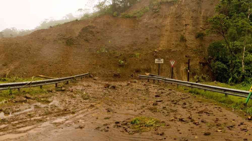
Mudslide blocking a road in Costa Rica
Update

A fascinating case study from the 24 June 2025 Granizal landslide in Medellín, Colombia, which killed 27 people and destroyed 50 homes, shows demonstrates that it is not just the urban poor that are exposed to landslides.

Eos - AGU
Research briefs

This piece of work sought to understand the patterns of landslides in Alaska over a century through the creation of a database compiled from “a combination of 24 digital newspapers and online media sources, including historic digitised Alaskan newspapers.

Eos - AGU
Cover
Documents and publications

This paper describes an AI‑based method for mapping landslide risk using Slide3 slope analysis, field tests like ERT and SPT, and GIS tools to create a clear, reliable picture of where landslides are most likely to occur.

Kyushu University
landslide-susceptibility-and-risk-analysis-in-benighat-rural-municipality.pdf thumbnail
Documents and publications

This study examines the factors influencing landslides in the Benighat-Rorang RM by analyzing soil structure, geology, land cover, geomorphology, fault lines, weather data, and road density to generate a comprehensive landslide Susceptibility Mapping.

Asian Institute of Technology - Disaster Preparedness, Mitigation and Management Program
Research briefs

Researchers studying a massive landslide in Alaska have detected strange seasonal seismic pulses caused by water freezing and thawing in rock cracks.

Seismological Society of America
How virtual reality helps prepare for real-life disaster risks - image with two people in VR goggles infant of wildfire
Update

Virtual reality (VR) offers immersive and interactive experiences that bring a multitude of scenarios to life – offering rich possibilities for disaster risk reduction.

United Nations Office for Disaster Risk Reduction (UNDRR)
Uploaded on