1. Home
  2. Knowledge Base | PreventionWeb
  3. Hazards

Flood

Flooding is an overflowing of water onto land that is normally dry (NOAA). There are various categories of floods. Coastal flooding is most frequently the result of storm surges and high winds coinciding with high tides (WMO, 2011).

A flash flood is a flood of short duration with a relatively high peak discharge in which the time interval between the observable causative event and the flood is less than four to six hours (WMO, 2006). A fluvial flood is a rise, unusually brief, in the water level of a stream or water body to a peak from which the water level recedes at a slower rate (WMO, 2012). A ‘glacial lake outburst flood’ is a phrase used to describe a sudden release of a significant amount of water retained in a glacial lake, irrespective of the cause (Emmer, 2017).
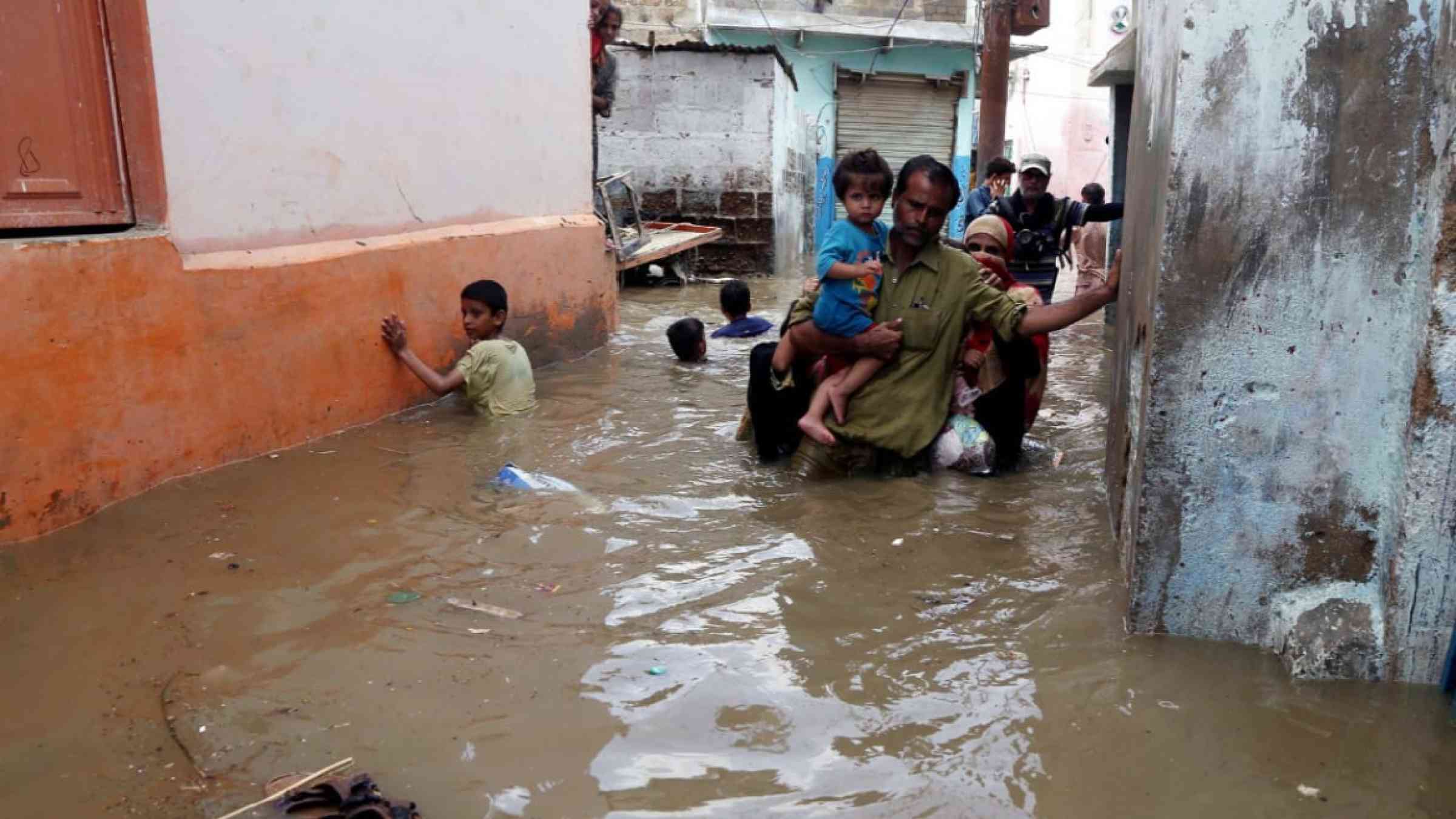
Floods affect more people than any other hazard. Worldwide, nearly 200 million live in coastal zones at risk of flooding. Flooding is usually the result of heavy or continuous rain that exceeds the absorptive capacity of the soil and the flow capacity of rivers, streams and coastal areas. Floods can be triggered by thunderstorms, tornadoes, tropical cyclones, monsoons, melting snow and dam breaks. The most common floods are flash floods, snowmelt floods, coastal floods and river floods. Flash floods and sudden floods are the most dangerous, especially when they occur at night.

Floating houses could be the future of flood protection for vulnerable populations.

Integrated Flood Management (IFM) is a process that promotes an integrated, rather than fragmented, approach to flood management. It integrates land and water resources development in a river basin, within the context of Integrated Resources Management, with a view to maximising the efficient use of floodplains and to minimising loss of life and property. IFM, like Integrated Water Resources Management, should encourage the participation of users, planners and policymakers at all levels (APFM).

This page refers to different types of floods, such as:

  • Coastal flood: Coastal flooding is most frequently the result of storm surges and high winds coinciding with high tides. The surge itself is the result of the raising of sea levels due to low atmospheric pressure.
  • Fluvial flood: A fluvial flood is a rise, usually brief, in the water level of a stream or water body to a peak from which the water level recedes at a slower rate (WMO, 2012).
  • Flash flood: A flash flood is a flood of short duration with a relatively high peak discharge in which the time interval between the observable causative event and the flood is less than four to six hours (WMO, 2006).
  • Glacial Lake Outburst Flood: A ‘glacial lake outburst flood’ is a phrase used to describe a sudden release of a significant amount of water retained in a glacial lake, irrespective of the cause (Emmer, 2017).
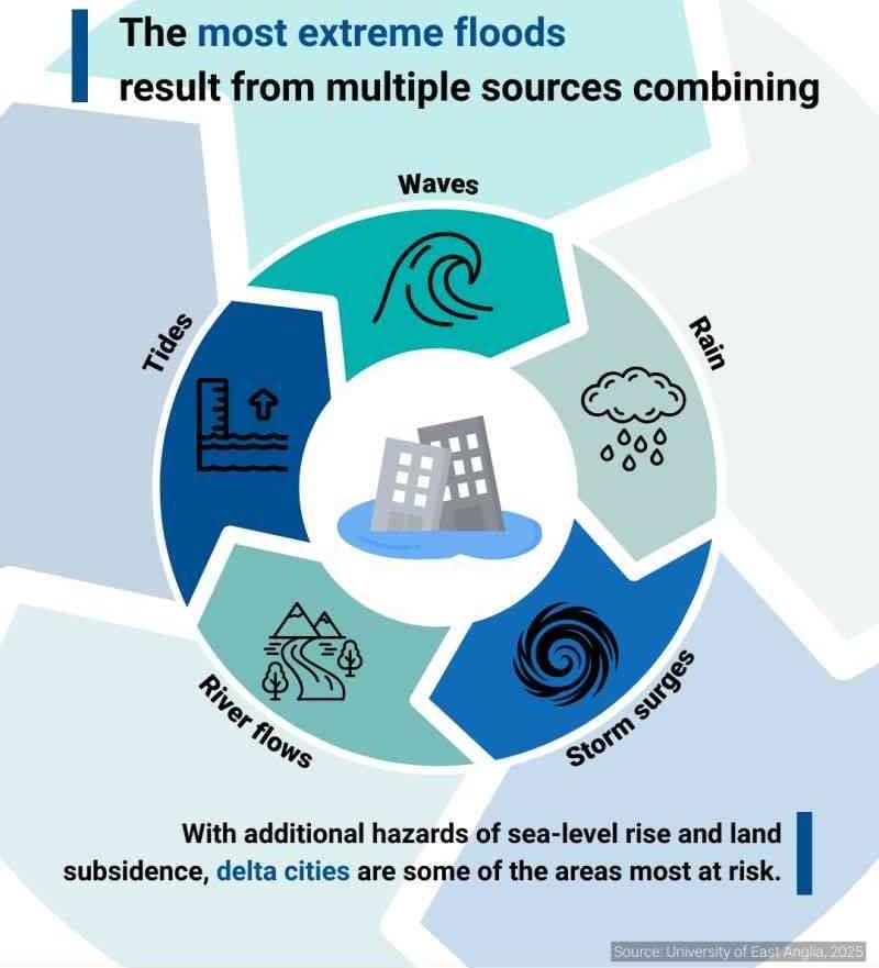
Flood sources infographic
Sources of floods (source: UNDRR). Enlarge image >
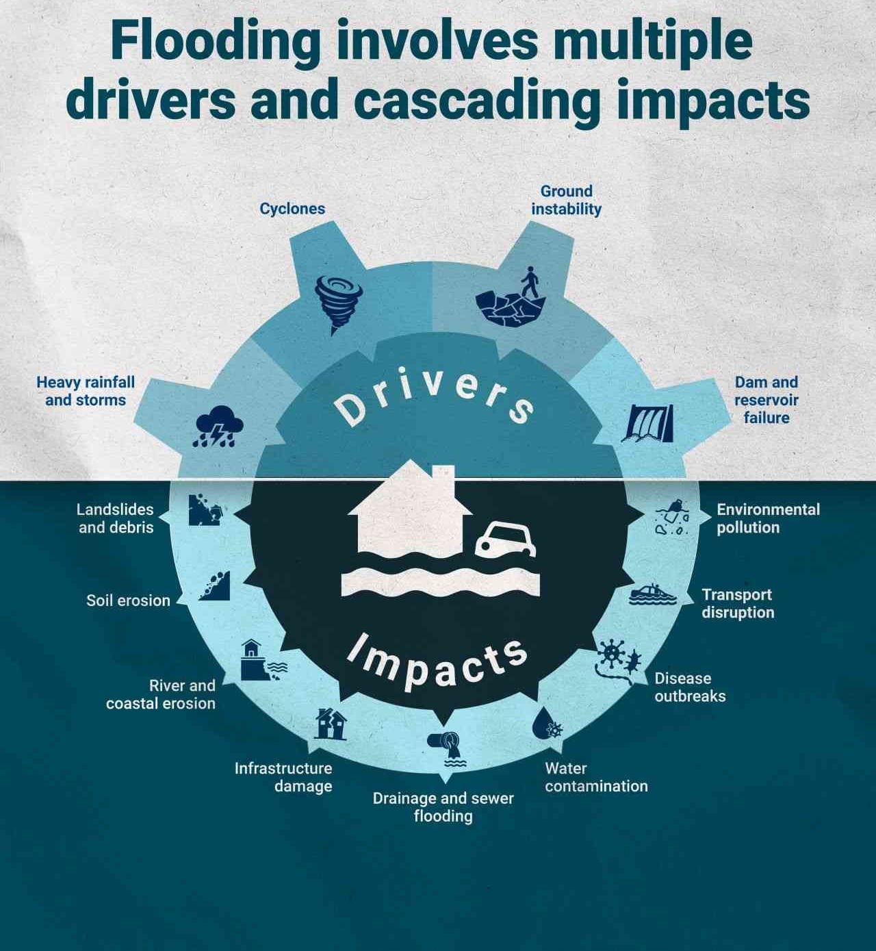
Flood cascading impacts
The drivers and cascading impacts of floods (source: UNDRR). Enlarge image >
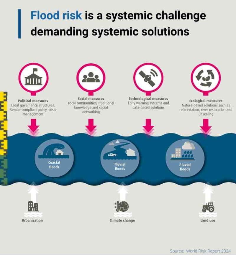
Flood systemic solutions infographic
Systemic solutions for floods (source: UNDRR) Enlarge image >

Risk factors

  • Rapid population growth.
  • Rapid urbanization.
  • Environmental degradation: loss of forests and natural flood buffers.
  • Climate change will expose more people to future floods.
  • Melting glaciers and rising sea levels will bring floods to places not previously at risk.

Vulnerable areas

  • Developing countries are most at risk.
  • Although Asia remains the continent most hit by floods, Africa and Latin America are also heavily affected.
  • The poor, with the least means to adapt are often forced to live in high-risk places: slopes, flood plains, ravines, or in crowded, urban low-lying areas in mega-cities.

Risk reduction measures

  • Integrate flood risk assessment into urban planning strategies.
  • Avoid building on flood-prone land.
  • Develop new building codes to reinforce flood resistance.
  • Create more space for rivers, floodplains and wetlands.
  • Ensure health of coastal reefs and mangrove plantations.
  • Maintain early warning systems, backed up by regular drills and evacuation exercises.
  • Have an evacuation plan for those at risk, including the elderly, disabled and very young.
  • Catalyse finance and insurance schemes to protect assets and livelihoods.
  • Protect and evacuate animals.

Latest Flood additions in the Knowledge Base

Uploaded on
Update

2026/27 El Niño could amplify existing vulnerabilities in commodities, energy and logistics. Organizations that combine scenarios and make shared dependencies visible can act sooner and better protect their strategy, business model and financial position.

Ernst & Young
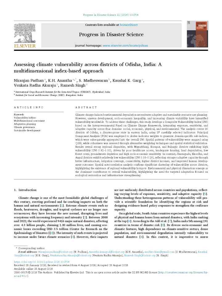
Assessing climate vulnerability across districts of Odisha, India: A multidimensional index-based approach thumbnail
Documents and publications

This study develops a multidimensional climate vulnerability index for Odisha’s 30 districts, finding marked regional disparities driven by environmental and physical factors, and recommends targeted, domain-specific adaptation strategies for DRR.

Progress in Disaster Science (Elsevier)
Dhunge Bazaar near Trishuli in Nuwakot, Nepal, shows extensive damage following severe flooding in the Bhotekoshi River. Floodwaters have damaged houses, roads, bridges, public buildings and other infrastructure, while security forces and rescue teams work to evacuate affected residents and clear blocked roads. Aerial footage shows the scale of destruction across the flood-affected area.
Research briefs

Study finds built-up areas potentially exposed to flooding in Nepal and neighbouring river catchments grew by 46% between 2016 and 2023. Rising exposure in valleys highlights the need to integrate disaster risk into land-use and infrastructure planning.

Conversation Media Group, the
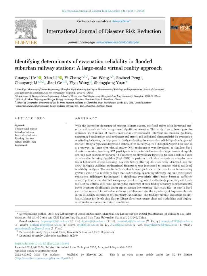
Identifying determinants of evacuation reliability in flooded suburban railway stations: A large-scale virtual reality approach thumbnail
Documents and publications

This study uses immersive VR simulations and machine learning to identify manual guidance by station staff as the most effective factor for reliable flood evacuation in suburban railway stations, emphasizing staff deployment and clear emergency broadcasts

International Journal of Disaster Risk Reduction (Elsevier)
A participatory modeling framework for rapid estimation of loss and damage following flood disasters thumbnail
Documents and publications

The study integrates asset inventories, satellite imagery and impact modelling to estimate flood losses and damages within days, once a sufficiently detailed flood footprint is available.

International Journal of Disaster Risk Science
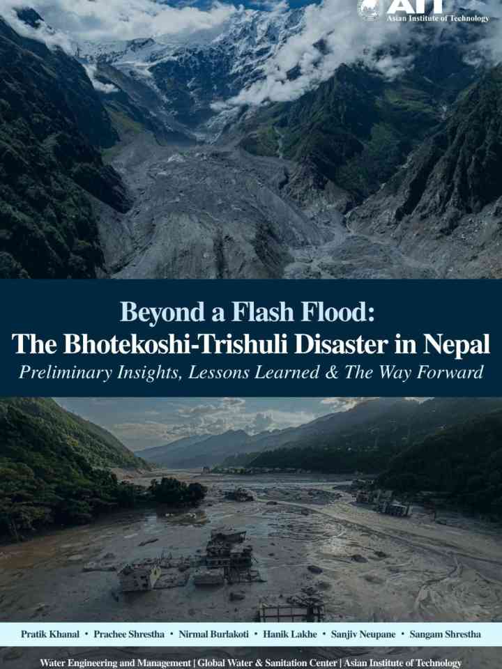
Beyond a flash flood: The Bhotekoshi - Trishuli disaster in Nepal - Preliminary insights, lessons learned and the way forward thumbnail
Documents and publications

This report analyzes the 2026 flash flood in Nepal, finding a massive rock-ice avalanche—not rainfall—triggered the disaster. It advocates multi-hazard monitoring, early warning systems, and transboundary risk management to build Himalayan resilience.

Asian Institute of Technology - Disaster Preparedness, Mitigation and Management Program
Designing a parametric flood and drought insurance framework for Caribbean farmers and agricultural SMEs: Case studies of Belize and Saint Vincent and the Grenadines thumbnail
Documents and publications

This study develops a meso-level parametric flood and drought insurance model for smallholder farmers and SMEs in Belize and Saint Vincent and the Grenadines, leveraging blockchain to automate payouts, enhance resilience, and strengthen rural livelihoods.

Economic Commission for Latin America and the Caribbean (ECLAC/CEPAL)
Research briefs

An interpretable model is one that can be verified, discussed, and challenged. This is the prerequisite for AI to become a legitimate tool in water management.

Conversation Media Group, the
Uploaded on