Sea Ice (Icebergs)
Sea ice is any form of ice found at sea (WMO, 2015).
Primary reference(s)
WMO, 2015. Manual on the Global Observing System: Volume 1 – Global aspects: Annex V to the WMO Technical Regulations: WMO No. 544. World Meteorological Organization (WMO). Accessed 16 May 2025.
Annotations
Additional scientific description
The presence of sea ice in polar and subpolar oceans is a defining environmental factor that interacts with weather and climate and impacts on the ecology and human activities in these regions. Sea ice is also a significant natural hazard, both through direct interaction with assets and infrastructure and through the indirect impacts of variability and rapid changes in its distribution, in particular in Arctic and subarctic regions.
There are three types of sea-ice hazard: broad, long-term hazards and risks associated with a rapid reduction in (summer) ice volume and extent; near-term hazards resulting from changes in sea-ice extent and dynamics such as increased coastal erosion and threats to coastal infrastructure; and immediate risks and the potential for disasters derived from the combination of sea-ice hazards and human activities such as shipping or offshore resource development (Eicken and Mahoney, 2015).
Owing to a wide range of possible causes, preventing disasters and mitigating hazards requires approaches that address a multitude of factors. Hazard and risk maps are one option to help in the long-term planning and coordination of emergency response assets. Such maps do not appear to be available at the regional scale in the Arctic, although national ice forecasting services may generate local maps that indicate ice severity as a hazard indicator. For example, the Chinese Marine Environ- mental Forecasting Center's Ice Severity Zones (Zhang et al., 2013) or the Barnett Ice Severity Index used in the United States (Eicken et al., 2009; Eicken and Mahoney, 2015).
Ice crystals form at the surface of the ocean mixed layer. Under sustained heat loss these ice crystals aggregate and can form a solid layer, up to several metres thick. During this process the solid ice expels salt (brine rejection), which increases the salinity of the underlying water and can initiate convective mixing in the ocean. In a few places where this cold, salty water is dense enough, it can sink via overflowing plumes along the bottom topography to reach the ocean abyss. This newly formed dense water generally flows slowly at depth towards the equator.
A thick sea-ice layer restricts wind and wave action near coastlines, lessening coastal erosion and protecting ice shelves. Sea ice also creates an insulating cap across the ocean surface, which reduces evaporation and heat loss to the atmosphere. As a result, the weather over ice-covered areas tends to be colder and drier than it would be without ice (Scott and Hansem, 2016).
Metrics and numeric limits
Not available.
Key relevant UN convention / multilateral treaty
International Code for Ships Operating in Polar Waters (Polar Code) (IMO, 2017).
Drivers
The primary drivers of sea ice include rising atmospheric and oceanic temperatures, wind dynamics, ocean currents, and feedback processes such as the ice–albedo effect. Increasing air temperatures—especially in the Arctic, where warming is about four times the global average—lead to earlier melting and delayed seasonal formation (IPCC, 2023a).
Subsurface warming from Atlantic and Pacific inflows significantly contributes to basal sea ice thinning (WMO, 2023). Wind patterns and ocean currents, including the Arctic Oscillation and Beaufort Gyre, influence sea ice distribution, drift, and concentration (NOAA, 2023). The ice-albedo feedback further accelerates melting, as open ocean absorbs more solar radiation than reflective ice (IPCC, 2023b). Together with anthropogenic climate forcing, these drivers are amplifying regional and global sea ice loss.
Impacts
'Sea ice plays a crucial role in regulating the global climate, supporting polar ecosystems, and shielding Arctic coastlines. Its decline amplifies global warming by reducing surface reflectivity, disrupts ocean and atmospheric circulation, and increases the risk of extreme weather in mid-latitudes (IPCC, 2023 b). Melting ice also accelerates coastal erosion, puts ice-dependent species and Indigenous ways of life at risk, and may open new Arctic shipping lanes with growing geopolitical and ecological implications (UNEP GEO-6, 2019).
Multi-hazard context
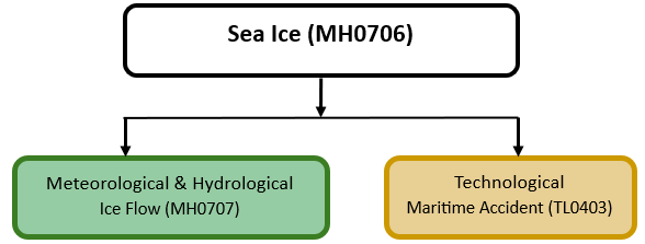
The figure below summarises common interactions between sea ice and other hazards. This information should be used with caution and not be solely relied upon in Disaster Risk Management, particularly as some interactions may not have been included. Note that hazardous events occurring together or locally in space or time may not necessarily cause, amplify, or be otherwise related to each other. Specific examples of multi-hazard context can be found in the ‘Hazard drivers’ and ‘Impacts’ sections above.
Multi-hazard diagram
Risk Management
Sea Ice Trackers and Analysis: The Norwegian Meteorological Institute gives access to the latest products and information about sea ice via its website. It provides satellite imagery, operational ice charts, automatic sea ice analysis, and sea ice trackers, etc. (Norwegian Meteorological Institute, no date).
Monitoring
The section above and the table below offer an overview of monitoring sea ice. This information can be used for forecasting within a national early warning system (EWS). Since EWS capacities and processes differ across countries, the most current and specific information regarding EWS should be obtained from the appropriate national or regional agency/authority responsible for disaster management.
| Which institution(s) produce(s) Disaster Risk Data/Information? |
|
| How is the Hazard Observed/Monitored/Forecast? | Sea ice and icebergs are monitored using satellites, aircraft, and ocean vessel observations to track their movement, thickness, and melting patterns. Scientists analyse sea surface temperatures, ocean currents, and wind conditions to predict iceberg drift and ice coverage. Computer models simulate ice behaviour, helping forecasters issue warnings for shipping, offshore industries, and coastal communities. Early alerts improve navigation safety, support climate research, and help manage risks from ice-related hazards. |
References
Eicken, H. and Mahoney, A.R., 2015. Sea ice: hazards, risks, and implications for disasters’, in Schroder, J.F., Ellis, J.T. and Sherman, D.J. (eds.) Coastal and Marine Hazards, Risks, and Disasters. Amsterdam: Elsevier, pp. 381–401. Accessed 16 May 2025.
Eicken, H., Lovecraft, A.L. and Druckenmiller, M. (2009) ‘Sea-ice system services: A framework to help identify and meet information needs relevant for Arctic observing networks’, Arctic, 62, pp. 119–136.
International Maritime Organization (IMO), 2017. International Code for Ships Operating in Polar Waters (Polar Code). International Maritime Organization (IMO). Accessed 16 May 2025.
IPCC (2023a). Sixth Assessment Report – Synthesis Report: Summary for Policymakers, p. 11. Intergovernmental Panel on Climate Change (IPCC). Accessed 9 July 2025
IPCC (2023b). Sixth Assessment Report – Working Group I: The Physical Science Basis, Chapter 7, p.174. Intergovernmental Panel on Climate Change (IPCC). Accessed 9 July 2025
NOAA (2023). Arctic Report Card: Sea Ice Overview, pp. 14–15. U.S. National Oceanic and Atmospheric Administration (NOAA). Accessed 9 July 2025.
Norwegian Meteorological Institute, no date. Sea ice climate indicators. Accessed 16 May 2025.
Scott, M. and K. Hansem, 2016. Sea ice. NASA Earth Observatory. Accessed 5 December 2019.
WMO (2023). Global Cryosphere Watch: Sea Ice. p.22. World Meteorological Organization (WMO). Accessed 9 July 2025.
UNEP, 2019. Global Environment Outlook – GEO-6 Technical Summary, Polar Regions and Cryosphere segment. United Nations Environment Programme (UNEP). Accessed 09 July 2025.
Zhang, X.L., Zhang, Z.H., Xu, Z.J., Li, G., Sun, Q. and Hou, X.J. (2013) ‘Sea ice disasters and their impacts since 2000 in Laizhou Bay of Bohai Sea, China’, Natural Hazards, 65, pp. 27–40.