Artificial Intelligence captures complex disaster risk
The integration of Artificial Intelligence (AI) is not just an incremental improvement; it has the potential to fundamentally alter the landscape of how we understand the risks emanating from a warming planet that outpace our resilience.
But here is the catch: the true frontier of AI isn't just about predicting a storm's path. It is about understanding the "invisible dominoes"—the complex, compounding, and cascading risks that happen when our infrastructure fails. In our hyper-connected world, a single point of failure in a power grid or a data center can turn a localized inconvenience into a national catastrophe.
1. The credibility challenge: AI as a public good
One of the most immediate impacts of AI is the democratization of model creation. By lowering computational and technical barriers, AI-based forecast systems are popping up everywhere. However, this accessibility is a double-edged sword because we risk an environment where forecast systems emerge and vanish like bubbles. Ultimately, leaving the public confused about which products to trust.
To be useful as a public good, we need to establish rigorous benchmarks and neutral brokers to validate these systems. In the Global South, where data gaps are a chronic headache, AI is already stepping in. Tools like Google Flood Hub provide 7-day riverine forecasts to 460 million people across India and Bangladesh. Yet, as AI becomes a primary tool for disaster preparedness, the need for standardized validation remains vital to ensure that "accessible" also means "reliable" for the people who need it most.
2. Mapping the "system-of-systems": The Odisha power play
For decades, high-resolution forecasting was the exclusive domain of a few large global centers. AI is breaking this monopoly, allowing for "hyper-local" precision. A prime example is Odisha, India. After Cyclone Fani in 2019 caused over $1.2 billion in damages to the power sector, the state began using AI to shift from a culture of recovery to one of resilience.
By integrating AI with GIS mapping, Odisha is identifying specific weak spots in its transmission lines using the Coalition for Disaster Resilient Infrastructure Global Infrastructure Risk Model and Resilience Index’s , or the CDRI GIRI Model’s, probabilistic fragility curves. This allows utilities to reinforce poles and substations in high-risk zones before the wind starts blowing. AI shifts the conversation from "Will the tower fall?" to "If this tower falls, which hospital loses power, and how does that affect the city's water pumps?" This is how we tackle the 7.4x indirect economic loss typically seen when power grids go dark.
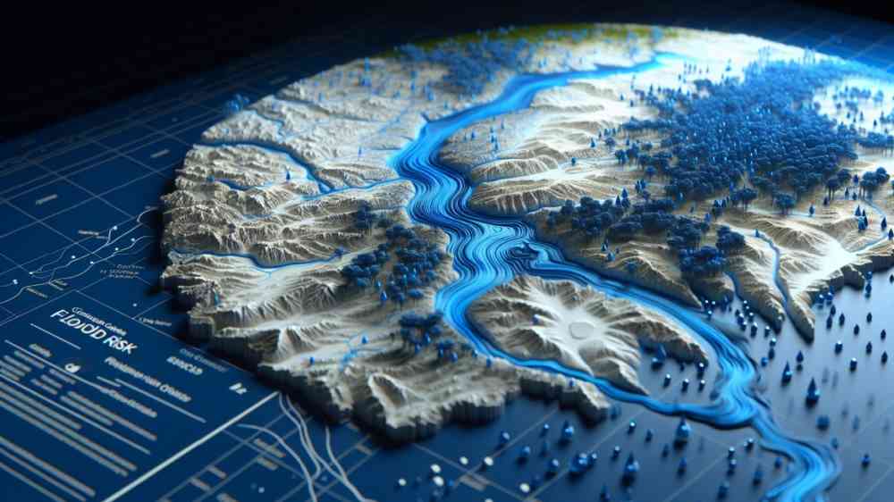
3. The GeoAI Guardian: Predicting the cascade
As cities scale, so does the complexity of their systems. The fusion of geospatial intelligence, digital twins, and AI is redefining the entire infrastructure lifecycle—turning raw data into a roadmap for resilience, smarter decision-making, and long-term sustainability. The most transformative leap occurs when AI moves from prediction to prescription. This is where the concept of the " GeoAI guardian" comes in. While the GIRI model provides a world-class "static" map of infrastructure vulnerability, a GeoAI Guardian acts as a "dynamic digital twin."
In Small Island Developing States (SIDS) like Dominica or Saint Lucia, infrastructure is often has a "single point of failure." A damaged coastal road or undersea cable can paralyze an entire nation. A GeoAI Guardian ingests real-time storm surge data and overlays it on GIRI’s maps to predict exactly when a port will become inoperable. It models the cascading risk : a port closure leads to food shortages, which compounds with a power outage to create a humanitarian crisis. For islands, this 72-hour window of AI-driven certainty is the difference between a managed challenge and a total system collapse.
4. Navigating the vertical frontier: Mountainous resilience
In mountainous regions like the Himalayas , the threat is three-dimensional. These areas face Glacial Lake Outburst Floods (GLOFs) and landslides that can wipe out communities in minutes. Traditional monitoring is often too slow to catch these rapid events.
AI models are now being trained to monitor glacial retreat and slope stability in real-time, providing predictions with stunning 20-meter resolution. By linking this to the GIRI framework, which accounts for geological hazards, authorities in Nepal or Sikkim, India can predict the "impact path" of a landslide on critical highways. This helps us understand compounding risks —where heavy monsoon rain (the trigger) hits a slope already destabilized by a minor earthquake (the conditioner).
5. Capturing the resilience dividend
The GIRI model estimates that without resilience, the world faces $732– $845 billion in annual losses. However, AI provides the roadmap to the "Resilience Dividend. " By using AI to unpack the complex relationship between physical damage and downstream economic pain, governments can prioritize investments that offer the most protection.
For instance, GIRI data shows that indirect economic costs are, on average, 7.4 times higher then the cost of the physical asset itself. In some developing nations, this can reach as high as 16x. When we use AI to harden the "critical nodes" of a network, we aren't just saving a bridge; we are safeguarding the livelihoods of an entire region.
Conclusion: A choice of futures
We stand at a crossroads. We can allow a "free market" approach where forecast systems emerge without validation, leading to a messy landscape where only the wealthiest users and the most reliable products survive. Or conversely, we can build a collaborative ecosystem, where AI agents and global models like GIRI work together as a public good.
AI has the power to unpack the most complex risks our species has ever faced. It allows us to see the invisible dominoes before they start to fall. The technology is here; the data is becoming more accessible. What we need now is the leadership to ensure that these "GeoAI Guardians" are deployed to protect the lifelines of every nation, from the coastal plains of Odisha to the highest peaks of the Himalayas.
Dr. Sanjay K. Srivastava is a senior expert in disaster risk reduction, science-policy integration, and technology for resilience, currently a Chair Professor at NIAS and Adjunct Faculty at KMC/MAHE. He spent over a decade at UNESCAP as Chief of Disaster Risk Reduction, leading flagship initiatives such as the Asia-Pacific Disaster Report and advancing regional and national risk and resilience strategies, following earlier leadership roles at UNESCAP, SAARC, and ISRO. An award-winning scholar with over 150 publications, he holds a PhD in Remote Sensing and has additional training in digital transformation from UC Berkeley.