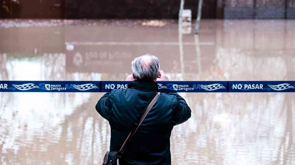
As devastating floods continue to wreak havoc in India’s southern state of Kerala, new research has indicated that information from social media can help emergency managers assess the floods’ impacts and supplement scientific data.
These conclusions, reported in the International Journal of Disaster Risk Reduction, stemmed from a study on social sensing and the 2018 floods in Kerala, which killed 433 people and displaced more than a million others.
“Social sensing” describes the collection and analysis of social media data to observe real-world events. In the new research, scientists in the United Kingdom assessed the potential of social sensing to locate and characterize the social and economic effects of the 2018 Kerala floods.
They analyzed data from Telegram, Twitter, a community-produced relief coordination app called Kerala Rescue, and the government flood damage database Rebuild Kerala. First, scientists analyzed images, messages, and appeals for help. They extracted messages in English, machine translated local languages to English where possible, and removed duplicates. Finally, the filtered information was georeferenced.
“The main contribution of this paper is demonstrating the agreement between four very different data sources…concerning the 2018 Kerala flood,” said James Young, one of the authors and a computer scientist at the University of Exeter.
Scientists and policymakers are hoping to integrate even more sources of social data into social sensing surveys. In January 2021, for instance, the India Meteorological Department (IMD) launched a portal for people to send information in any format on weather events in their locations. In June 2022, the Interdisciplinary Programme in Climate Studies at the Indian Institute of Technology Mumbai launched a project that uses information sent on Twitter by Mumbai citizens to generate real-time flood maps for the city.
Hello #Mumbaikars! @climateiitb needs your HELP!!
— Climate Studies, IIT Bombay (@ClimateIITB) June 7, 2022
We are planning to generate real-time flood maps for #Mumbai using the power of @Twitter!
Tweet about Flood scenes in your area this monsoon using #mumbaiflooddata / #mumbaiflood & Geotagging to help us collect flood data.
(1/4)
“This is just the beginning” of harnessing the power of social sensing, said Madhavan Rajeevan, now a scientist with the National Centre for Earth Science Studies in Kerala. The IMD portal was launched under Rajeevan’s tenure as secretary of India’s Ministry of Earth Sciences. “This kind of information, especially in real time, could be very valuable for government agencies to understand where the flooding is occurring more so that they can move disaster management people there.”
Social sensing techniques can even analyze past events to help guide future forecasts. “Events can be retrospectively analyzed,” explained Young, “to provide information to assist with impact-based forecasting, enabling the creation of better flood resilience planning and infrastructure.”
A source of real-time information
Around the world, social media is emerging as an important source of real-time and postdisaster information.
Young’s colleagues at Exeter, for example, have used social sensing to provide the United Kingdom’s Met Office with near-real-time analysis of floods in the United Kingdom.
Teman teman, di Tangerang Selatan sedang hujan deras nih! Di tempat kamu bagaimana? Pantau tinggi air di saluran kamu! Tetap waspada! #BersamaKurangiRisiko pic.twitter.com/84RCDqrCF2
— PetaBencana.id (@petabencana) August 4, 2022
Linda See, a senior research scholar at the International Institute for Applied Systems Analysis in Austria, cited another app, Peta Bencana, as a “great example” of the use of social media. The app was used to help monitor flooding in Indonesia in 2022.
Irfan Rashid, an assistant professor in the Department of Geoinformatics at the University of Kashmir at Srinagar, said data from social media platforms such as Twitter, YouTube, Instagram, and Facebook helped scientists better understand and characterize the flow depth and velocity of the rock-ice avalanche associated with the Chamoli disaster of February 2021. In that event, about 200 people were killed, and two power projects were destroyed. In the future, social sensing data could support a better understanding of hydrometeorological and physical processes in the Himalayan region, he said.
Like Rashid, See pointed to the opportunities brought on by integrating social sensing with mapping technology. If the information collected through social sensing is georeferenced, some of it could be used in the verification of remotely sensed features, she said. If users posted their flooded locations, for example, they could help verify remote sensing maps of inundated areas.
“Social sensing has helped me, as well as Earth scientists across the globe, to better understand and characterize the processes related to glacier lake outburst floods, landslide lake outburst floods, debris flows, and rock and ice avalanches,” said Rashid.