Please help us improve PreventionWeb by taking this brief survey. Your input will allow us to better serve the needs of the DRR community.
A system for order and engagement - Guatemala City, Guatemala
According to the 2018 WorldRiskReport, Guatemala ranks seventh in the world in its vulnerability to disaster risks. On average, the country experiences 27 earthquakes of under 6.5 magnitude each month and in the past 20 years, economic losses from disasters have amounted to more than USD two billion. Guatemala City itself is within range of three active volcanoes and lives and property in the city are regularly threatened by seasonal hurricanes as well as landslides and urban fires.
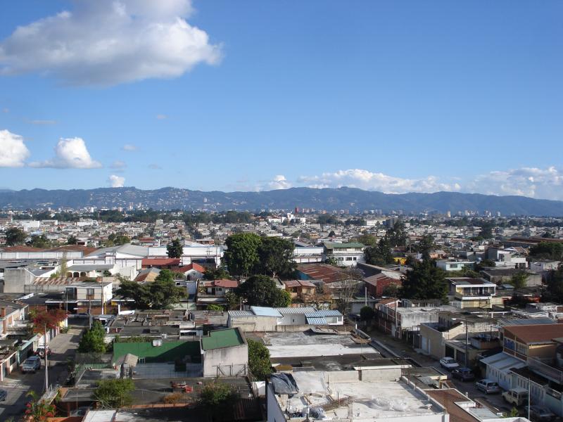
Guatemala City is the financial power house of the country. The city’s population of 1.8 million swells to over 3 million during day time with migrant workers flooding in from surrounding municipalities.
‘Seventy per-cent of the city’s infrastructure is dedicated to commerce and services,’ says Mayor, Ricardo Quinonez. ‘Our most valuable asset is our population. Being prepared for disasters is not just about having good infrastructure and services in place, we need to work closely with communities and build strategic alliances with partners from the public and private sector to build disaster resilience.’
Each year, Mayor Quinonez leads a commemoration held for the 23,000 people who died in the devastating 7.5 magnitude earthquake that struck Guatemala on February 4, 1976. Over 1.5 million lost their homes. Many ended up building illegal structures which grew into overcrowded and unplanned settlements on the outskirts of Guatemala City. Thousands of homes now cling precariously to the steep hillsides of the ravines that intersect the city.
In 2016, Deputy Mayor, Hector Flores was tasked with improving the city’s capacity to prevent, prepare for and respond to disasters. He was the driving force behind the creation of the Vulnerability and Emergency Management Plan, known as AVE.
‘Before, our disaster response protocols were written in manuals and when an emergency happened, no-one could remember what was written or what they should do’, explains Flores. ‘We needed a system that established order and engaged many different actors in a real time situation’.
AVE is comprised of seven components including a digital platform and mobile app; an emergency response coordination structure and response plan for municipal workers; a coordination group for engaging with external actors and a citizen’s participation plan.
One component of AVE is a disaster risk reduction (DRR) action plan developed by the municipality with support from the UN Office for Disaster Risk Reduction (UNDRR) under a European Commission funded global initiative - ‘Making Cities Sustainable and Resilient’.
Douglas Rodas is logistics coordinator with the municipality’s recently formed Operations Centre for Emergency Prevention (COPEM). The city lacked a dedicated disaster resilience unit and the establishment of COPEM was a first step in delivering the DRR plan. Now, Rodas is part of a dedicated seven-person team responsible for the overall coordination of AVE.
COPEM has made significant progress in developing new disaster response protocols for each of the city’s municipal departments.
‘Before, only the police and fire services had protocols but now there is conformity across City Hall,’ explains Rodas. ‘Since we developed the DRR plan, everyone knows what they need to do and when they need to act in an emergency. Now each department also understands the responsibilities of each other’.
The AVE app is used as a tool to enhance communication between teams and provide reminders on key response actions that are required.
‘The municipal transit police know they have to keep roads to the airport and hospitals clear and the mapping team know that they have to launch their drones to carry out an aerial damage assessment. If a building collapses, the planning team may be called upon to source its blueprint from their computers to aid search and rescue efforts,’ says Rodas.
One priority has been to map the entire city in 3D. The exercise has helped the city’s planning team to identify 252 informal settlements considered to be high risk.
‘We can now start to produce maps with different layers of information showing the topography of an area, the density of housing as well as underground infrastructure such as water lines. We can even calculate the number of people in an apartment block and their socio-economic status’, explains Emilio Vargas from the urban planning department.
‘This level of information helps us to integrate risk into our collective planning whether it is developing green spaces in the city or identifying investments that need to be made in vital infrastructure’.
With limited resources, one of the priorities of the municipality’s DRR plan is to change the mindset of the public, making DRR everyone’s business. A network of volunteers - ‘Ecorades Municipales’ is being trained in each of the city’s 22 zones to become DRR focal points within their communities.
‘The Ecorades will serve as the municipality’s eyes and ears’, explains Douglas Roda. ‘If they see a fire or some type of disaster in their neighbourhood, they report back to us via the auxiliary Mayor in their zone.’
At the national level it is the Guatemalan Ministry of Defence who take the lead in disaster management. Colonel Ariel Mazariegos, Director General of the army’s disaster management division, has played a key role in the development of the municipality’s DRR plan.
‘We have provided the training, tools and know-how to the municipality on the development of their protocols and disaster response plans. The next stage is to mobilize the army to support a realistic disaster simulation in one zone of the city. This requires a lot of logistical support’.
In November 2108, the army collaborated closely in the organisation of the city’s first annual earthquake response simulation exercise, a table-top exercise involving 250 people and 15 institutions from across the municipality. Plans are now in place to carry out further simulation exercises which will reach sizeable public audiences. Cooperation is ongoing with the Ministry of Education to target schools and simulation exercises will also be held with the staff of Banks located in the cities financial district.
‘Part of our strategy is to knock on doors and build relationships in the public and private sectors to build disaster resilience across the city’, explains Douglas Rodas. ‘We are talking to the leading mobile providers in the city to ensure we have a communications network that withstands a major disaster such as an earthquake. We are also linking with the Chamber of Commerce who can provide machinery to clear access roads and debris.’
Mayor Quinonez is determined that the city is prepared for any eventuality. The municipality’s DRR plan includes identifying sites for four mega-shelters capable of housing 800 evacuees each.
‘We want everyone to own disaster risk reduction. There are 820 Barrios across the city where we plan on creating disaster response committees. I see them coming together for training at weekends at these sites, alongside NGO’s who have experience and understanding of working with and managing volunteers. Our top priority is getting all entities in the city working together in an integrated response. We have the muscle and now we also have the technology with AVE to make the response much more efficient.’
Explore further
Also featured on
Please note: Content is displayed as last posted by a PreventionWeb community member or editor. The views expressed therein are not necessarily those of UNDRR, PreventionWeb, or its sponsors. See our terms of use
Is this page useful?
Yes No Report an issue on this pageThank you. If you have 2 minutes, we would benefit from additional feedback (link opens in a new window).