
How drone-based multispectral mapping supports disaster risk assessment and early warning

A few years ago, I examined a satellite image of a flooded valley, trying to understand what had been lost. The image was captured after the flood had peaked, showing only murky water and submerged rooftops. No one could show me what the landscape looked like before the rains.
Without that pre-event baseline, assessing the damage became largely a matter of estimation. We could see the impacts, but we could not accurately measure what had changed or understand why. That experience reinforced an important lesson: in disaster risk reduction, timing can matter as much as technology.
Why post-event data alone is not enough
Drone flights carried out after disasters often attract attention because they help locate survivors and document damage. However, if data are collected only after a hazard occurs, there is no reliable baseline against which to compare the impacts.
Without pre-event imagery, it is difficult to understand why floodwater followed a particular path, determine whether a slope failed suddenly or had been moving gradually over time, or distinguish new damage from pre-existing conditions. These limitations affect damage assessments, vulnerability analyses, early warning systems and long-term risk planning.
How multispectral mapping complements other technologies
Standard drone cameras capture visible red, green and blue wavelengths. Multispectral sensors also capture near-infrared and red-edge wavelengths, making it possible to identify vegetation stress before it becomes visible to the human eye. Waterlogged, diseased or drought-stressed vegetation reflects near-infrared light differently from healthy vegetation, helping identify drainage problems, wildfire risk and subtle ground movement.
Multispectral mapping is often combined with other remote sensing technologies.
Light Detection and Ranging (LiDAR) produces highly accurate elevation models that support floodplain analysis and landslide monitoring.
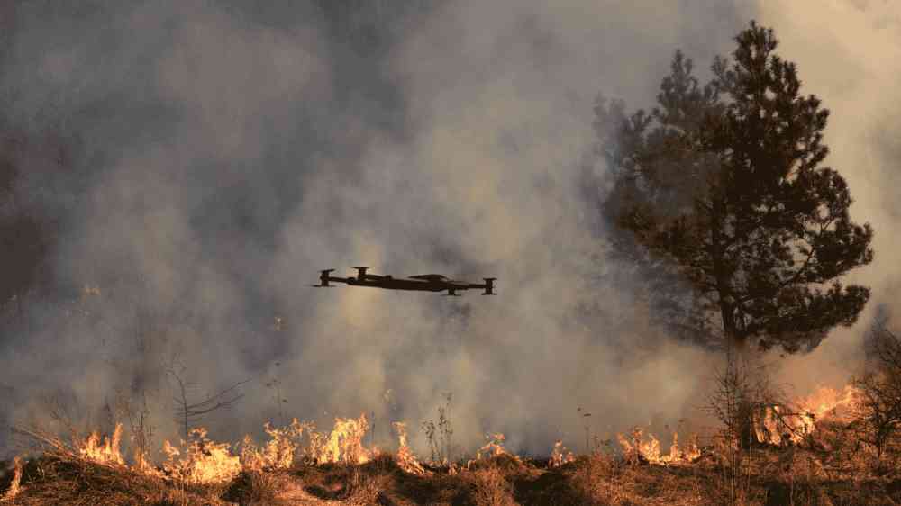
Thermal imaging detects heat anomalies, which can help identify smouldering fire risk or underground water leaks.
Together, these datasets create a more comprehensive pre-event baseline than satellite imagery alone. Unlike satellite imagery, drone-based data offers several practical advantages. Drones provide centimeter-level resolution compared to the meter-level resolution of most satellites. They can be deployed on-demand, regardless of cloud cover, which is a common limitation in tropical and monsoon-prone regions. Drone sensors can also capture data beneath tree canopy and within narrow river corridors that satellites cannot resolve. Additionally, drone flights can be scheduled locally and repeatedly, enabling change detection over time without depending on satellite tasking schedules or commercial licensing costs.
The most valuable drone flight is not necessarily the one carried out immediately after a disaster. It may be the routine survey conducted months earlier, documenting a landscape before it changes.
Malawi: Building flood baselines through local capacity
In Blantyre, I met a drone pilot trained through the African Drone and Data Academy (ADDA) , supported by the United Nations Children's Fund (UNICEF). According to the programme, more than 1,400 young people, 60 per cent of them women, have received training in drone operations and geospatial technologies.
Graduates work with Malawi's Department of Disaster Management Affairs to conduct multispectral surveys during the dry season , producing high-resolution baseline data for river corridors, including vegetation indices and detailed topographic information.
When Cyclone Freddy struck Malawi in 2023, the Rapid Geospatial Response Unit deployed within 24 hours . By comparing post-event imagery with these pre-event datasets, the team identified overtopped riverbanks, damaged farmland, and accessible transport routes. The resulting information supported flood forecasting for more than 236,000 residents.
This example illustrates that rapid response depends not only on emergency deployments, but also on systematic data collection before disasters occur.
The Caribbean: Maintaining shared baseline data
The Caribbean Disaster Emergency Management Agency (CDEMA) launched the GeoCRIS platform in 2020 as a regional repository for hazard information, infrastructure data and drone-derived baseline datasets.
The example from Dominica describes how quarterly multispectral and LiDAR surveys are used to monitor flood-prone areas around Roseau. LiDAR supports drainage and storm surge analysis, while multispectral imagery helps identify vegetation growth that could obstruct evacuation routes.
When hurricanes threaten, these datasets can be combined with storm surge models to support operational planning and resource allocation.
Medellín: Monitoring slow-moving landslides
Between 2018 and 2022, the Inform@Risk project established a living laboratory in Bello Oriente, Medellín. Researchers combined repeated drone surveys, multispectral imagery and LiDAR-derived terrain models to monitor gradual slope movement.
By comparing changes in vegetation health over time, the team identified areas where vegetation stress corresponded with millimetre-scale ground movement that would otherwise have been difficult to detect.
These observations contributed to the development of a preliminary landslide early warning system, which was later transferred to the local authorities.
Lessons for practitioners
Several practical lessons emerge from these examples:
- First, establish baseline datasets before disasters occur. The appropriate combination of multispectral, LiDAR and thermal sensors will depend on the local hazard profile.
- Second, collect data regularly . A single survey provides a snapshot, while repeated observations enable change detection and trend analysis.
- Third, invest in local capacity . The experience of the African Drone and Data Academy demonstrates how local expertise can strengthen long-term disaster risk management.
- Finally, ensure that datasets are interoperable and shared with disaster management agencies before emergencies occur. Information that cannot be accessed during a crisis cannot effectively support decision-making.
Investing in the "before"
The most valuable drone flight is not necessarily the one carried out immediately after a disaster. It may be the routine survey conducted months earlier, documenting a landscape before it changes.
Those baseline datasets make more accurate risk assessment and more effective early warning possible. Investing in data collection before disasters occur helps ensure that, when hazards strike, decision-makers have the information they need to act quickly and effectively.

Patrick Maple is Editor and UAS Geospatial Specialist at DroneAsAService.com, where he leads multispectral mapping initiatives for disaster risk reduction, infrastructure, and environmental monitoring. He writes on how aerial intelligence supports practical decision-making on the ground.