Icing (Including Ice)
Icing refers to any deposit or coating of ice on an object caused by the impact of liquid hydrometeors, usually supercooled (WMO, 1992).
Primary reference(s)
WMO, 1992. International Meteorological Vocabulary, WMO-No. 182. World Meteorological Organization (WMO). Accessed 16 May 2025.
Annotations
Additional scientific description
Icing, in general, is any deposit or coating of ice on an object, caused by the impingement and freezing of liquid (usually supercooled) hydrometeors; to be distinguished from hoar frost in that the latter results from the deposition of water vapour (NOAA, 2019).
An ice deposit may form on different parts of an aircraft when flying in supercooled clouds or precipitation. The intensity and characteristics of the icing vary, but depend primarily on the degree of supercooling, the droplet diameters and concentration, and the characteristics of the airflow around the aircraft. The main types of icing are soft rime, hard rime, clear ice, and glaze (WMO, 2017, 2020a, b, c, d).
Necessary conditions for icing include air temperatures at or below 0°C and supercooled liquid water droplets or wet snowflakes.
However, if an aircraft has been in below freezing temperatures and then in above freezing temperatures, the aircraft's surface temperature can remain below freezing for some time. Thus, icing still may be possible in ambient temperatures above freezing (NOAA, 2019).
NOTE: Supercooled liquid water droplets are predominantly found at temperatures ranging from 0°C to -20°C. Although rare, small amounts of supercooled water droplets can be found at temperatures as low as -40°C. The smaller and purer the droplets, the lower their freezing points.
NOTE: When a supercooled droplet strikes an object such as the surface of an aircraft, the impact destroys the internal stability of the droplet and raises its freezing temperature. This is known as aerodynamic heating - the temperature rise resulting from adiabatic compression and friction as the aircraft penetrates the air (NOAA, 2019).
Metrics and numeric limits
Not identified.
Key relevant UN convention / multilateral treaty
Sendai Framework for Disaster Risk Reduction 2015-2030.
Drivers
Factors which affect the icing threat for aeroplanes include: particle size; particle concentration; shape of aircraft surfaces; aircraft speed; environmental temperature; and aircraft surface temperature (must be 0°C or less) (NOAA, 2019).This table illustrates icing effects on primary forces and the resulting effect on aircraft (NOAA, 2019).
| Primary force | Icing effect on force | Resulting effect on aircraft |
|---|---|---|
| Lift | Decreased | Excessive loss of lift will cause aircraft to lose altitude |
| Weight | Increased | Excessive weight will cause aircraft to lose altitude |
| Thrust | Decreased | Excessive loss of thrust will cause aircraft to lose airspeed and lift |
| Drag | Decreased | Excessive drag will cause aircraft to lose airspeed and lift |
Impacts
Heavy accumulations of ice can bring down trees and topple utility poles and communication towers. Ice can disrupt communications and power for days while utility companies repair extensive damage. Even small accumulations of ice can be extremely dangerous to motorists and pedestrians. Bridges and overpasses are particularly dangerous because they freeze before other surfaces (AMS, 2012).
Multi-hazard context
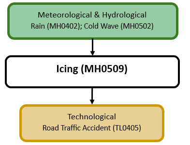
The figure below summarises common interactions between icing and other hazards. This information should be used with caution and not be solely relied upon in Disaster Risk Management, particularly as some interactions may not have been included. Note that hazardous events occurring together or locally in space or time may not necessarily cause, amplify, or be otherwise related to each other. Specific examples of multi-hazard context can be found in the ‘Hazard drivers’ and ‘Impacts’ sections above.
Multi-hazard diagram
Risk Management
An example of a National Alerting Parameter for icing is by China for road icing (China Meteorological Administration, 2012.
Monitoring
The section above and the table below offer an overview of monitoring icing. This information can be used for forecasting within a national early warning system (EWS). Since EWS capacities and processes differ across countries, the most current and specific information regarding EWS should be obtained from the appropriate national or regional agency/authority responsible for disaster management.
| Which institution(s) produce(s) Disaster Risk Data/Information? |
|
| How is the Hazard Observed/Monitored/ Forecast? | Icing is monitored using weather radar and ground-based sensors to track precipitation type, air temperature, and surface conditions conducive to ice formation. Meteorologists analyse temperature inversions, wind patterns, and humidity levels to predict when liquid precipitation will freeze upon contact with the ground or on aircraft surfaces. Advanced computer models forecast possible icing, helping forecasters issue early warnings. These warnings assist transportation agencies and the general public in preparing for hazardous walkways and roads and other related impacts. |
References
AMS, 2012. Glossary of Meteorology: Ice storm. American Meteorological Society (AMS).. Accessed 16 May 2025.
China Meteorological Administration, 2012. Weather Warnings: Road Icing. Accessed 16 May 2025.
NOAA, 2019. Icing. National Weather Service, National Oceanic and Atmospheric Administration (NOAA). Accessed 16 May 2025.
WMO, 2017. International Cloud Atlas: Icing. World Meteorological Organization (WMO). Accessed 16 May 2025.
WMO, 2020a. Soft Rime. World Meteorological Organization (WMO). Accessed 16 May 2025.
WMO, 2020b. Hard Rime. World Meteorological Organization (WMO). Accessed 16 May 2025.
WMO, 2020c. Clear Ice. World Meteorological Organization (WMO). Accessed 16 May 2025.
WMO, 2020d. Glaze. World Meteorological Organization (WMO). Accessed 16 May 2025.