Fog
Fog is a suspension of very small, usually microscopic water droplets in the air, reducing visibility at the Earth’s surface (WMO, 2017).
Primary reference(s)
WMO, 2017. Fog. International Cloud Atlas: World Meteorological Organization (WMO). Accessed 16 May 2025.
Annotations
Additional scientific description
Under light wind, stable and humid conditions, if the air near the ground cools sufficiently, water vapour in the air may condense into tiny water droplets. These droplets reduce the visibility near ground level. This phenomenon is called fog (Hong Kong Observatory, 2019).
Fog differs from cloud only in that its base is at the Earth's surface while the cloud base is above the Earth's surface. When composed of ice crystals, it is termed ice fog (WMO, 2017). Visibility reduction in fog depends on the concentration of cloud condensation nuclei and the resulting distribution of droplet sizes. According to the American Meteorological Society (AMS) weather observing practice, fog that hides less than 0.6 of the sky is called ground fog. If fog is so shallow that it is not an obstruction to vision at a height of 6 feet above the surface, it is called simply shallow fog (AMS, 2012).
Fog is easily distinguished from haze by its higher relative humidity (near 100%, having physiologically appreciable dampness) and grey colour. Haze does not contain activated droplets larger than the critical size according to Köhler theory (AMS, 2012).
Mist may be considered an intermediate between fog and haze; its particles are smaller (a few microns maximum), it has lower relative humidity than fog, and does not obstruct visibility to the same extent (AMS, 2012).
There is no distinct line, however, between any of these categories. Near industrial areas, fog is often mixed with smoke, and this combination has been known as smog. However, fog droplets are usually absent in photochemical smog, which only contains inactivated haze droplets (AMS, 2012).
In aviation weather observations, fog is encoded F, and ground fog GF (AMS, 2012).
Metrics and numeric limits
Not identified.
Key relevant UN convention / multilateral treaty
Sendai Framework for Disaster Risk Reduction 2015-2030.
Drivers
Fog of all types originates when the temperature and dew point of the air become identical (or nearly so). This may occur through cooling of the air to a little beyond its dew point (producing advection fog, radiation fog, or upslope fog), or by adding moisture and thereby elevating the dew point (producing steam fog or frontal fog). Fog seldom forms when the dew point spread is greater than 4°F (-15.56°C) (AMS, 2012).
Impacts
Fog can reduce visibility both on land and on marine surfaces. By international agreement (particularly for aviation purposes), fog is the name given to the resulting visibility of less than 1 km (0.6 mile), however, in forecasts for the public, this generally refers to visibility of less than 180 m (0.1 mile) (UK Met Office, 2019).
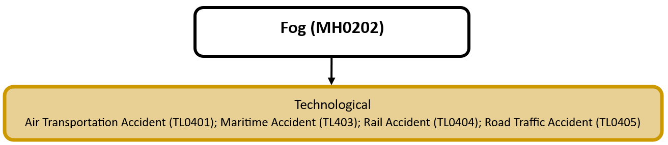
Multi-hazard context
The figure below summarises common interactions between fog and other hazards. This information should be used with caution and not be solely relied upon in Disaster Risk Management, particularly as some interactions may not have been included. Note that hazardous events occurring together or locally in space or time may not necessarily cause, amplify, or be otherwise related to each other. Specific examples of multi-hazard context can be found in the ‘Hazard drivers’ and ‘Impacts’ sections above.
Multi-hazard diagram
Risk Management
In terms of national alerting parameters, examples include alerting parameters for issuing a fog advisory in Canada (Government of Canada, 2019) and alerting parameters for a heavy fog warning in China (China Meteorological Administration, 2012).
Monitoring
The section above and the table below offer an overview of monitoring fog. This information can be used for forecasting within a national early warning system (EWS). Since EWS capacities and processes differ across countries, the most current and specific information regarding EWS should be obtained from the appropriate national or regional agency/authority responsible for disaster management.
| Which institution(s) produce(s) Disaster Risk Data/Information? |
|
| How is the Hazard Observed/Monitored/Forecast? | Fog is monitored using weather stations, satellites, and LiDAR technology to track temperature, humidity, and visibility conditions in real time. Meteorologists analyse these factors along with wind speed and atmospheric pressure to predict when and where fog will form. Computer models simulate fog formation and behaviour, helping forecasters issue warnings for transportation, aviation, and public safety. Early alerts help reduce accidents, improve air quality assessments, and support industries affected by low visibility. |
References
AMS, 2012. Fog. Glossary of Meteorology. American Meteorological Society (AMS). Accessed 16 May 2025.
China Meteorological Administration, 2012. Weather Warnings: Heavy Fog. Accessed 16 May 2025.
Government of Canada, 2019. Alerting parameters Environment Canada uses for issuing a Fog Advisory. Accessed 16 May 2025.
Hong Kong Observatory, 2019. Fog Explained. Accessed 16 May 2025.
UK Met Office, 2019. What is the difference between mist, fog and haze? Accessed 16 May 2025.
World Meteorological Organization (WMO), 2017. Ice Fog. Accessed 16 May 2025.