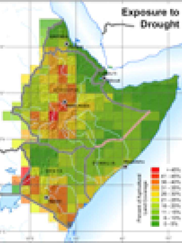
Horn of Africa: exposure to drought
This map illustrates the Horn of Africa's crop exposure to drought, demonstrating the percentage of agricultural land coverage for each cell. It is one of the layers used to create the flood risk map for the region.
Explore further
Hazards
Drought and Desertification
Publication year
2007