
What Türkiye’s AFAD-DEHAS platform means for earthquake risk reduction
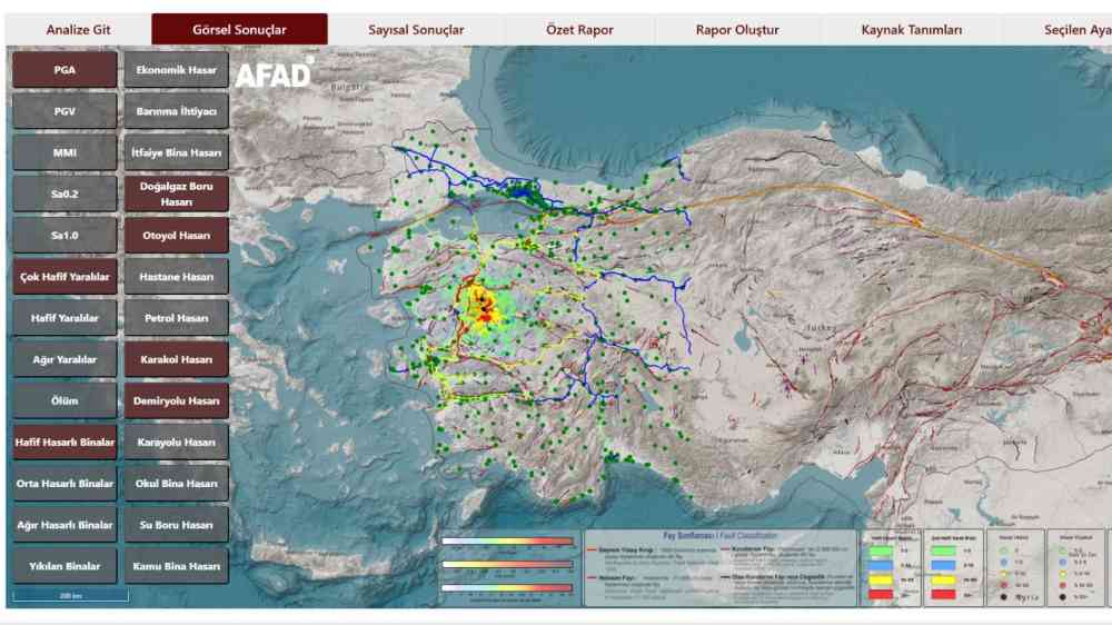
Screenshort view of the main interface of DEHAS Platform (General Overview).
Disaster loss and damage assessment systems are a cornerstone of effective disaster risk management. They help authorities quickly estimate physical damage, human losses and service disruptions after an event, supporting response and recovery efforts.
Used before disasters, these systems also play a critical role in reducing risk. Scenario-based analyses can inform planning, strengthen capacity development programmes, and guide mitigation strategies. In both contexts, timely and reliable loss estimates are essential for decision-making and long-term resilience.
Learning from past earthquakes in Türkiye
Türkiye has been developing earthquake loss estimation tools since 2010. Its previous system, AFAD-RED (Rapid Earthquake Damage Assessment), supported multiple phases of disaster management—from preparedness and planning to emergency response.
The system proved its value during major earthquakes, including the 2011 Van, 2020 Elazığ and 2023 Kahramanmaraş events. It provided rapid and reasonably accurate estimates of damage and losses, helping authorities prioritise response efforts.
These experiences also revealed important gaps, particularly in accuracy, speed, data integration and usability—highlighting the need for a more advanced system.
A new generation platform: AFAD-DEHAS
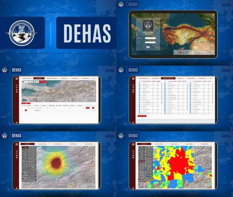
In response to these challenges and building on advances in information technology and seismic science, Türkiye has developed a new system: the AFAD Earthquake Early Loss and Damage Analysis System (AFAD-DEHAS). AFAD-DEHAS is a web-based platform that allows multiple users to run analyses simultaneously. It supports both real-time assessments immediately after an earthquake and scenario-based modelling for preparedness and planning.
What makes AFAD-DEHAS different
A key strength of AFAD-DEHAS is its integration of advanced scientific methods and real-time data.
The system:
- Uses updated ground motion prediction models to estimate how earthquake shaking spreads;
- Incorporates real-time data from accelerometer networks to improve accuracy immediately after an event;
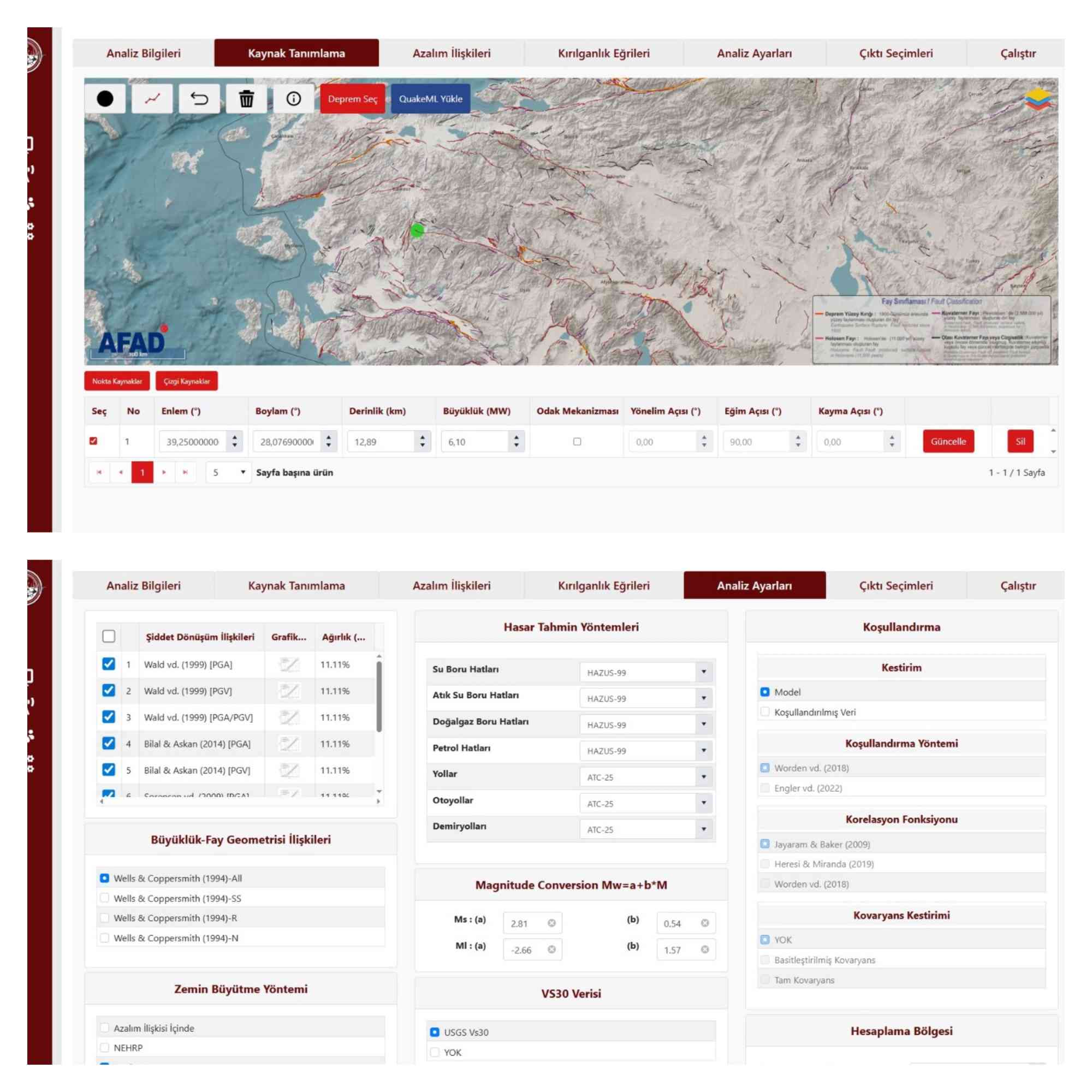
- Applies 28 fragility functions tailored to Türkiye’s building stock, including reinforced concrete, masonry, steel and other structures.
- These features allow the platform to produce more precise estimates of damage across different locations.
Fragility functions are important for a better understanding of the vulnerability of buildings. Because different buildings behave differently under seismic loads, fragility functions are used to assess their damage potential.
These features allow the platform to produce more precise estimates of damage across different locations.
Turning data into actionable insights
AFAD-DEHAS is supported by a continuously updated national building inventory and census database. This enables detailed modelling of exposure—what is at risk—and improves estimates of casualties, shelter needs and service disruptions.
By combining hazard, exposure and vulnerability data in a single system, AFAD-DEHAS provides a more complete picture of potential impacts. The platform generates dynamic maps and datasets that can be shared instantly across institutions using web-based geographic information system (GIS) technologies.
This enables instant information sharing across institutions, which enhances coordination among emergency responders and decision-makers. For example, emergency medical services can identify areas with high concentrations of severe injuries, while hospitals and logistics teams can proactively allocate resources based on predicted demand.
AFAD-DEHAS is fully integrated with the Disaster and Emergency Management Decision Support System (AFAD-AYDES), Türkiye’s central coordination platform for disaster response. This integration supports faster and more coordinated action under the National Response Plan of Türkiye (TAMP). It also strengthens preparedness by enabling authorities to simulate earthquake scenarios, run drills and test mitigation strategies.
From rapid response to long-term resilience
By transforming complex seismic data into clear, actionable information within minutes, AFAD-DEHAS improves both emergency response and long-term planning.
The system not only improves the speed and accuracy of emergency response but also supports long-term disaster risk reduction efforts by providing a robust analytical framework for planning and preparedness.
As countries face increasing disaster risks, tools that translate complex data into timely, practical insights will be essential. Türkiye’s experience offers valuable lessons for others seeking to strengthen preparedness, reduce losses and build resilience against future earthquakes.