1. Home
  2. Knowledge Base | PreventionWeb
  3. Themes

Risk identification and assessment

A qualitative or quantitative approach to determine the nature and extent of disaster risk by analysing potential hazards and evaluating existing conditions of exposure and vulnerability that together could harm people, property, services, livelihoods and the environment on which they depend. Performing risk, hazard and vulnerability assessments is a key disaster risk management activity.

This theme covers aspects related to hazard/vulnerability/climate risk assessment, disaster risk modelling and analysis.

Through UNICEF’s open-access GeoSight platform, decision-makers can visualise risk, compare layers, and identify priority areas for action.

Latest Risk identification and assessment additions in the Knowledge Base

Reimagining disaster risk assessment: The role of information equity in vulnerable communities thumbnail
Documents and publications

This study advances an equity-centered approach by centering informational equity as an underexamined dimension of disaster vulnerability. Findings show informational inequities emerge from systematic misalignments across the risk communication ecosystem.

International Journal of Disaster Risk Reduction (Elsevier)
UN global risk report 2026 thumbnail
Documents and publications

This report draws on a survey of 1,300 stakeholders assessing 28 global risks. Large-scale war, AI and frontier technologies gained prominence, while climate change inaction remained the most important global risk.

United Nations - Headquarters
Dynamic image of a wildfire engulfing a countryside field, with thick smoke and flames.
Update

Wildfires can turn natural metals in soil into toxic, airborne particles. Stanford researchers are working to predict where these metals travel and warn people in harm’s way.

Doerr School of Sustainability, Stanford University
Hurricane Beryl as seen from space from the International Space Station
Update

What happens if sea level rise, hurricane wind strength, or other factors turn out worse than expected? The author gives about a 90% chance that climate change will cause a net increase in Atlantic hurricane destruction over the coming 30 years.

Yale Climate Connections
Cover
Documents and publications

The Heat Impact Assessment (HIA) Framework as a strategic instrument to strengthen heat risk management in the country.

Rocky Mountain Institute
National Disaster Management Authority (India)
Equatorial extreme convective storms are expanding and becoming more persistent thumbnail
Documents and publications

This study leverages the first long-term, sub-kilometer, sub-hourly observational network in equatorial Singapore (730 normal k meters squared" data-speech-attached="true" data-semantic-braille="⠅⠍⠘⠆" data-braille-attached="true" has-speech="true">), with 122 rain gauges reporting 5 min intensities for 2020–2024 and 82 stations with hourly accumulations for 1980–2024, combined

AGU Advances (Wiley)
Update

The Mediterranean may seem far removed from the world’s major tsunami zones, but history and modern modeling show that destructive waves can strike the French Riviera with surprisingly little warning.

ScienceDaily
Update

The floods in Nepal in late August 2026 were not a conventional rainfall-driven event, but a chain reaction in which slope failure, ice, rock, water, sediment, and river geometry combined to turn a remote mountain disturbance into a far-reaching disaster.

Moody's
Update

Researchers from the Qinghai-Tibet Plateau expedition team identified the Aug. 26 glacier landslide in Nepal, which crossed into China, as one of the most extreme and destructive natural disasters ever recorded in the Himalayas.

Vietnam.vn
Update

As the risk of ‘fire weather’ increases, humans are learning to adapt to an ominous new normal

Telegraph Media Group Limited
Update

Analysis of more than 36,000 buildings affected by the January Victorian bushfires shows why broad hazard assessments alone cannot reveal the vulnerability of individual properties.

Nearmap
RASUWA, NEPAL- August 31, 2026: devastating flood in the Bhotekoshi River on August 26 caused widespread destruction in Betrawati Bazar, located along the border of Nuwakot and Rasuwa districts in Nepal. The flood damaged homes, businesses, roads and other infrastructure, leaving the area severely affected.
Update

The Nepal-Tibet floods highlight urgent gaps in monitoring Himalayan snow and glaciers. The article calls for improved observation, early warning systems, cross-border cooperation and community-led adaptation to reduce future flood and drought risks.

Conversation Media Group, the
Republic of Fiji: disaster management reference handbook thumbnail
Documents and publications

This updated Disaster Management Reference Handbook provides a comprehensive picture of Fiji’s disaster management architecture, socioeconomic vulnerabilities, hazard profile, and logistical infrastructure.

Center for Excellence in Disaster Management & Humanitarian Assistance (CFE-DMHA)
Divergence between physical and emotional heat resilience in Chinese cities thumbnail
Documents and publications

Using social media and meteorological data, this study quantifies the mismatch between physical heat exposure and public emotional responses from 2010 to 2024 in China.

Nature Climate Change
Tsunami hazard in the Anguilla Bank Archipelago, Lesser Antilles: historical data, fault characterization and numerical simulation thumbnail
Documents and publications

This study assesses earthquake-related tsunami hazard across the Anguilla bank through numerical simulations of selected seismic rupture scenarios.

Natural Hazards (Springer)
Research briefs

The central north Amazon, with extensive areas of high forest cover, natural savannas and vast and important indigenous territories, was not previously considered as being the most affected by climate change.

Lancaster University
Large container ship maneuvered by tugboats through the Panama Canal under a clear sky.
Update

As what could be the strongest El Niño on record develops, families, communities and economies need to prepare for the worst. Local areas may see more intense effects than expected, or they may see different effects than in past El Niños.

Conversation Media Group, the
Powerful river rapids rush under a stone bridge in a dramatic canyon setting.
Update

Flash floods can occur within minutes after extreme rainfall, landslides or infrastructure failures. Climate change is increasing heavy rainfall, while ageing infrastructure and urban development can worsen flood impacts and raise risk.

Georgetown University
Update

What happens when water, ice and more thunder down into a valley?

WSL Institute for Snow and Avalanche Research (SLF)
Update

In an exclusive Climate Tracker Asia interview, UNDRR chief Kamal Kishore discusses early action, disaster financing and cascading risks across Asia-Pacific.

Climate Tracker
Documents and publications

This study develops a standardised, reproducible, and operational methodology to screen tsunami risk at the community scale across the Caribbean Basin, based exclusively on open and globally consistent datasets

International Journal of Disaster Risk Reduction (Elsevier)
Changes in glacial lakes and associated risks in the China‒Nepal Himalayas thumbnail
Documents and publications

This study presents a detailed and refined glacial lake outburst floods (GLOFs) risk assessment using a data-driven machine learning framework.

Advances in Climate Change Research (Elsevier)
Tunisia climate and health vulnerability assessment thumbnail
Documents and publications

This Climate and Health Vulnerability Assessment (CHVA) sets out to understand how climate change is affecting health outcomes and Tunisia’s health system, and what opportunities exist for health system adaptation.

World Bank, the
Research briefs

Extreme heat has become more common—as both research and lived experience show—but when it arrives is a different question.

Columbia Climate School
Research briefs

Dozens of glacial lakes have formed across northern India in the last three decades, while existing lakes have expanded rapidly, highlighting the need to monitor a landscape reshaped by climate change.

PhysOrg, Omicron Technology Ltd
Rapid analysis report: Scientific anatomy of the 26 August 2026 Bhotekoshi flash flood thumbnail
Documents and publications

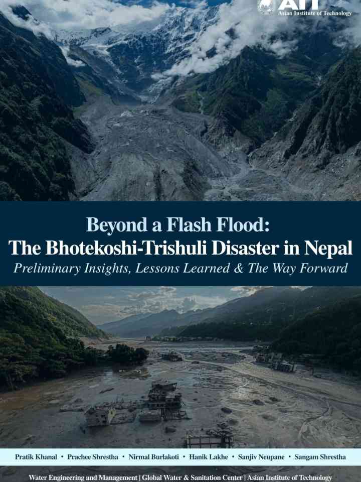
The report concludes that the 26 August 2026 Bhotekoshi flash flood appears to have been triggered by an ice, rock and soil mass failure around the Deding/Langtang region rather than intense localized rainfall.

Integrated Research on Disaster Risk
Institute of Himalayan Risk Reduction
National Society for Earthquake Technology - Nepal
Update

Volcanologist Philipp Ruprecht explains the connections between two geophysical hazards

University of Nevada, Reno
Measuring floods by their scars: toward a data-driven flood severity scale thumbnail
Documents and publications

This paper introduces the FLOSEV flood severity scale, an impact-based classification system using fatalities, affected municipalities and damage indicators. Tested on more than a century of Italian floods, it enables comparison of flood impacts.

Natural Hazards (Springer)
Explore the historic Ait Benhaddou, a UNESCO World Heritage Site in Morocco's desert.
Update

After seven years of drought, Morocco experienced an exceptionally wet winter in 2025–26 as Atlantic storm tracks shifted southward. The article argues that future rainfall will depend more on North Atlantic conditions than on El Niño alone.

Conversation Media Group, the
Research briefs

UCC team present Ireland’s first national Coastal Exposure Index, showing where communities, cultural heritage and other coastal assets face the greatest exposure. Mayo has the largest stretch of coastline classified as “Very High Exposure”, at 414.5 km

University College Cork
Drought development characteristics modulate global dry–wet abrupt alternation through distinct land–atmosphere feedbacks thumbnail
Documents and publications

This study shows that antecedent drought development is linked to distinct, region-dependent pathways from drought to extreme precipitation, providing a basis for anticipating compound hydrological extremes. Rapid transitions from drought to extreme

Nature Communications (Nature)
On the reliability of estimated return periods for climate extremes thumbnail
Documents and publications

This study reflects on the probability of observing an extreme event of interest within a finite dataset, whether derived from observations or model simulations, to inform risk assessment or climate adaptation efforts.

International Journal of Disaster Risk Science
Medical professionals in protective gear conducting outdoor testing operation.
Update

Given its speed, scale and scope, the Bundibugyo Ebola virus disease that broke out in the DRC in mid-2026 could become a global epidemic. Preventing a fast-spreading outbreak that has already taken over a large geographical region is difficult.

Conversation Media Group, the
The Bagmati River flood in Kathmandu, 2024.
Update

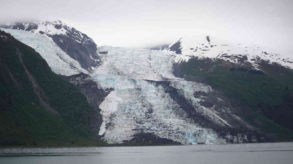
On August 26, the side of a mountain near the border between Nepal and Tibet collapsed. Seven billion cubic feet of glacial ice and rock, enough to fill 100 football stadiums, crashed roughly a mile straight down into the river below.

Grist Magazine
Eruption of a volcano
Update

Indonesia’s Mount Anak Krakatau has erupted again this week, sending plumes of volcanic ash high into the sky and disrupting hundreds of flights. More than 300,000 passengers have been affected.

Conversation Media Group, the
Update

Unusual heat this year may have melted ice and thawed bonds that hold glaciers in place – leading to catastrophe

Guardian, the (UK)
Cross-border travel patterns affect magnitude estimates for the Ebola Bundibugyo epidemic thumbnail
Documents and publications

This research examines how geographic spread approaches can be adapted to account for the specific travel patterns and epidemiological context of the DRC–Uganda border. A geographic spread approach is used to estimate the burden of infectious disease.

Nature Health
Assessing the consequences of compound coastal–fluvial flooding under climate change: exposure, vulnerability and damage estimates in eastern England thumbnail
Documents and publications

This study applied an integrated flood risk assessment framework to evaluate climate-driven compound flood risk in Broadland, with particular emphasis on how methodological choices influence exposure, damage and spatial risk estimates.

International Journal of Disaster Risk Reduction (Elsevier)
Global estimation of bankfull river discharge reveals distinct flood recurrences across climate zones thumbnail
Documents and publications

This study uses observations and machine learning to estimate bankfull river discharge globally. Results show that bankfull return periods vary significantly across climate zones, challenging the common 2-year assumption used in global flood models.

Nature Communications (Nature)
Tracking progress in the governance of critical risks thumbnail
Documents and publications

This report identifies key challenges in preparing for future changes to the critical risk landscape, drawing on reports, ‘Survey on Governance of Critical Risks’ and ‘Survey on Governance of Critical Infrastructure Resilience’ carried out in 2022-25.

Organisation for Economic Co-operation and Development
Update

August was the hottest month of the year, with an average temperature of 25.6 C, up 5.2 ​C from the 1951-1980 average and 3.5 C ​above the 1991-2020 norm, according to Italy's research public body.

Thomson Reuters
Update

Glacier retreat, expanding glacial lakes, thawing permafrost and unstable slopes are increasing the risk of disasters in the Himalayas.

Mongabay
Update

The drought of 2026 is not yet over, and some of its effects are already visible. There are economic consequences for agriculture, transport and industry. But there are also consequences that are less visible and may have long-term effects.

Deltares
Update

Satellite and drone imagery provide an initial view of the landslide that triggered the 26 August 2026 Nepal-Tibet debris flow. The analysis suggests a massive bedrock failure on a steep slope, while the role of climate change requires further study.

Eos - AGU
Update

UCB fire scientist argues that widespread thinking about the wildfire crisis is wrong in some basic ways. In a 2024 paper, she and co-authors argued that it isn't the increasing size of fires that's threatening homes and lives: it's their speed.

Utah Public Radio
Update

Rainfall deficits and high temperatures have created unusually dry conditions and have spurred water shortages on much of the tropical archipelago.

National Aeronautics and Space Administration (NASA)
Forest Wild fire near houses on Portugal Summer
Update

Fire adds a further layer of risk. Wildfire strips vegetation that normally protects soil from rainfall, and can increase soil water repellency, affecting infiltration, runoff and erosion.

Conversation Media Group, the
Smoke, fire and glowing embers in the forest
Update

Peat fires are a recurring challenge in Indonesia. Drought caused the archipelago's peat landscapes to become unrelenting infernos on several occasions in the past, with fires producing blankets of smoke for weeks and upending daily life for millions.

National Aeronautics and Space Administration (NASA)
Update

While an imminent catastrophe is not predicted in Jammu and Kashmir’s Chenab Valley, recent studies and government assessments suggest that Kishtwar district possesses many of the characteristics that make Himalayan regions vulnerable to such disasters.

The Chenab Times
Rapid soil moisture depletion during flash droughts accelerates wildfire spread in the United States thumbnail
Documents and publications

Study finds that rapid root-zone soil moisture depletion during flash droughts is more strongly linked to accelerated wildfire spread than conventional drought conditions across the United States.

Nature Communications (Nature)