Global Assessment Report on Disaster Risk Reduction 2015
Making development sustainable: The future of disaster risk management |
Global Assessment Report on Disaster Risk Reduction 2015
Making development sustainable: The future of disaster risk management |
|
|
146
Part II - Chapter 7
( Source: Salgado et al., 2014a and 2014b.)
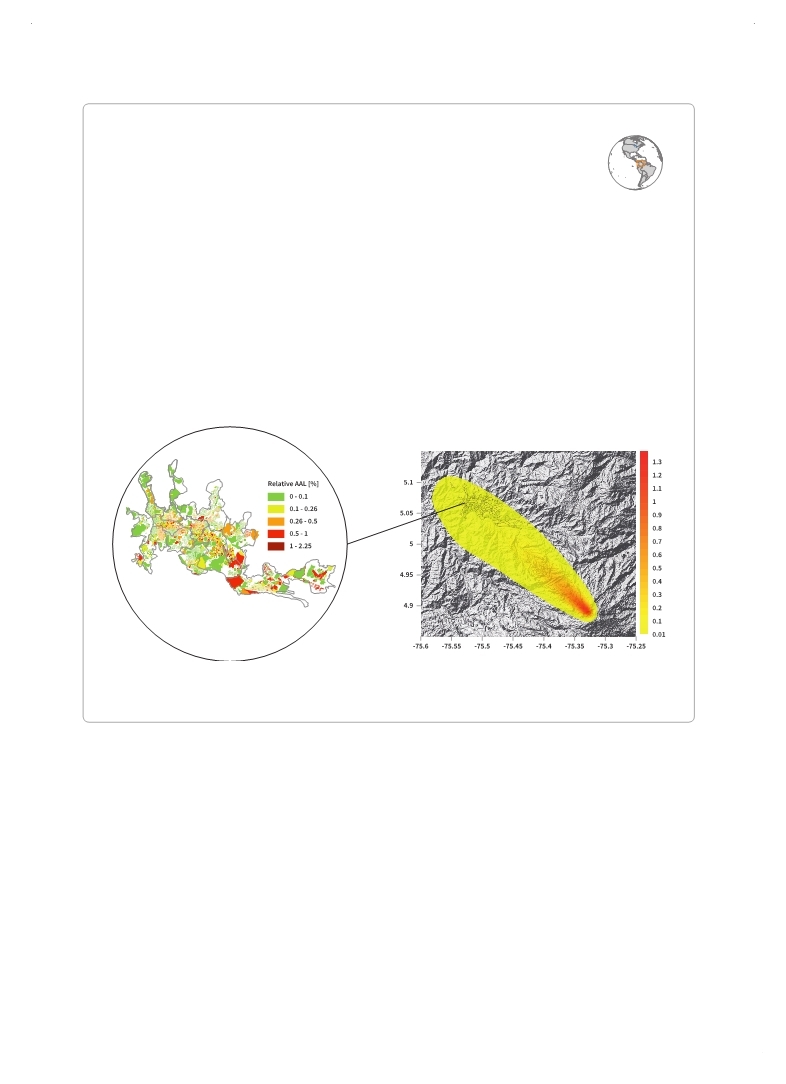
Relative AAL loss distribution for the building stock of Manizales
Box 7.9 Risk assessment informing a comprehensive disaster risk management strategy in Manizales, Colombia
In Manizales, Colombia, a full set of probabilistic risk assessments were carried out to develop a comprehensive disaster risk management strategy. This included retrofitting existing structures, updating a municipal earthquake insurance scheme and performing a cost-benefit analysis of structural risk reduction measures and land-use planning. Probabilistic seismic hazard assessment was used to calibrate the national earthquake building code to local seismic micro-zones for both building stock and the water and sewage network.
Flood hazard for the Chinchiná basin was assessed using 30 years of rainfall data. Landslide risk analysis based on detailed information about land use, topography and geological information was used to support urban planning applications. In addition, probabilistic volcanic ash hazard was analysed for the Ruiz Volcano located 30 km south-east of Manizales. Ultimately, the Manizales voluntary municipal insurance scheme was based on this multi-hazard risk assessment. In this innovative scheme, middle and high-income groups underwrite policies, while low-income homeowners are subsidized by other homeowners and the local government, which acts as an intermediary. Volcanic ash thickness hazard map (m)
rather than by the end-users and decision-makers who need access to targeted information in different formats. All too often, risk information is driven by supply rather than demand, meaning that even when decision-makers are aware that they require risk information, it is often not available in a usable form.
Finance ministers, for example, might be interested in metrics such as annual average loss
(AAL) or probable maximum loss (PML) in order to estimate the potential fiscal impact of disasters or the costs and benefits of investing in disaster risk reduction. They need numbers, not maps. In contrast, planners preparing local land-use or zoning plans will require hazard and risk maps rather than numbers (
 GFDRR, 2014a GFDRR, 2014a GFDRR (Global Facility for Disaster Reduction and Recovery). 2014a,Understanding Risk: The Evolution of Disaster Risk Assessment since 2005, Background Paper prepared for the 2015 Global Assessment Report on Disaster Risk Reduction. Geneva, Switzerland: UNISDR.. GFDRR (Global Facility for Disaster Reduction and Recovery). 2014a,Understanding Risk: The Evolution of Disaster Risk Assessment since 2005, Background Paper prepared for the 2015 Global Assessment Report on Disaster Risk Reduction. Geneva, Switzerland: UNISDR.. Click here to view this GAR paper. |
 
Page 1Page 10Page 20Page 30Page 40Page 50Page 60Page 70Page 80Page 90Page 100Page 110Page 120Page 130Page 136Page 137Page 138Page 139Page 140Page 141Page 142Page 143Page 144Page 145Page 146Page 147->Page 148Page 149Page 150Page 151Page 152Page 153Page 154Page 155Page 156Page 157Page 158Page 159Page 160Page 170Page 180Page 190Page 200Page 210Page 220Page 230Page 240Page 250Page 260Page 270Page 280Page 290Page 300Page 310
|
|
 
|
 
|