Can we track disasters before they happen?
By Aida Hadzic-Hurem
In May 2014, Bosnia and Herzegovina was hit by devastating floods causing loss of human life, and damages and losses of 2 billion EUR. In the midst of the tragedy, all of us were proud of the exceptional assistance that UNDP provided to the ones that needed it the most. Our staff worked tirelessly and efficiently to deliver much needed relief, putting in place recovery programs worth close to 80 million USD.
As UNDP, we also used the momentum to start creating awareness that poor development decisions can worsen the impact of disasters. Disaster Risk Analysis System (DRAS) was hence born out of the understanding that disaster risk management cannot happen with civil protection measures alone.
It’s not that Bosnia and Herzegovina doesn’t already have solid scientific data on hazards, exposure, and vulnerabilities. The main challenge instead is a lack of systematic data collection, exchange of information among public institutions, and translating the available data into action. Even where adequate information is available, it is rarely used by decision-makers and translated into an effective response.
Complicated reporting and governance structures among different levels of government often leave local government authorities (municipalities) disconnected from changes and progress happening at higher levels. This is a lost opportunity, as municipalities have the greatest power to make tangible changes on the ground.
At UNDP, once we connected these dots, we had an idea for the solution. Supported by the Government of Turkey through the Catalytic and Scaling up Facility, we gathered all the relevant governmental institutions to offer a simple solution to preventing human casualties and economic losses caused by disasters.
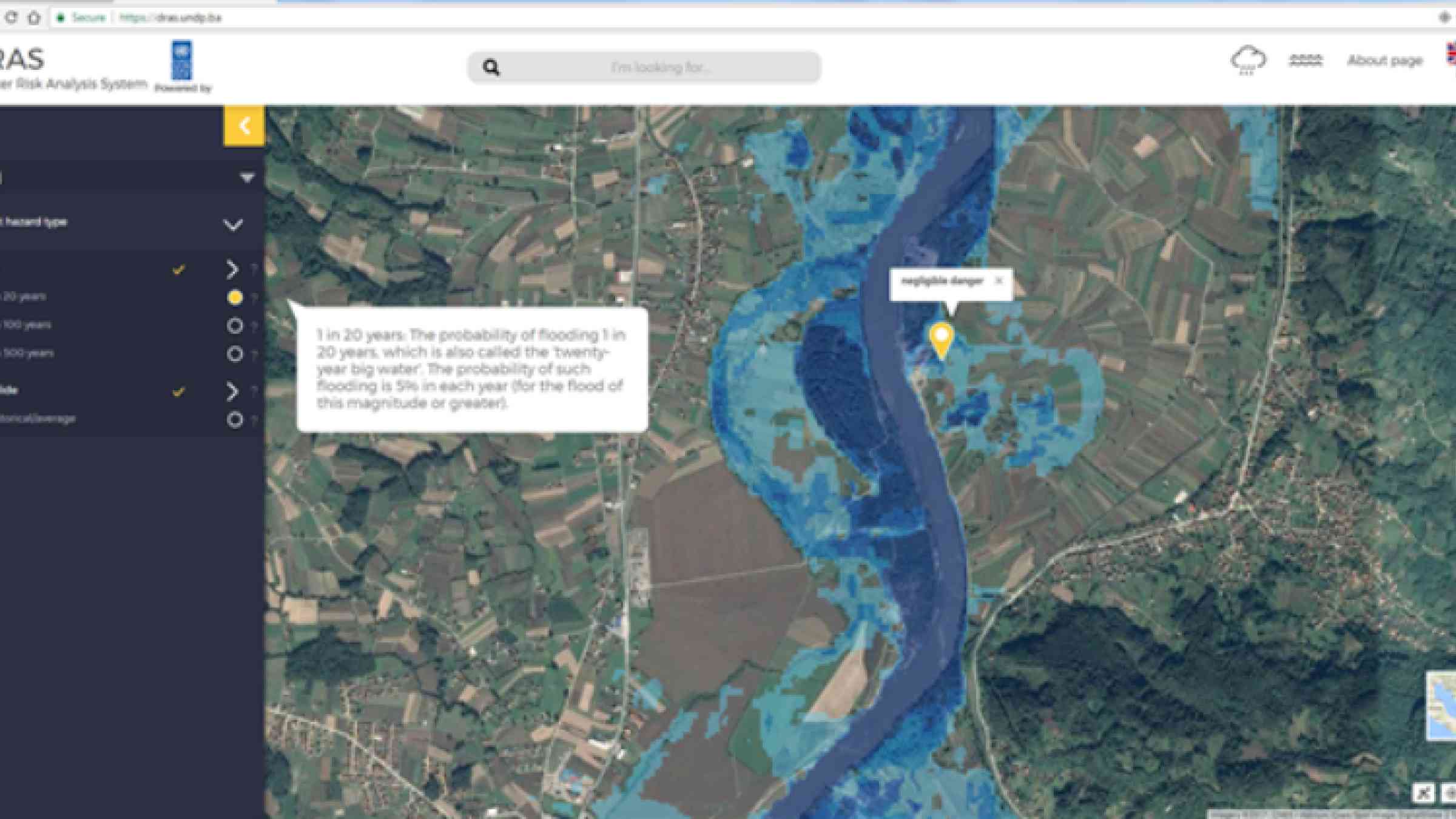
DRAS is an online tool that provides free access to scientific hazard data, not only to municipalities but also to all citizens. It uses existing hazard maps and projects them on publicly available Google maps. The application connects existing data on precipitation and water levels. This way, any citizen in municipalities with a DRAS application can easily access scientific data displaying whether their homes are under threat of floods or landslides, and check current rainfall or water levels in their vicinity.
With DRAS, municipalities for the first time have an overview of vulnerable categories of population on spatial maps (Google Maps). With the ability to overlap spatial data with hazard data, inclusion of vulnerable categories into prevention and response planning has never been easier for municipalities.
Last but not least, DRAS enables fast computer analysis and creation of spatial risk assessments for municipalities combining scientific hazard, detailed land use and vulnerability data. In accordance with the European Union Floods Directive methodology, DRAS represents a perfect opportunity for municipalities to conduct evidence-based decision-making because it enables objective and precise calculations of risks by using scientific data already available at higher levels of government.
For now, DRAS is available for use only in Tuzla and Doboj municipalities, where we launched the pilot, with plans to launch it in 5 more municipalities in the next year. Since it can be used anywhere in the world it holds a major opportunity for a scale-up in the region as well.