Improved predictions of severe weather to reduce community impact
This project has studied the dynamics, predictability, and processes of severe weather, including fire weather, with the purpose of understanding phenomena with severe impact, improving forecasts of severe weather, and better depicting forecast uncertainty in these events. These goals help facilitate better risk management, improve user preparation, reduce adverse outcomes, and enable more effective mitigation.
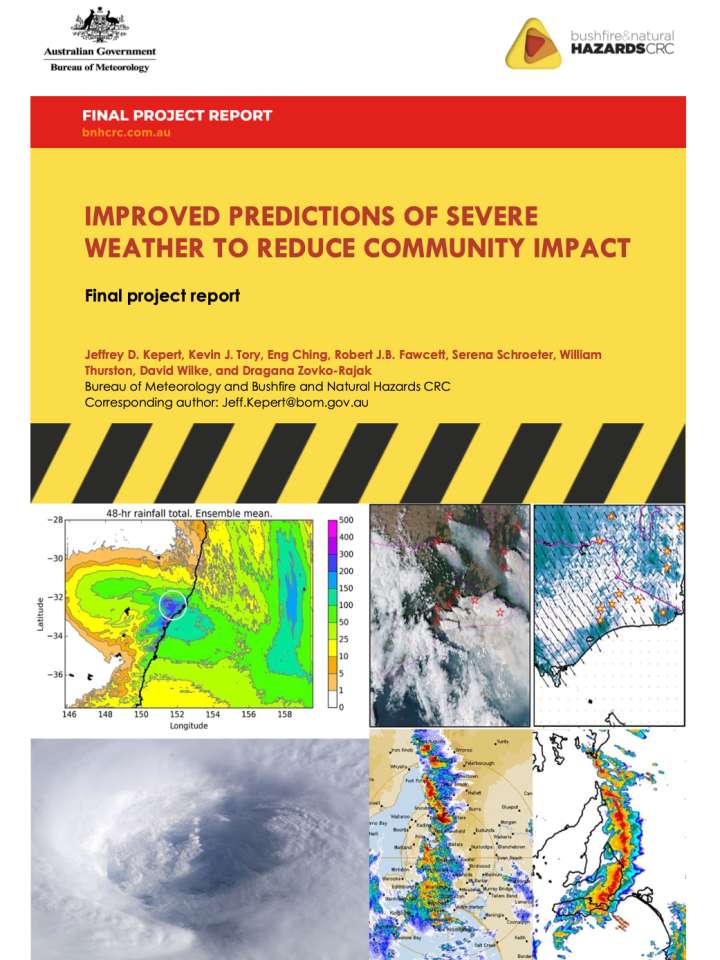
The project has featured two main strands. The first strand comprised case studies of severe weather events. For these, we have combined high-resolution numerical weather prediction (NWP) with a wide range of in situ and remotely sensed observations, to better understand both the high-impact event in question, and other events of that class. All except one of the studies used a version of the Bureau’s operational NWP system, ACCESS. The events comprised two severe mid-latitude systems (an east coast low, and a severe thunderstorm and tornado outbreak), two severe fires, and a tropical cyclone, thereby covering the gamut of severe weather in Australia. Two of the studies featured ensemble simulation, with the east coast low case being the first time that ensemble ACCESS had been run at this resolution within the Bureau and foreshadowing the Bureau’s new operational ensemble capability. Each case discovered important fine-scale features that contributed to the severity of the event, advancing our knowledge base and ability to respond.
The second strand studied two important phenomena associated with bushfire plumes: the formation of pyrocumulus clouds and ember transport. In each case, we began with idealised, high-resolution simulations of plumes using a large-eddy model. We used this technology, in which the model is run on a 50-m grid, to capture the most energetic size range of the turbulent eddies that are prominent in fire plumes. We found that the mean travel distance of firebrands depends mainly on wind speed and fire intensity, but the spread in the landing positions shifts from being substantially crosswind at light winds, to dominantly along-wind at high winds. This spread is greatly increased by the turbulence in the plume, and the maximum spotting distance can be more than double the mean for this reason.
Explore further