Researchers and ski safety experts develop new tool that maps potential avalanches
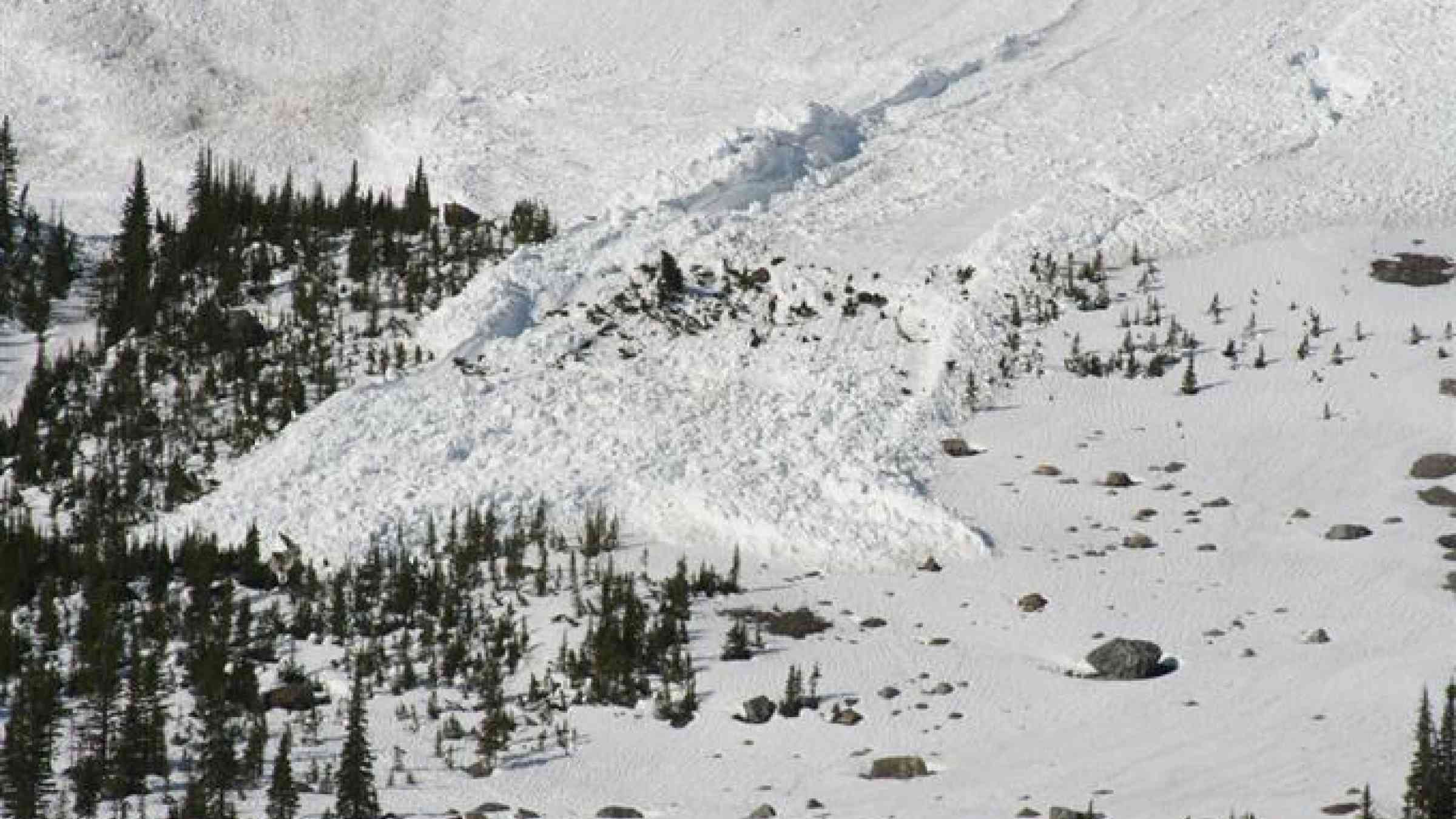
In 2014, two Colorado avalanche control workers were whisked to the hospital after an avalauncher accident near the Continental Divide. They had been using the avalauncher, a compressed gas cannon, to shoot small charges into snowy slopes that posed a serious avalanche risk to motorists below. This is how it’s done in Colorado’s high country: safety teams use explosives to loosen snow that might otherwise accumulate heavily and eventually slide in a deadly avalanche. That day in 2014, the charge exploded too early, in the barrel of the launcher.
The accident prompted a re-evaluation of the Colorado Department of Transportation’s (CDOT) avalanche control techniques, and resulted in the installation of a remotely deployed system called Gazex, which CDOT had recently started experimenting with. Now, transportation officials have brought in researchers who are applying a new, hi-tech tool that safely maps snow depth in steep terrain, making avalanche control safer and more efficient for safety teams.
Jeffrey Deems, a researcher with the National Snow and Ice Data Center at the University of Colorado Boulder, and his colleagues have developed a new application for laser-scanning (lidar) systems that map snow depth at very high resolution, and have been testing it at Colorado’s Arapahoe Basin Ski Area. The researchers have been using the laser scanner system to craft detailed maps of the slopes in summer, without snow, and then comparing them to snow-covered slopes months later.
“Conventionally, avalanche experts go out into the terrain and, based on their expert knowledge, estimate where snow accumulates and where safety teams can most effectively deploy explosives,” Deems said. “But these decisions are made in a very uncertain, data poor environment.”
Avalanche experts commonly make inferences on how much snow has accumulated based on a flat study plot that is not anywhere near the avalanche slope. “From the study plot the experts eyeball a terrain and say, usually when we get six inches here we’ll have twelve inches over there,” Deems said. “That’s not always the case. It’s just a rule of thumb based on experience. With this technology, we can actually show them how much snow has accumulated across the landscape.”
The researchers have been testing the technique at Arapahoe Basin where they help snow safety teams target their explosives placements. The snow depth change maps help the safety teams look for old and new snow accumulation patterns. The data also help the safety team refine their explosives targeting plans, and guide them when they need to decide whether to shoot explosives into certain areas.
“It helps the snow safety team reduce the avalanche danger by more precise targeting,” Deems said. “It also can reduce worker exposure to explosives and reduce costs related to avalanche control by supporting a decision not to use explosives on a given day.”
Deems and his colleagues have also been helping the team at Arapahoe Basin plan their mitigation infrastructure. A ski area expansion is requiring the installation of explosives delivery tram lines, cableways along which charges are placed above the avalanche starting zones and are detonated. In a novel application, the tram line locations are being planned and refined with the aid of the lidar-derived snow depth maps, allowing more efficient and effective tram network design.
“We found that the initial tramway layout was effective at targeting a few high-risk areas, but the lidar snow depth maps revealed other, less obvious accumulation spots, and supported a redesign of the planned tram line network,” Deems said.
The technique does not remove all the uncertainty, only some. “The safety teams are really interested in seeing the spatial variation in the snowpack directly rather than having to infer it,” Deems said. “The maps that we make are maps that avalanche professionals make in their minds, conventionally. Now we could show them this map and instead of spending their mental energy coming up with where they think the snow is, they can start to make decisions based on knowing where the snow is.”
Collaborating with the safety teams has also helped the researchers refine the technique and applications. Deems said, “It’s an important feedback for us, and also potentially a teaching tool for new employees to understand how snow accumulates and behaves on the terrain that they are responsible for.”