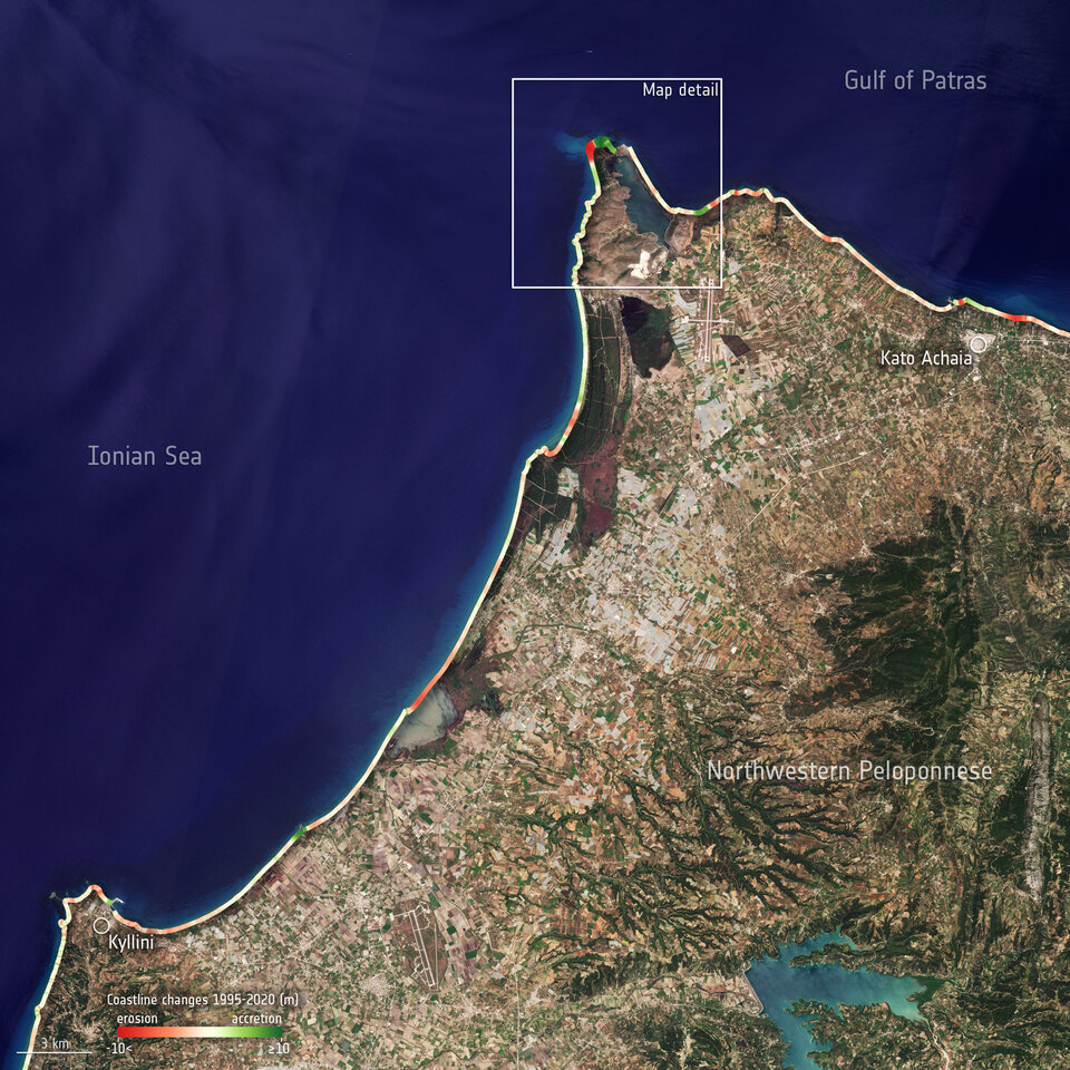
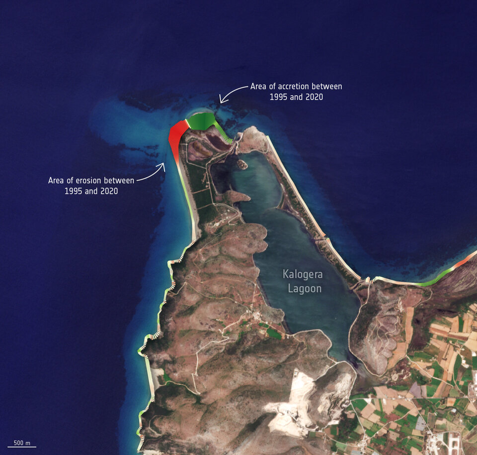
Hundreds of satellite images spanning over 25 years have been compiled to show the evolution of Greece’s ever-changing coastlines.
For decades, coastal areas have been subject to intense urbanisation and population growth. These areas are some of the most dynamic on Earth and, unfortunately, suffer from severe coastal hazards owing to storm activity and sea level rise. Monitoring coastal areas is key to understanding the evolution of coastal dynamics and in helping authorities protect these environments.
The Space for Shore project, funded by ESA, provides a variety of tools for coastal erosion monitoring using Earth observation products. The consortium is composed of technical experts from five European countries.

Two key players of the consortium, Terraspatium and i-Sea, have processed hundreds of satellite images, including data from the Copernicus Sentinel-2 mission, from 1995—2020 to analyse over 900 km of coast in Greece – in the Peloponnese, Eastern Macedonia and Thrace regions.
The results highlight the fragility of Greece’s coastline and indicate the likelihood of coastal erosion increasing in the coming years. Over the 1995—2020 period, around 40% of the coastlines analysed have shown ‘progradation’ which is the seaward growth of beaches caused by the progressive build-up of sediment. The team found that nearly 10% of the studied coastal areas are subject to erosion greater than 3 m per year.
Deltas, estuaries and capes appear to be the most exposed areas with retreat that can reach 30 m per year. Erosion at river mouths are especially of great concern as this signifies a sediment deficit and suggests critical and long-lasting consequences for coasts deprived of sediment input from rivers.
The high-frequency monitoring of nearshore bathymetry is key in sediment management and coastal engineering. The analysis shows that changes in the nearshore bottom slope, sandbar migration or even an overall increase in depth, are all worrying signs of sediment shortage that can forewarn or aggravate coastal erosion.

As an example, the team studied Zakynthos Island, particularly the Laganas coastal area. Given that the beaches are frequently watched by ecologists who closely monitor the migration of loggerhead sea turtles, they found it to crucial to observe the bathymetry and the waterline of the coast to record changes in its environmental impact.
Aurélie Dehouck, Head of i-Sea and coordinator of Space for Shore, commented, “Over the last 25 years, our analysis has revealed a strong variability in Greece’s coastlines, with extremely dynamic local changes.

“From this assessment of intra-period variability, two foregone conclusions emerge: the need to monitor coastal dynamics on crossed timescales to better identify sediment movement, problematic depletions and coastal responses to high-energy events, and the need to constantly monitor in order to know the real status of beaches of which the issues of the present and the future are based.”
“Through the Space for Shore project, a comprehensive set of in situ scientific measurements, combined with numerous retrospective remote sensing data were produced. Thus, an evidence-based up-to-date assessment framework for the extent of coastal erosion was provided, rendering it an extremely helpful and substantially incomparable toolkit to the coastal managers throughout the region, both for the present and future use,” commented Athanasios Nalmpantis from the Public Sector at the Region of Eastern Macedonia & Thrace.
On 22 January, the results of the Coastal Change from Space project were presented in an online webinar.