Education the way forward for Guayaquil, Ecuador
It is widely acknowledged that the frequency and intensity of natural hazards, particularly weather-related events, is being driven by climate change. The impacts of global warming and rising sea-levels are being felt increasingly in countries with low-lying coastal belts. Guayaquil, Ecuador’s biggest city, is one city that is taking measures to adapt to and mitigate to these threats.
In 2013, the UN Intergovernmental Panel on Climate Change ranked Guayaquil among the 10 cities most at risk from rising sea-levels which, by 2050, could range from between 20-80 cm in a worst-case scenario.
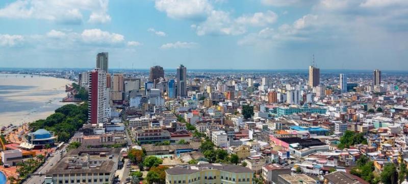
Juan Ramirez is Director of Risk Management and Cooperation within the Municipality of Guayaquil. He has the daunting task of keeping the city safe from a range of natural and man-made hazards. Guayaquil sits close to the Pacific seaboard and is encircled by two major rivers the Guayos and the Salado.
‘The most regular threat we face are from seasonal rains between January and May,’ explains Ramirez. Most of the city is flat, barely 3 meters above sea-level. When we have high tides coupled with heavy seasonal rains, parts of the city become inundated and we experience bad flooding as the water has nowhere to go.’
Earthquakes pose a constant threat to the city. Guayaquil is located barely 200 kilometres from the Pacific Ring of Fire, an area prone to high levels of seismic activity. In 2016 Ecuador was rocked by a 7.8 magnitude earthquake which affected 2.6 million people. Over 250 buildings in Guayaquil were damaged and power and water supply to the city were disrupted.
Ramirez has played a leading role in the development of Guayaquil’s Disaster Risk Reduction (DRR), plan developed with technical support from the United Nations Office for Disaster Risk Reduction (UNDRR) in a project funded by the European Commission called ‘Making Cities Sustainable and Resilient: Implementing the Sendai Framework for Disaster Risk Reduction 2015-2030 at the local level’.
Domenica Tabacchi, Guayaquil’s Deputy Mayor, has been a firm advocate for the project since its inception.
‘The municipal authorities could not achieve this on its own. We had 50 representatives from the public and private sector involved. By bringing everyone together in one process we saved a lot of time and resources’.
Developing the plan involved a process where the cities levels of disaster resilience were ranked against the resilience scorecard for cities, a tool developed by UNDRR. A number of priorities emerged, including the need to build disaster resilience at the community level, as well as strengthening the capacity of public institutions in DRR and putting in place more effective systems to support disaster response efforts.
‘We came up with 84 short-, medium- and long-term actions in our DRR plan’, explains Ramirez. ‘Already we are seeing changes. The Committee of Risk Management, which is comprised of public and private organisations, used to meet together maybe twice a year. Now we meet once or twice a month to discuss contingency planning for disasters and to discuss the levels of progress we are making against the DRR plan’.
Under the plan there have also been significant developments in data collection and analysis which has helped improve decision making in Guayaquil’s Emergency Operations Centre. Prior to 2018, the centre had to rely upon one digital rain gauge controlled by the Institute of Meteorology and Hydrology to measure rainfall. Now, a network has been established that centralizes data from 25 measurement stations covering the entire city. Some are managed by EMAPAG, the municipal authority for water and sanitation and others by different municipal cantons.
Federic Certain is the Director General of Interagua, a private company contracted by EMAPAG to manage the city’s drinking water, waste water and storm water.
‘Connecting all the rain data loggers is an important step, but the way this information is used and shared is more important. Now we have real time information that shows how many millimetres of rain are falling per second. This gives legitimacy to the information sharing process and allows emergency services to plan, deploy and prioritise their emergency response actions.’
Data on precipitation levels is combined with CCTV images from cameras located all over Guayaquil enabling Interagua to deploy emergency trucks to clear blocked drains in the event of flooding and the fire brigade to deploy search and rescue teams.
Other steps have been taken under the new DRR action plan to improve levels of disaster preparedness. Guayaquil lacked any functional equipment for monitoring earthquakes as the systems in the city, which were managed by the central government, had become obsolete. An agreement is now in place under which the Municipality will purchase six accelographs for the National Geophysics Institute. These will be strategically located around the city to monitor seismic activity.
The municipality has also developed a contingency plan with the Guayaquil transit authority to improve traffic flow in the city and avert chaos when disasters such as floods or earthquakes disrupt public transportation networks.
‘We want to strengthen the capacity of public institutions in DRR. This means improving municipal ordinance, building the skills and experience of our staff and creating protocols so that they know how to act before, during and after disasters’, explains Ramirez.
City-wide disaster simulation exercises are now held twice a year. The most recent simulation in 2019 involved 500,000 people from 287 institutions, including municipal workers, the emergency services and the general public.
Major Reynaldo Carbo, Chief of the Guayaquil Fire Academy, was closely involved in the crafting of the city’s DRR plan. He believes it has transformed the way in which the Fire Service interacts with communities around the city.
‘Before our community outreach was pretty limited. We used to make ad hoc approaches to individual schools every time we wanted to run a fire safety education session or to teach kids how to prepare for an earthquake. Now we can reach entire neighbourhoods thanks to a new level of cooperation with the municipality’.
The Department for Social Action and Education (DASE), which conducts vocational programmes and social welfare programmes in some of the most vulnerable and disaster-prone areas of the city, teamed up with the Fire Service. Its teams around the city now handle the organisation of all the community awareness sessions, including organising the venue, logistics and equipment needed by the firefighters. Most importantly they mobilize community members to attend. In 2019 only 36 children were injured by fireworks during the New Year celebrations compared to at least 200 injuries the previous year; a clear sign that the fire safety messages are getting through.
Major Carbo has a clear vision for Guayaquil’s fire service in the near future.
‘In 2021 I hope we won’t have to be so reactive as a fire service. The profile of the firefighter will be someone who is trained to stand up and speak to communities about preventing disasters – educating the public in prevention is the only way forwards.’