Much-anticipated regional drone training offers new options for Central American humanitarian community
By Tej Rae
José Guzman has been paying close attention to the finer details of the two-week regional drone workshop in El Salvador because he plans to share what he has learned with his co-workers when he returns to the World Food Programme (WFP) office in the Dominican Republic.
“We have extreme drought in our country right now. The drones will be used for soil analysis. We need to give information to the farmers on what to plant and what not to plant in that area. Secondly, we had floods. Our office is going to buy four drones, and I will go back and show other staff how to use them,” he explains, while waiting for his turn to practice flying the drone obstacle course.
Here are some of the other ways that 54 participants from humanitarian and government agencies in Honduras, Guatemala, Nicaragua, Panama, the Dominican Republic and El Salvador hope to use drones when they return to their jobs:
- map the changes El Niño has brought to the topography;
- evaluate farmland in the Dry Corridor for crop viability;
- identify areas prone to landslides;
- assess a site after a plane crash;
- test volcanic lakes for seismic activity.
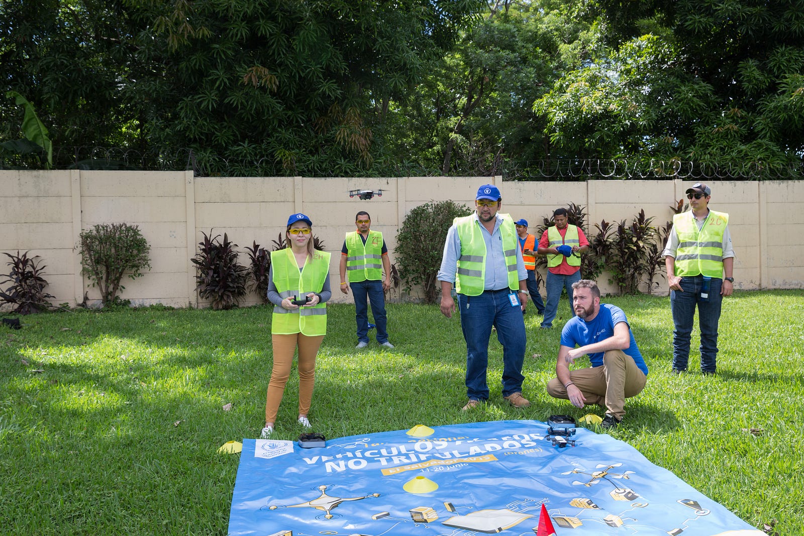
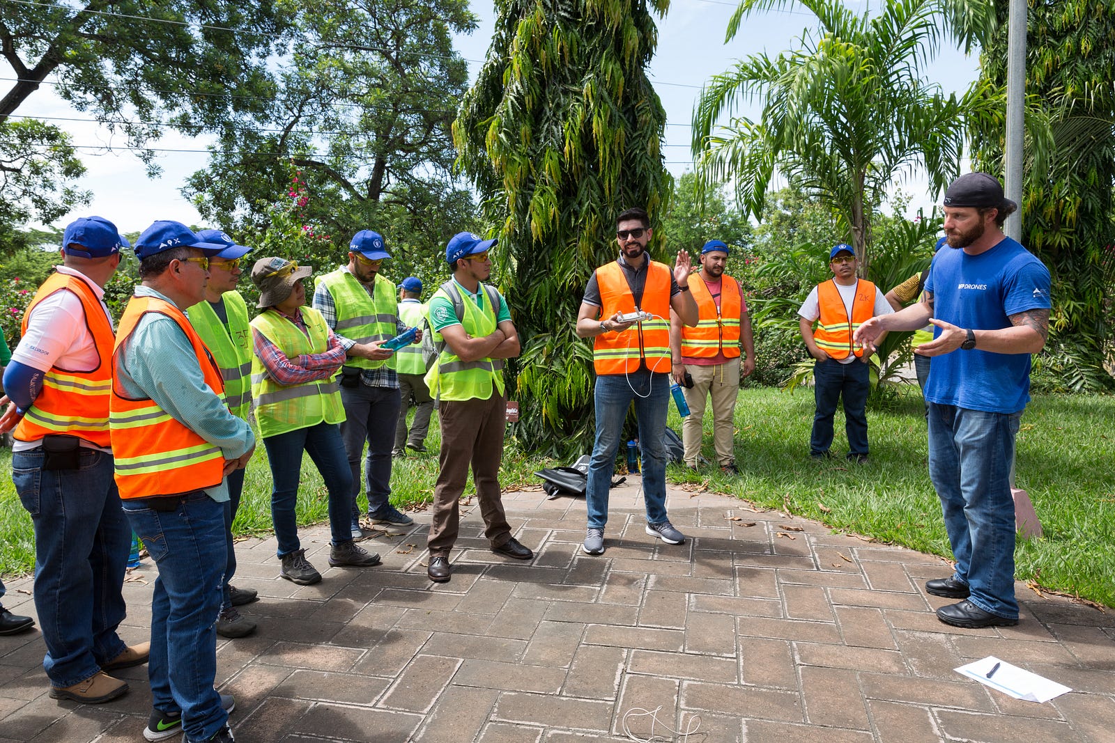
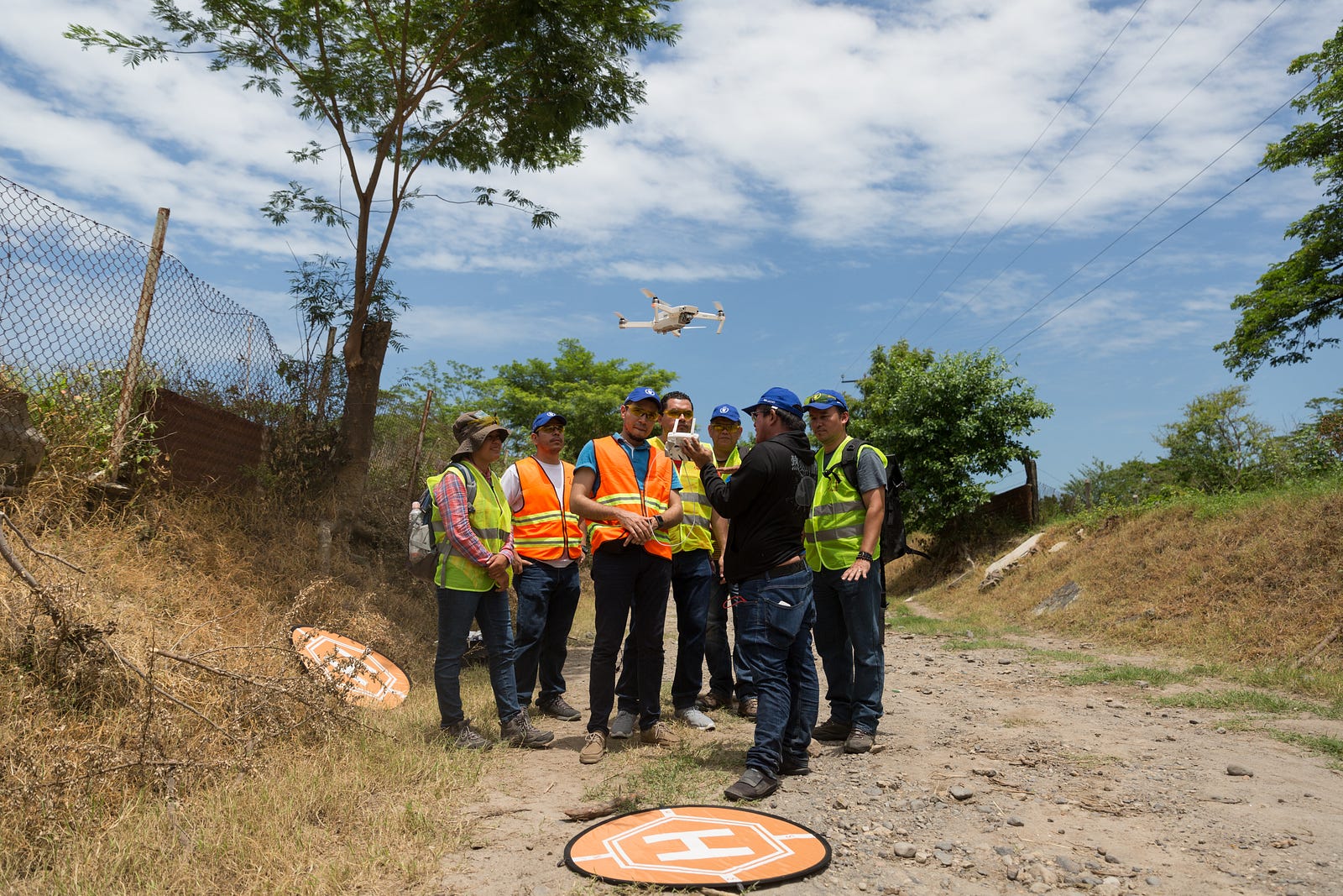
The two-week training, led by experts on mission for WFP, is made up of three segments (Let’s Fly, Let’s Map, and Let’s Coordinate) that focus on how to pilot a drone, use mapping software to consolidate photos, and liaise with local civil aviation authorities on safety standards. After Madagascar, Mozambique, Colombia, Bolivia, Ethiopia and Haiti, this is the first regional workshop for Central America and the Caribbean, and a much-anticipated opportunity for many of the participants.
Interventions for the Dry Corridor
In 2009, the drought-stricken area that runs from Chiapas, Mexico to the western provinces of Panama and includes Guatemala, El Salvador, Honduras, and Nicaragua was labeled the ‘dry corridor’ by the Spanish-language newspaper El Mundo. The double impact of climate change and El Niño means this area is subject to drought and heatwaves along with heavy rainfall and hurricanes. This year, El Niño began in February and is predicted to last until October, with negative impacts on food security for up to 45 million people, 40 percent of whom live in rural areas.
“This workshop came along at the right time,” says Mey Riveiro, a participant who works for the Ministry of Agriculture in Honduras. “In our ministry, we have been looking forward to these technologies. We have a budget for drones and software, but no one knew how to operate them. We will use the technology to monitor the growth of corn, beans and basic grains during the drought. We can use sensors [attached to the drones] to analyze the soil, to avoid planting crops that won’t thrive. We might have to diversify the crops [for a better yield].”
The technology that Mey Riveiro and other participants will need to master is a multi-spectral camera with green, red, red-edge and near infrared wavebands. Some of the drones used during this training offer this option. In the past decade, these cameras have been used to monitor soil moisture, seed viability and infestation by pests that are not detectable to the human eye.
Better photos, better maps
Drones make data collection faster, safer and more affordable than using planes and helicopters. In Central America, drones will complement more limited forms of communication, such as private citizens texting government agencies or sending photos from phones.
Emilio Lara Heussler works for CONRED, Guatemala’s emergency response agency, which relies heavily on good Samaritans and passable roads to determine the extent of the damage in case of disasters. “Right now, CONRED has a mobile app that invites citizens to send info if they have witnessed a landslide or car accident with hazardous materials. We coordinate with all the emergency agencies, like firefighters, local army and NGOs for tactical response. We gather all the information and send it over for strategic coordination. We’re the ones who go to the field.”
Fernando Tomacas of WFP El Salvador faces similar constraints for time-sensitive communication, and plans to use drones to improve services. “We will use drones for disasters like earthquakes or floods. We currently use GPS or reports from local people. They tell us what’s happening with WhatsApp, texting or email. Otherwise, we have to go to the field and see what happened. ”
An expedition to the highest volcano in El Salvador
Eduardo Gutiérrez works for the volcanic monitoring agency in El Salvador, a country with 23 volcanoes, six of which are active. Last Saturday, the participants and training team hiked to the top of Santa Ana volcano to take a water sample from the crater, which can be used to track seismic activity. This usually requires a team of firefighters to descend into the crater — a high-risk mission into poisonous water and gases that is scheduled every couple of years.
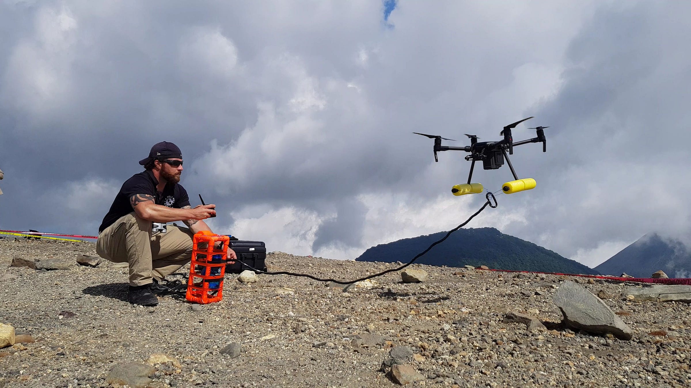
During the excursion, the team demonstrated how this could be done remotely. Two drones are needed: one to carry the beaker for the water sample, and the other to navigate from above, when the first drone can no longer be seen by its pilot.
“For us, it’s very interesting,” commented Gutiérrez on these new possibilities. “We are not a rich country. When we need to buy technology, it’s not a high priority.”
On that day, the drone landed a little too fast on a rock, and the sample was lost, but now Gutiérrez can see how it’s done, the first step in a process that could help his department track seismic cycles. One week later, the trainers returned to Santa Ana to take another water sample for MARN, the ministry of the environment and natural resources, where Gutiérrez works.
Another potential use for drones in this region is to investigate airplane accidents. Néstor Campos, who works with civil aviation El Salvador says, “We will use drones for air crash investigation, or to find victims after an accident, especially when the terrain is difficult to access, like a mountain or a river. The last accident was four years ago. Most frequently, they happen in the flying schools.”
Going forward
As the drone team experienced in Mozambique, these trainings represent the first steps of a process that eventually leads to government agencies moving towards independent use of drones. But before drones are launched, agreements with local authorities need to be signed. “We need to work together with different institutions like the aviation authority,” says Hugo Rosales, WFP IT officer in El Salvador, who helped organize the training.
Once the new technology is operative, the staff from participating institutions will have their own means to gather time-sensitive information, instead of depending on less reliable sources. As Amanda Martínez from WFP Nicaragua says, “The government is looking forward to benefiting from this, which is why the country director was excited to send me here. The training is very useful, everything we have learned here. The regional perspective allows us to share information and do things together.”
The first Regional Drone Workshop for Central America was held in El Salvador from 10 to 21 June, 2019, with the support of the the Government of Belgium, the University of El Salvador, the Unmanned Aircraft Systems (UAS) team of WFP, and the Emergency Telecommunications Cluster (ETC).