Vanuatu: composite hazard map
Title in original language
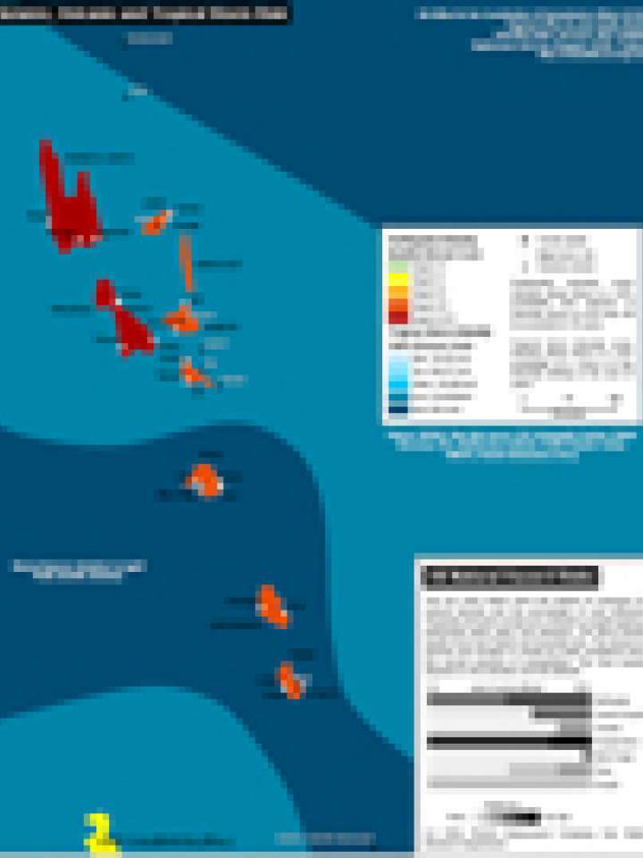
Vanuatu: natural hazard risks
This map illustrates Vanuatu's exposure to seismic, volcanic and tropical storm hazard.
Earthquake intensity zones indicate where there is a 20% probability that degrees of intensity shown on the map will be exceeded in 50 years; tropical storm intensity zones indicate where there is a 10% probability of a storm of this intensity striking in the next 10 years.
The map is based on data provided by: UN Cartographic Section, Global Discovery, FAO, Smithsonian Institute, Pacific Disaster Center, UNISYS, Munich Reinsurance.
Explore further
Country and region
Vanuatu
Publication Year
2011