Latest additions to the knowledge base

The latest additions to the PreventionWeb knowledge base. New content is monitored and added on a daily basis. Filter your search results by year, content type, location, theme and hazard, or explore further sections of the knowledge base.

11月17日至19日,东亚领导人系列会议将相继在印度尼西亚旅游胜地巴厘岛举行。与会者将围绕如何深化区域合作,强化协调机制,应对欧债危机和自然灾害对东盟和亚太地区的影响展开讨论。 东盟共同体建设是此次第十九届东盟峰会关注的焦点之一。2003年10月,第九届东盟峰会首次提出建设东盟共同体目标,并将实现这一目标的时间定在2015年。面对频发的自然灾害,东盟努力凝聚各成员国及亚太地区各方力量,加强联合救灾演习,力求在灾难应对方面形成完善的区域合作机制,运用合力保护民众的生命和财产安全,将自然灾害带来的损失降到最低。
People's Daily Online
Sporadic light rain fell this morning on the vastness of Uganda’s Lake Victoria as Alex Bakunda MP, chairman of the Ugandan Parliament’s Foreign Affairs Committee, chatted with local fisherman, Babalanda Yusuf, about the difficulty of making a living from fishing in Africa’s largest body of fresh water.
United Nations Office for Disaster Risk Reduction - Regional Office for Africa
Disaster risk reduction topped the agenda of the United Nations General Assembly President Nassir Abdulaziz Al-Nasser who visited the city of Kobe and its Disaster Reduction and Human Renovation Institution. The centre has experienced an increase of 30% in the number of visitors since the devastating Great East Japan Earthquake in March 2011.
United Nations Office for Disaster Risk Reduction - Kobe Office

The world map of exposure comparatively shows the potential annual exposure of individual countries to natural hazards such as earthquakes, storms, floods and droughts, as well as the exposure of populations to sea level rise by one meter for each country

The map for the WorldRiskIndex shows the results of the calculations (Exposure X [Susceptibility + Lack of coping capacities + Lack of adaptive capacities]).

This dataset includes an estimate of the annual physical exposure to drought. Unit is expected average annual population (2007 as the year of reference) exposed (inhabitants). This product was designed by UNEP/GRID Europe for the Global Assessment Report

The map shows a subset of the global estimated risk index for flood hazard. The dataset includes an estimate of the global risk induced by flood hazard. Unit is estimated risk index from 1 (low) to 5 (extreme). This product was designed by UNEP/GRID

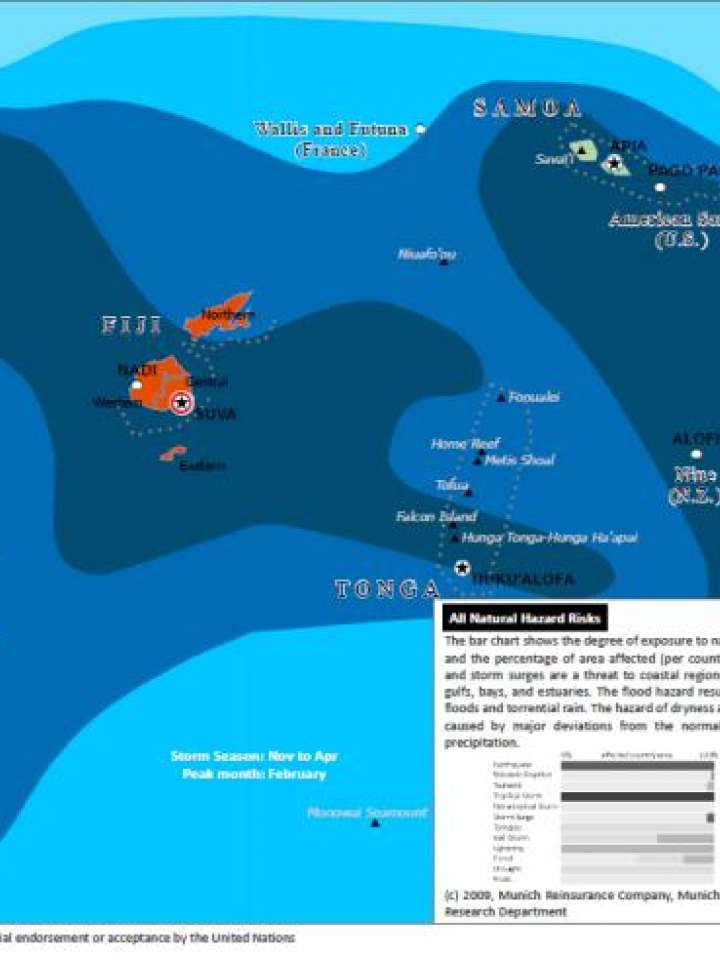
This map illustrates Fiji's exposure to seismic, volcanic and tropical storm hazard.

Can't find what you're looking for?

Understanding risk basics

PreventionWeb offers explainers that cover the basic concepts of risk.

Risk reduction how-to

How can you help others reduce disaster risk?

Is this page useful?

Yes No Report an issue on this page

Thank you. If you have 2 minutes, we would benefit from additional feedback (link opens in a new window).