Please help us improve PreventionWeb by taking this brief survey. Your input will allow us to better serve the needs of the DRR community.
Launch of GEM Global Social Vulnerability map
A step towards analyzing and better understanding the various socio-economic factors that can exacerbate the impact of earthquakes.
The GEM Foundation released today three global earthquake social vulnerability maps, along with a peer-reviewed paper describing the methods, metrics, and tools for the global assessment of social vulnerability and integrated risk from earthquakes. The launch was part of the virtual 2020 Understanding Risk Forum-Community Sessions.
More than 100individuals from around the globe joined the virtual event which featured the presentation of three internally and externally validated global maps demonstrating social vulnerability, economic vulnerability, and recovery potentialfrom earthquakes worldwide.
GEM Secretary General, John Schneider underscores the importance of the global maps saying, “These recently released collaborative products aim to present the current state of social vulnerability modelling at the global scale, and to kickstart an in-depth discussion of the future work needed to downscale the global social vulnerability modelling effort at the sub-country and city levels and to expand this effort to hazards beyond earthquakes.”
Although increasing exposure of critical infrastructure and economic assets has been the major cause of long-term increases in economic loss from disasters, the potential impact from earthquakes extends beyond direct physical impacts and loss of life. GEM’s scientific framework posits that the socioeconomic conditions can increase or decrease the potential for harm or loss during an earthquake event and after the event in terms of the differential recovery potential of populations.
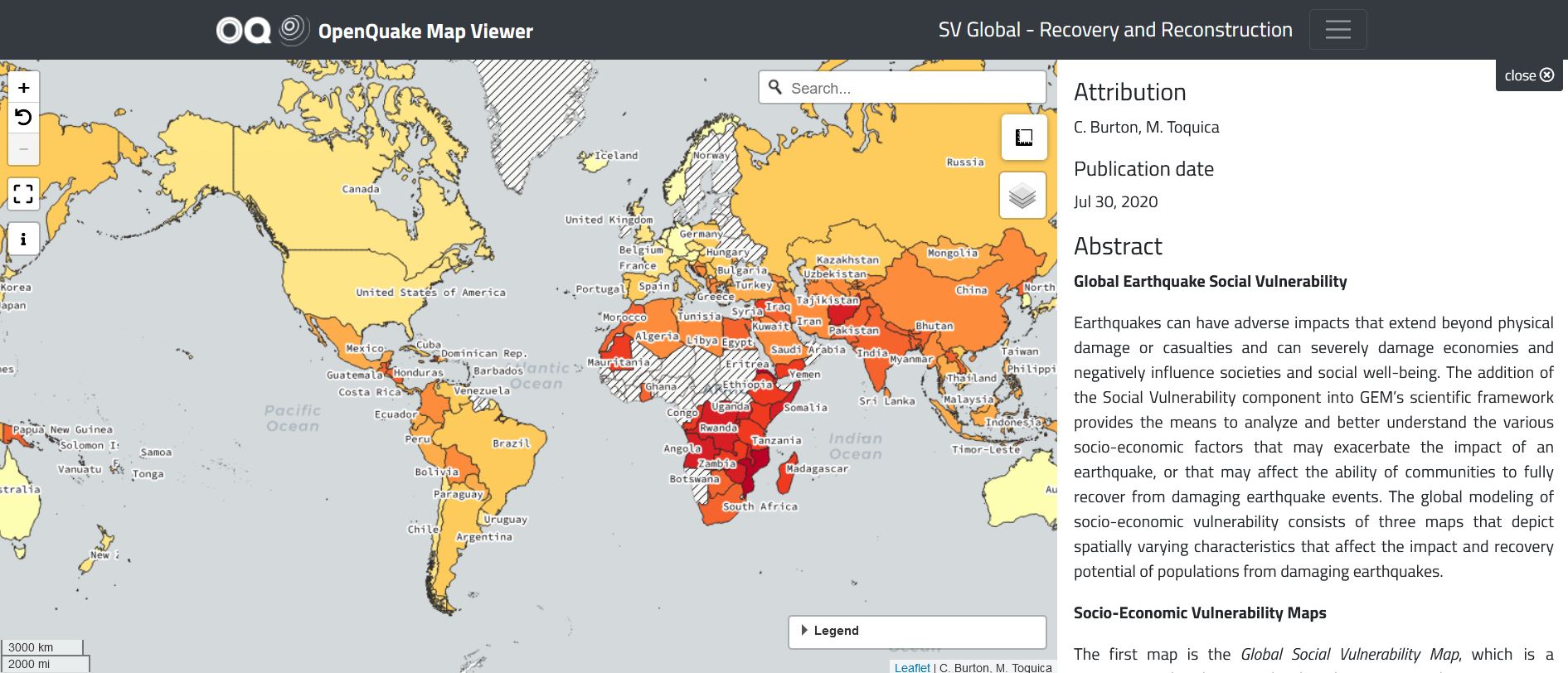
The current reconstruction and recovery map(disaster resilience) shows that nations in northern and southern Africa, Central America, the Andean region in South America, and Asia have low to medium capacity to: anticipate threats, reduce its overall vulnerability, and recover from adverse impacts from earthquakes when they occur.
The analyzed data is based on the density of the built environment, education levels, and political participation. The data also includes post event processes that facilitate a population’s ability to reorganize, change, and learn in response to a damaging earthquake. Although the analyses focused on social vulnerability to earthquakes, the methodology is equally applicable to other hazards.
The measurement of the recovery potential of communities from damaging earthquakes is vital in understanding how to efficiently allocate limited resources when disaster strikes. GEM’s social vulnerability maps will help equip national risk reduction managers with better strategies during emergencies.
The global social vulnerability maps were developed in collaboration with various public and private institutions, national governments, and individual experts with the objective of giving disaster management professionals, especially at the country level, the ability to anticipate an impact that goes beyond physical damage or casualties from earthquakes.
Explore further
Please note: Content is displayed as last posted by a PreventionWeb community member or editor. The views expressed therein are not necessarily those of UNDRR, PreventionWeb, or its sponsors. See our terms of use
Is this page useful?
Yes No Report an issue on this pageThank you. If you have 2 minutes, we would benefit from additional feedback (link opens in a new window).