Please help us improve PreventionWeb by taking this brief survey. Your input will allow us to better serve the needs of the DRR community.
Approaching agriculture in Cambodia from a geospatial perspective
Beneficiary: Sopheap Sok
Title: Chief Officer of the Agricultural Geographic Information System at the Agricultural Information and Documentation Centre
Workshops: Introduction to Use of Geospatial Information Technology for Drought Risk (2017); Advanced Use of Geospatial Information Technology for Drought Risk Management (2018)
Every day we make decisions that have an impact on our lives and the lives of those around us. We often rely on data and technology to make sure we make the best choices. Even the smallest decisions can be made easier by using technology. For instance, checking the weather forecast allows us to make an educated decision on how we should dress, or choose the best way to get to work.
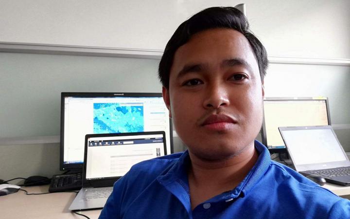
Courtesy of Mr. Sopheap Sok
Decisions that have the potential to influence the lives of millions of people are no different, and can also be improved with technology, however, these larger decisions require a lot more information based on complex data analysis to support the decision-making process, especially when considering pressing issues — and never in the history of mankind have we had more pressing issues than those we face today.
Fortunately, technological tools are already being used to great effect, by helping decision-makers access the accurate information they need. When it comes to geographic problems, the decision-making process requires “spatial thinking”: complex, location-based knowledge that can only come from a Geographic Information System (GIS), a computer-based tool that analyzes, stores, processes and visualizes geographic information, usually in the form of a map. With GIS, we can connect data and geography to understand what belongs where. However, the same as any other tool, GIS requires specific skills to fully comprehend how it works, in order to get the best out of it.
Sopheap Sok, Chief Officer of the Agricultural Geographic Information System at the Agricultural Information and Documentation Centre, under the Ministry of Agriculture, Forestry, and Fisheries in Cambodia, fully understands the importance of adopting a geospatial perspective for facing tough challenges and advancing national development. In 2017, Sopheap participated in an introductory training on the use of Geospatial Information Technology for Drought Risk Management, delivered by UNITAR’s Operational Satellite Applications Programme — UNOSAT. Eager to learn more on how to apply GIS to the realities in Cambodia, in 2018 he took part in an advanced training on the same subject, also focused on Drought Risk Management.
“The topic on GIS is very much related to my current career and I wanted to seize this opportunity to learn new things”.
Sopheap was excited with the knowledge he was gaining, especially on band combination, vegetation index calculation, geospatial data collection and change detection, and the new technologies that could be used for natural disaster management. The training also contributed to improving his spatial analysis skills. “This workshop gave me new insights on how to download satellite imagery and analyze satellite image paradigm to varying geographies”.
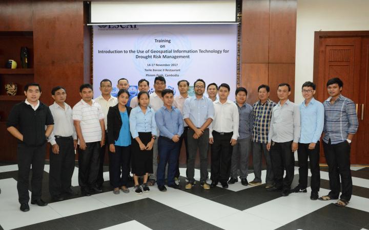
Courtesy of Mr. Sopheap Sok
With his increased technical and analytical understanding, Sopheap decided to create the agricultural geographic information webpage, where he could share everything he learned about the use of GIS in agriculture. With this done, he felt there was still more to be done to support his country’s development, so he came up with an innovative idea: to use smartphones to collect data from the field. Now Sopheap is going even further with an action plan to incorporate GIS into the Office’s annual activities. “I feel strongly motivated to share what I’ve learned and experienced during the training, so I teamed up with my colleagues to organize a workshop for all the departments under the Ministry of Agriculture, Forestry and Fisheries on the Basic Use of ArcGIS to Create Maps. I’ve also proposed that the Agricultural Information Bureau Office include the Geo-Information Farming Website into the Action Plan of 2017–2018. In 2019, I’m planning to organize another training for all Provincial Departments of Agriculture, Forestry and Fisheries on Disaster Data Collecting on Crops, and to integrate the information into the data system”.
Sopheap is indeed putting everything he learned into practice and he wants to continue learning, in particular about the use of Unmanned Aerial Vehicles (UAV), also known as drones.
“I think UNITAR’s activities are really useful because GIS and Remote Sensing seminars are very demanded by all government officials in Cambodia. I hope UNITAR will provide more training on UAV and Remote Sensing for Crop Mapping and Using Google Earth engine for natural disaster analysis”.
We can only hope to meet Sopheap’s expectations of future training and contribute to a more sustainable future in Cambodia.
Explore further
Please note: Content is displayed as last posted by a PreventionWeb community member or editor. The views expressed therein are not necessarily those of UNDRR, PreventionWeb, or its sponsors. See our terms of use
Is this page useful?
Yes No Report an issue on this pageThank you. If you have 2 minutes, we would benefit from additional feedback (link opens in a new window).