Please help us improve PreventionWeb by taking this brief survey. Your input will allow us to better serve the needs of the DRR community.
Can coastal cities turn the tide on rising flood risk?
By Jonathan Woetzel et al.
Climate change is increasing the destructive power of flooding from extreme rain and rising seas and rivers. Many cities around the world are exposed. Strong winds during storms and hurricanes can drive coastal flooding through storm surge. As hurricanes and storms become more severe, surge height increases. Changing hurricane paths may shift risk to new areas. Sea-level rise amplifies storm surge and brings in additional chronic threats of tidal flooding. Pluvial and riverine flooding becomes more severe with increases in heavy precipitation. Floods of different types can combine to create more severe events known as compound flooding. With warming of 1.5 degrees Celsius, 11 percent of the global land area is projected to experience a significant increase in flooding, while warming of 2.0 degrees almost doubles the area at risk.
When cities flood, in addition to often devastating human costs, real estate is destroyed, infrastructure systems fail, and entire populations can be left without critical services such as power, transportation, and communications. In this case study we simulate floods at the most granular level (up to two-by-two-meter resolution) and explore how flood risk may evolve for Ho Chi Minh City (HCMC) and Bristol (See sidebar, “An overview of the case study analysis”). Our aim is to illustrate the changing extent of flooding, the landscape of human exposure, and the magnitude of societal and economic impacts.
[...]
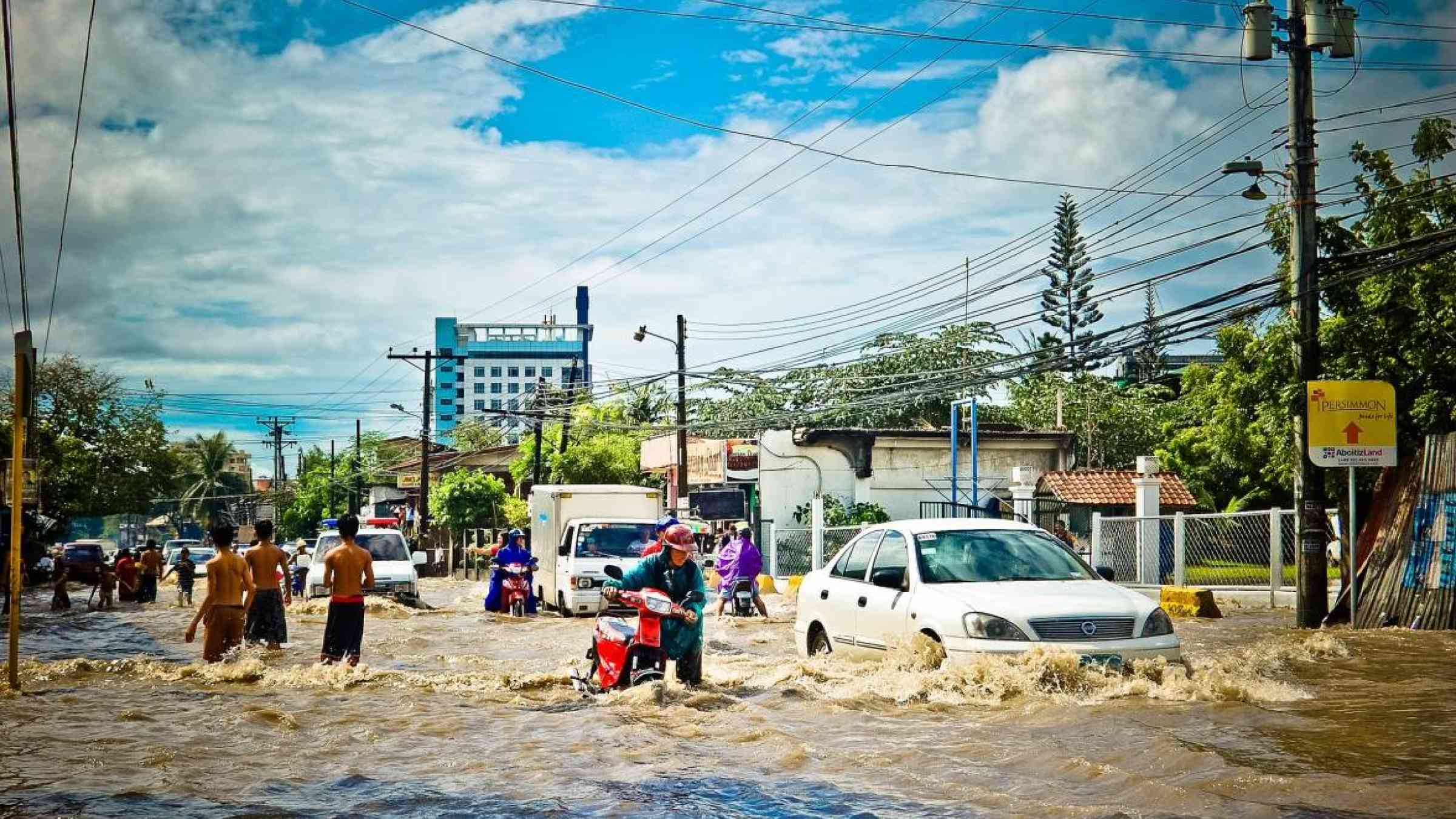
What to know about flood risk in Ho Chi Minh City, Vietnam
Flooding is a common part of life in Ho Chi Minh City. This includes flooding from monsoonal rains, which account for about 90 percent of annual rainfall, tidal floods and storm surge from typhoons and other weather events. Of the city’s 322 communes and wards, about half have a history of regular flooding with 40 to 45 percent of land in the city less than one meter above sea level.
[...]
Could Bristol’s flood risk grow from a problem to a crisis by 2065?
Bristol is facing a new flood risk. The river Avon, which runs through the city, has the second largest tidal range in the world, yet it has not caused a major flood since 1968, when sea levels were lower, and the city was smaller and less developed. During very high tides, the Avon becomes “tide locked” and limits/restricts land drainage in the lower reaches of river catchment area. As a result, the city is vulnerable to combined tidal and pluvial floods, which are sensitive to both sea-level rise and precipitation increase. Both are expected to climb with climate change. While Bristol is generally hilly and most of the urban area is far from the river, the most economically valuable areas of the city center and port regions are on comparatively low-lying land.
[...]
Explore further
Please note: Content is displayed as last posted by a PreventionWeb community member or editor. The views expressed therein are not necessarily those of UNDRR, PreventionWeb, or its sponsors. See our terms of use
Is this page useful?
Yes No Report an issue on this pageThank you. If you have 2 minutes, we would benefit from additional feedback (link opens in a new window).