Please help us improve PreventionWeb by taking this brief survey. Your input will allow us to better serve the needs of the DRR community.
USA: Communities utilize land use planning to reduce wildfire risks and costs
By Kimiko Barrett, Ph.D.
Community Planning Assistance for Wildfire (CPAW) is helping communities reduce wildfire risks and costs. Four new communities join 26 others this coming year.
- Helping communities reduce wildfire risks and costs is a top priority as wildfires increase in size, severity, and frequency.
- CPAW is a collaborative process that provides recommendations tailored to meet the site-specific needs and resources of communities. Communities are selected through a competitive grant process; all services are voluntary and come at no cost to the community.
- CPAW outcomes are linked with other risk mitigation efforts, such as Firewise Communities, Community Wildfire Protection Plans, and Multi-Hazard Mitigation Plans.
- CPAW’s long-term goal is to create fire-adapted communities–where residents safely live with wildfire on the landscape.
As wildfires grow in size and frequency–and as the dangers rise–helping communities reduce wildfire risks and costs is a top priority. Protecting homes and structures threatened by wildfires depletes federal agency budgets, and increasingly places firefighter’s lives in danger. The effects of climate change, alongside increasing development within the wildland-urban interface (WUI), amplify these adverse outcomes.
Today, one-third of all U.S. homes are in the WUI, the area where flammable vegetation and homes meet or intermingle. And with more than 35,000 structures lost to wildfire in the last decade, more communities should consider adopting regulations, plans, and codes that reduce wildfire risk in the WUI.
CPAW: Helping communities reduce wildfire risks and costs
Headwaters Economics and Wildfire Planning International created the Community Planning Assistance for Wildfire (CPAW) program in response to the increasing wildfire risk. Building on principles outlined in the National Cohesive Wildland Fire Management Strategy, CPAW works to help communities become better fire-adapted through improved land use planning.
CPAW assistance is voluntary and comes at no cost to communities. CPAW’s team provides technical assistance in the form of land use planning, forestry expertise, risk modeling, and research and science to identify and integrate wildfire mitigation measures into development processes and plans.
Communities working to reduce risk
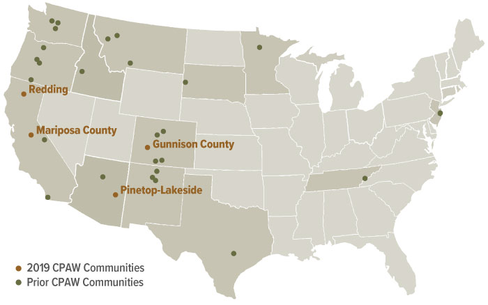
Recently, the Community Planning Assistance for Wildfire program announced that four new communities will join 26 others in the CPAW program in 2019. The communities are Gunnison County, Colorado; Mariposa County, California; Pinetop-Lakeside, Arizona; and Redding, California.
Over the course of one year, the CPAW program will provide customized assistance to these communities including land use planning recommendations, training and capacity building, and specialized research. Gunnison County and Pinetop-Lakeside also will receive wildfire hazard assessments in partnership with the Rocky Mountain Research Station. All communities will receive ongoing implementation support, networking with other CPAW communities, and data and science as needed and as funding allows.
CPAW also provides ongoing support to the 26 communities already enrolled in the program, including research, trainings, and implementation support.
Creating fire-adapted communities
In applying land use planning tools to reduce wildfire risk, CPAW envisions fire-adapted communities where residents safely live with wildfire on the landscape.
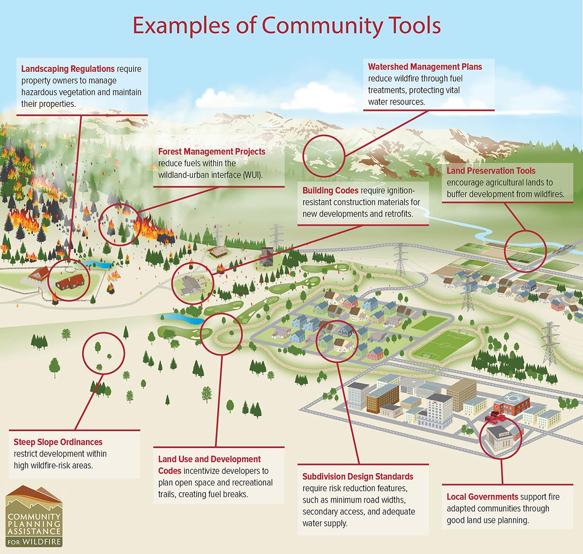
Land use planning involves better management of the built environment, such as subdivision design, infrastructure layout, home construction, and landscaping treatments, to reduce wildfire risks from the unbuilt or natural environment.
The tools of land use planning are diverse and often work in tandem with other development objectives, such as zoning overlays, development ordinances, land preservation and watershed management plans, and building codes.
While land use planning tools can take many forms, they generally can be described through this scenario: a wildfire breaks out within the forest and is allowed to burn because of the ecological benefits. Due to good land use planning, the wildfire burns around the community and no houses are destroyed.
Strategies such as fuel breaks, landscape treatments, development and design standards, building codes, subdivision regulations and other planning tools are successfully applied to improve a community’s resiliency.
As a result of good planning, wildland fire has played its role in reducing fuels, agency funds are now used for restoration projects rather than defense of homes, and the community has safer developments. Insurance rates have dropped and home values have increased.
Explore further
Please note: Content is displayed as last posted by a PreventionWeb community member or editor. The views expressed therein are not necessarily those of UNDRR, PreventionWeb, or its sponsors. See our terms of use
Is this page useful?
Yes No Report an issue on this pageThank you. If you have 2 minutes, we would benefit from additional feedback (link opens in a new window).