1. Home
  2. Knowledge Base | PreventionWeb
  3. Themes

Data and information management

This theme covers aspects related to hardware, software, networks, and media for the collection, storage, processing, transmission and presentation of information for disaster risk reduction (DRR), as well as related services. It also addresses information management to support knowledge sharing for DRR, such as data exchange standards and taxonomy.

Latest Data and information management additions in the Knowledge Base

Meetings and conferences
Online
Hamilton Bean is a Professor of Communication at the University of Colorado Denver and an internationally recognized expert on disaster warning systems and public alerting.
Weather monitoring equipment with a sunset sky backdrop, highlighting technology and atmosphere.
Research briefs

Study reveals a hidden problem: Temperature proxies used in many climate-impact studies can contain substantial measurement error, leading to misestimation of true impacts of temperature and, potentially understate climate impacts by at least 15%.

Wake Forest University
Update

The DisasterAWARE ecosystem was not introduced in the middle of a crisis—it was already part of the international operating environment that bridges communities. It has been exercised through continuous engagements.

Pacific Disaster Center
A modern architectural building in bright orange and blue serves as a temporary evacuation center for the tsunami disaster in Bantul, Yogyakarta
Rama Nassif
This blog poses that trust is a critical performance condition in DRR. Early warnings, shelters and preparedness plans may exist, but protection depends on whether people see them as credible, accessible, understandable and accountable.
Evaluating a model’s appropriateness for climate & disaster risk finance decision making thumbnail
Documents and publications

This guidance note provides a framework for evaluating whether climate and disaster risk models are fit for climate and disaster risk financing decisions, covering model transparency, hazard, exposure, vulnerability, loss and uncertainty assessment.

InsuResilience Solutions Fund
Update

Two smoke-damage bills awaiting the governor’s signature address a longstanding issue brought to the fore by the Los Angeles County fires: When is it safe for wildfire survivors to move back into their homes?

Associated Press
Documents and publications

This study develops a standardised, reproducible, and operational methodology to screen tsunami risk at the community scale across the Caribbean Basin, based exclusively on open and globally consistent datasets

International Journal of Disaster Risk Reduction (Elsevier)
Update

More than half of reporting companies provide no core quantitative metrics, raising concerns over their ability to measure nature-related risks and potential greenwashing.

Eco-Business
Changes in glacial lakes and associated risks in the China‒Nepal Himalayas thumbnail
Documents and publications

This study presents a detailed and refined glacial lake outburst floods (GLOFs) risk assessment using a data-driven machine learning framework.

Advances in Climate Change Research (Elsevier)
Measuring floods by their scars: toward a data-driven flood severity scale thumbnail
Documents and publications

This paper introduces the FLOSEV flood severity scale, an impact-based classification system using fatalities, affected municipalities and damage indicators. Tested on more than a century of Italian floods, it enables comparison of flood impacts.

Natural Hazards (Springer)
Sensitivity analysis of flood frequency to the length of the data recording period thumbnail
Documents and publications

This study examined the sensitivity of flood-frequency estimates to the length of hydrometric records using the annual maximum series (AMS) and partial value series (PVS) approaches at 15 hydrometric stations in the Karkheh Basin, Iran.

Nature Scientific Reports
Global estimation of bankfull river discharge reveals distinct flood recurrences across climate zones thumbnail
Documents and publications

This study uses observations and machine learning to estimate bankfull river discharge globally. Results show that bankfull return periods vary significantly across climate zones, challenging the common 2-year assumption used in global flood models.

Nature Communications (Nature)
Local-scale wind forecasting for tropical cyclone early warnings thumbnail
Documents and publications

This paper presents LiveCyc, a machine learning system that converts tropical cyclone forecasts into probabilistic 1-km wind forecasts. Evaluation across 16 U.S. hurricane landfalls shows well-calibrated results and supports optimized warning triggers.

American Meteorological Society
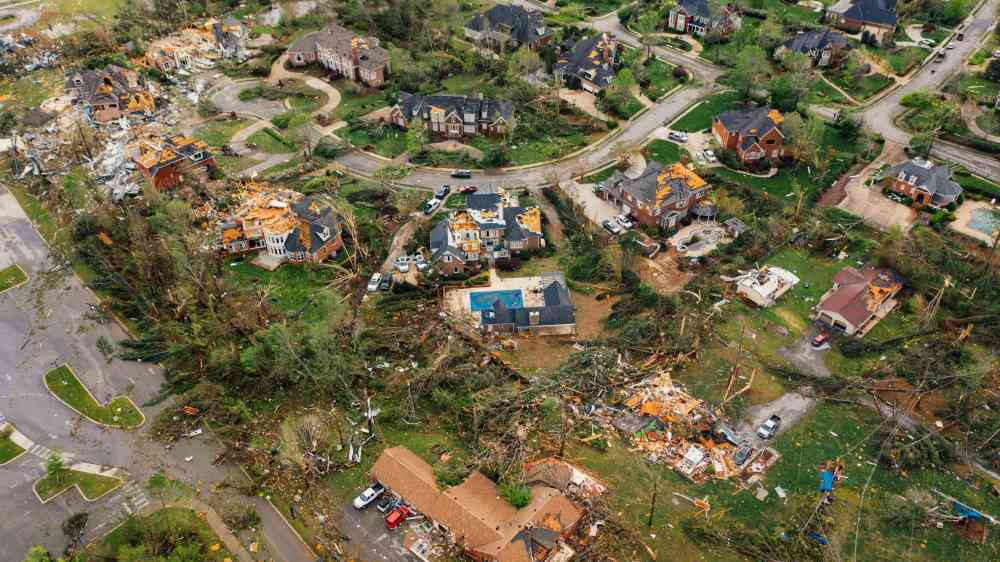
Aerial view showing severe tornado damage in Chattanooga, Tennessee neighborhood.
Lakshman Srikanth David Petley
Why is counting disaster fatalities harder than it looks? This blog examines how deaths are defined, attributed, verified and revised, and why better fatality data is essential for understanding and reducing disaster risk.
What can 150 years of census data tell us about population impacts from extreme weather in sparsely populated Northern Australia? thumbnail
Documents and publications

This paper analyses 150 years of census and hazard data to assess how extreme weather affected population trends in Northern Australia. It finds floods and cyclones can disrupt population growth highlighting need for resilience and adaptation planning.

International Journal of Disaster Risk Science
Weathering extremes: A toolkit for information resilience amid disaster thumbnail
Documents and publications

This toolkit examines how extreme weather events fuel mis- and disinformation and provides frameworks for assessing readiness, triaging threats, building partnerships and strengthening information resilience before, during and after disasters.

Center for Climate and Security, the
Update

A deadly Nepal-Tibet border flood highlights how limited cross-border data sharing, restricted access to Tibet and weak early warning systems can hinder disaster preparedness. The article calls for greater regional cooperation on climate and flood risks.

Conversation Media Group, the
Update

XAIDA is designing and applying AI-based methodologies to reveal how climate change impacts extreme weather events and to foresee their occurrence in the future.

Community Research and Development Information Service
Vacancy
Cairo
Closing date
This is a project post. Appointment or assignment against this position is for an initial period of one year. The incumbent reports to the Deputy Chief, under the overall authority of the Chief of the Regional Office.
Update

The ENSO Outlook, developed by IWMI, Sri Lanka, a first-of-its-kind ENSO Digital Public Infrastructure, is designed to turn El Niño and La Niña climate signals into timely, actionable measures, focusing on farm-level preparedness and response to shocks.

International Water Management Institute (IWMI)
A climate impact taxonomy operationalizing IPCC physical driver and risk concepts thumbnail
Documents and publications

This paper introduces a climate impact taxonomy linking IPCC climate impact-drivers with key climate risks, creating a practical framework for adaptation planning and decision-making.

Nature Climate Change
Update

HERA’s first-of-its-kind tool and analysis estimates how extreme heat affects economic output and mortality in cities around the world. It shows the likely impact on workers today and how those impacts could grow by 2050.

HERA (Climate Resilience for All)
Update

The University of Cumbria is leading an international partnership behind the launch of Apada Sahayak, a new bilingual app designed to help communities across the Himalayan region strengthen their preparedness for natural hazards and disasters.

University of Cumbria
Navigating data scarcity in flood risk assessment thumbnail
Documents and publications

The authors conducted a systematic review of 264 studies on flood risk assessment in data-scarce regions.

WIREs Water
Professional Meteorologist Analyzing Climate Science Data For Weather Forecast.
Bapon Fakhruddin Matti Heikkurinen
Adaptation is not a single dataset. It comprises numerous distinct data holdings distributed across NHMSs, sectoral ministries, NDMAs. Each of these sources operates within its own technical conventions. As a result, data may not be directly comparable.
Research briefs

The University of Tokyo (UTokyo-IIS) developed a real-time data assimilation system that has significantly improved streamflow and flood forecasting accuracy across Japan and outperformed the country’s current early warning systems.

Climate Adaptation Platform (CAP)
Update

Disaster communications experts discuss how maintaining reliable communications for first responders is essential during emergencies, and how every disaster demands flexibility, coordination and close partnerships to keep response efforts connected.

Domestic Preparedness
Update

Historical observations are our best way of filling crucial gaps in Australia’s climate records, allowing us to sharpen our forecasts of future weather extremes in a warmer world.

Conversation Media Group, the
A methodology to characterise land degradation and desertification in the European Union thumbnail
Documents and publications

This study proposes a methodology to characterise land degradation and desertification in the European Union

European Commission Joint Research Centre
Meetings and conferences
Online
This webinar, organized by UNDRR, ESCAP and SPC, will introduce the Global Disaster-Related Statistics Framework and explore its practical relevance for countries in the Pacific region.
Overcoming the limitations of social media analytics: Dynamic capabilities and workaround strategies for inclusive and resilient public service continuity
Documents and publications

This study addresses the limitations of using social media analytics in disaster management, arguing that human analysis remains indispensable, especially when dealing with vulnerable populations.

International Journal of Disaster Risk Reduction (Elsevier)
tourists cooling off in fountain heatwave Rome on a very hot day. Heat record in Italy - 08.06.2022
Update

The climate monitoring developed by CMCC for Rome uses ultra-high-resolution datasets to provide robust and reliable territorial information, useful for urban planning and evaluating adaptation measures.

Centro Euro-Mediterraneo sui Cambiamenti Climatici (CMCC)
Research briefs

A new study shows the pros and cons of different model training methods.

Eos - AGU
Update

A new online tool out of the Yale Center on Climate Change and Health (YCCCH) strives to provide hyperlocal information about the range of extreme weather risks on mortality, including the potential impact on older adults.

Public Broadcasting Service (PBS)
Local fisherman heading long tail boat to the pier at Koh Libong island, Trang province.
Update

Climate change adaptation ‘success’ is being defined and measured through metrics that often fail the communities they are meant to support.

Toda Peace Institute
Towards an operational European Drought Impacts Database (EDID) thumbnail
Documents and publications

This article gives insight into the implementation of European Drought Impact Database (EDID), its structure and attributes, and provides an analysis of the content.

Natural Hazards and Earth System Sciences, the
Update

Using data from FIFA, Brown epidemiologists developed a tracking tool aimed at assisting public health experts in the event of an infectious disease outbreak.

Brown University
Meetings and conferences
Online
Join the United Nations Development Programme (UNDP) for the next session of the Adaptation & Resilience Dialogues, exploring how countries can strengthen multi-hazard early warning systems and turn climate data into action.
Meetings and conferences
Online
Global risk modelling puts the country’s average annual loss at roughly US$91.5 million, with flooding accounting for about 98 percent of it. Most of the population, the farmland and the drainage network sit on a low coastal plain.
A map of North and Central America, Pacific Ocean, Australia with recent earthquakes location depicted as dots by the ESRI real time detection service.
Update

There is a quiet contradiction at the heart of natural hazard science. The regions most exposed to multi-hazard events are precisely the regions where we know the least.

European Geosciences Union
Meetings and conferences
Geneva
-
In person
6th Global Expert Forum for Producers and Users of Disaster-related Statistics, in hybrid format. Geneva, Switzerland, from 3-4 September 2026.
Research briefs

Beyond helping emergency managers better alert downstream communities to flooding events, tracking rapid runoff allows water managers to improve reservoir management.

Disaster Research Institute, Preston University
Clearing of rubble in Syria through a donor funded project.
Feature

Syria became one of the earliest countries to implement UNDRR's DELTA Resilience system, which will help it better understand and reduce the disaster risks it faces as it recovers from years of war.

United Nations Office for Disaster Risk Reduction (UNDRR)
Amboseli national park, Kenya.
Update

ClimWeb is a digital platform that supports Africa's National Meteorological and Hydrological Services to strengthen early warning systems and climate services.

World Meteorological Organization (WMO)
Open data
Last updated 12 Jun 2026
The case studies that are included in Disaster losses and damages data report are available on this page.
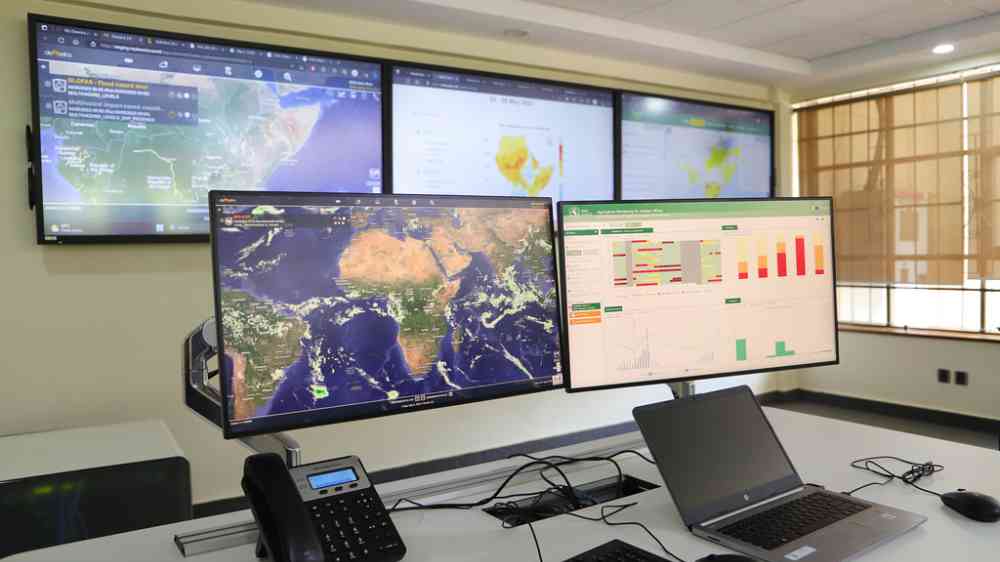
Computer screens showing maps and data
Research briefs

Researchers at the Institute of Industrial Science, The University of Tokyo (UTokyo-IIS) have developed a real-time data assimilation system that substantially improves streamflow and flood forecasting accuracy across Japan.

University of Tokyo 東京大学
Steps to identify and use adaptation indicators for national monitoring, evaluation, and learning systems thumbnail
Documents and publications

This brief supports members of national adaptation plan (NAP) teams involved directly or indirectly in MEL systems, and those supporting them, in identifying and using adaptation indicators for their national MEL systems effectively and efficiently.

National Adaptation Plan (NAP) Global Network
Person stretching arm for an Earth model at COP
Research briefs

Our novel artificial intelligence model can predict extreme storm surges with high accuracy, including under future climate conditions.

Conversation Media Group, the
Update

Maximum Information today announces the launch of PsiClone, a new live event monitoring platform that helps insurers, reinsurers and underwriting teams monitor portfolio exposure and act earlier during active tropical cyclone events.

Maximum Information
Last updated 5 Jun 2026
Explore case studies and best practices on the use of open data for disaster risk reduction.