Tsunami
Tsunami is the Japanese term meaning wave (‘nami’) in a harbour (‘tsu’). It is a series of travelling waves of extremely long length and period, usually generated by disturbances associated with earthquakes occurring below or near the ocean floor (IOC, 2019).
A tsunami can also be generated by other underwater disturbances such as landslides, volcanic eruption and meteorites. A tsunami consists of a series of 10 or more waves with crests arriving every 10 to 60 minutes. Tsunami waves can be very long (as much as 100 km) and tens or even hundreds of metres high. They can cross entire oceans without great loss of energy.
Destructive tsunamis can generated by large, shallow earthquakes with an epicentre or fault line near, or on the ocean floor. Usually, it takes an earthquake with a Richter magnitude exceeding 7.5 to produce a destructive tsunami. Receding water is one of the first visual signs of a tsunami. Experts believe that a receding ocean may give people as much as five-minutes warning to evacuate the area (IOC, UNESCO).
The Pacific is by far the most active tsunami zone, according to the US National Oceanic and Atmospheric Administration (NOAA), but tsunamis have been generated in the Caribbean and Mediterranean seas, and the Indian and Atlantic oceans.
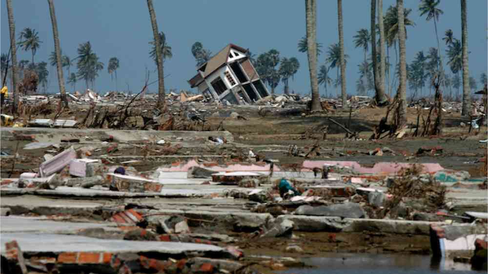
On Sunday morning 26 December 2004 at 00:58:53 UTC, a massive earthquake measuring 9.1 on the Richter scale struck off the west coast of Sumatra, Indonesia. The earthquake generated a series of towering waves which could travel at 80 km/h in shallow water, with the largest impact felt in Indonesia and Sri Lanka. Within 15 minutes of the earthquake, waves began striking the coasts of northern Sumatra and the Nicobar islands.Waves of up to 30 metres were recorded as the tsunami swept through Aceh, the hardest hit region of Indonesia. Around two hours after the earthquake struck, waves reached Sri Lanka, India and Thailand. An hour later they reached the Maldives, and, more than seven hours after the initial quake, the tsunami was observed in Mauritius and along the east coast of Africa.
The tsunami waves caused widespread death and injuries, displaced thousands, destroyed towns, homes, livelihoods, infrastructure, and wrecked coastal areas. Due to the scale of destruction estimates for total lives lost vary, according to the United Nations approximately 227,000 people were killed in fourteen countries. Data published by the Tsunami Evaluation Coalition indicated at least 275,000 people were killed. Across the region there are still people believed to have been swept away who have never been accounted for. Measured in lives lost, this makes it one of the 10 worst earthquakes in recorded history, as well as the single worst tsunami in history (Australian Institute for Disaster Resilience).
Risk management for tsunamis includes guidelines on tsunami risk assessment/management. Examples include IOC (2015) and UNDRR (2017). The Intergovernmental Oceanographic Commission is coordinating the implementation of a global tsunami warning system, building upon its experiences in the Pacific to establish regional warning systems for the Indian Ocean (IOTWMS); Caribbean Sea (ICG-CARIBE-EWS); and the North-eastern Aland, the Mediterranean and connected seas (ICG-NEAMTWS). The regional systems coordinate international tsunami warning and mitigation activities, including the issuance of timely and understandable tsunami bulletins to IOC Member States.
Risk factors
- Living by the sea in earthquake-prone zones.
- Poor quality buildings.
- Destruction of the environment and natural barriers.
- Lack of coastal land-use planning.
- The development of tourist settlements in tsunami-prone zones.
Vulnerable areas
- Tsunamis can be generated in oceans and seas around the world.
- But the Pacific Ocean has a much more frequent occurrence of large, destructive tsunamis because of the many large earthquakes along its edges.
Risk reduction measures
- Early warning systems.
- Understand what a tsunami is, how it develops, and its impact on the coast.
- Hazard map, including clearly designated shelters and safe areas.
- Reinforce building structures: move homes and buildings away from the shoreline.
- Protect essential infrastructure such as schools and hospitals, roads, harbours, power plants, banking, and build structures at higher levels if possible.
- Install seawalls and revetments, structures that can be built along the shoreline to help protect the shore from storm waves.
- Ensure that natural barriers - dunes, mangroves and coral reefs - are protected.
- Integrate indigenous knowledge into tsunami protection plans.
- Educate locals and tourists on tsunami risks and integrate tsunami education in the school curricula.
- Place tsunami evacuation signs along roadways clearly indicating the route to higher ground.
Tsunami early warning systems
To alert far-away coasts, internationally coordinated tsunami early warning systems, such as the Pacific Tsunami Warning and Mitigation System (PTWS), have been established to quickly provide tsunami threat information to countries.