Washington DC - An inconspicuous room in the World Bank’s Latin American & Caribbean division has become the eyes and ears of the soon-to-be-launched reconstruction operation of Haiti following the devastating January 12 earthquake.
Armed with top of the line, high-tech equipment to assess damage on the ground and with a great deal of enthusiasm and good will from colleagues from around the world, the small team manning this improvised "situation room" collects data and images of the flattened buildings in Port-au-Prince that are then processed and passed on to an army of experts getting ready to go to Haiti in a few weeks to start the arduous assessment and reconstruction process.
The group, led by the region’s Disaster Risk Management Team with the support of the Global Facility for Disaster Reduction and Recovery (GFDRR), has so far gathered thousands of high-definition images from toppled buildings and damaged infrastructure that provide a unique window into the extent of the damage and will make the experts’ task a lot easier once they get on the ground.
In a scenario where time is of the essence this effort has also cut by half the preliminary work required prior to the assessment mission that will be carried out by the Post Disaster Needs Assessment team, PDNA, in a few weeks’ time. “Normally the preliminary analysis should have taken weeks and we have cut it down to 36 hours”, says enthusiastically operation coordinator Galen Evans.
All this is possible thanks to a sophisticated array of equipment and clockwork coordination with many parties including the likes of Google and Microsoft, consulting giant McKinsey, ImageCAT, Earthquake Engineering Research Institute (EERI) and the Rochester Institute of Technology (RIT), working together on a volunteer basis with members of the scientific communities, NGOs, multilateral organizations and government agencies, under the umbrella of a partnership dubbed GEO-CAN (Global Earth Observation- Catastrophe Assessment Network).
Images relayed worldwide, experts weigh in
Here's how it happens.
RIT planes equipped with optical laser sensors and high-definition image gathering capabilities fly over the Haitian capital many times a day to capture aerial photos of the damage. The images are then downloaded to a server of the University of Puerto Rico at Mayaguez -the airplanes’ hub-, which in turn transfers them to computers in the University of Buffalo and RIT where they get processed and sent to the World Bank Haiti situation room and to all the parties collaborating in this effort. The images collected are soon made available on web sites and search engines as well as online maps, so the most number of experts and technicians can provide their input.
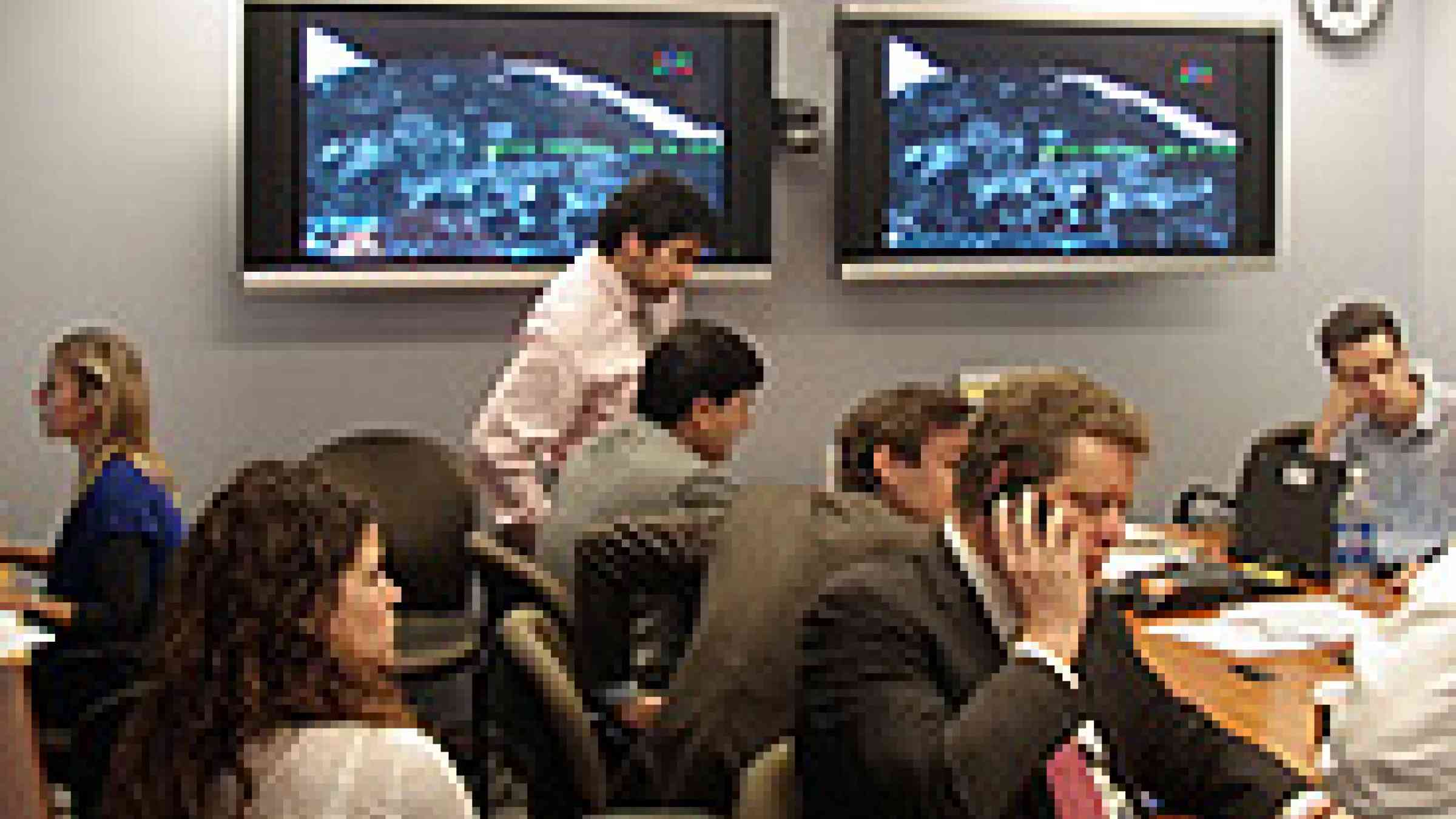
It is a round-the-clock operation of unprecedented proportions both in scope and in the level of cooperation involved, says Evans pointing at two huge HD screens mounted on a wall that show a photo of a street where the level of detail allows the naked eye to see the number plate of a passenger bus half buried in the debris.
Evans explains that the images they’re collecting are breaking new ground in aerial damage assessment as image precision is well above the satellite imagery standard of 60 centimeters of resolution. The photos being taken are 15 centimeters of resolution which means that experts would be able to figure out the position of objects as small as 15 centimeters in size (6 inches).
“That’s as precise as it can get”, he says. It allows technical personnel to more easily do the enormous job of classifying the battered structures of Port-au-Prince into categories that range from the heavily damaged to the completely destroyed, and to establish the footprint of buildings for future reconstruction work.
Academia, software developers partner in new way
Another area where this initiative is breaking new ground is in involving a worldwide array of cooperating partners that contribute to this effort with clockwork precision. From the academic sector providing the equipment to a large community of open-source developers providing software muscle to make this happen, this is a huge collaborative effort and an example of how the international community is working together to help the Haitian people rebuild their lives and communities, says GFDRR’s Senior Disaster Risk Management Specialist Doekle Geert Wielinga.
This is extremely critical in a fast-paced environment where the first set of experts is expected to arrive in the Haitian capital next week to lay the groundwork for the PDNA team arriving a few weeks later. All in all, Wielinga thinks that the assessment of damage and losses–or at least part of it— will have to be completed by March when the Haiti donor conference is scheduled to take place.
“It's a mammoth task but with this type of collaboration and effort we’re confident that it’ll be accomplished in time”, he concludes.