Asia and the Pacific: seismic hazard map
Title in original language
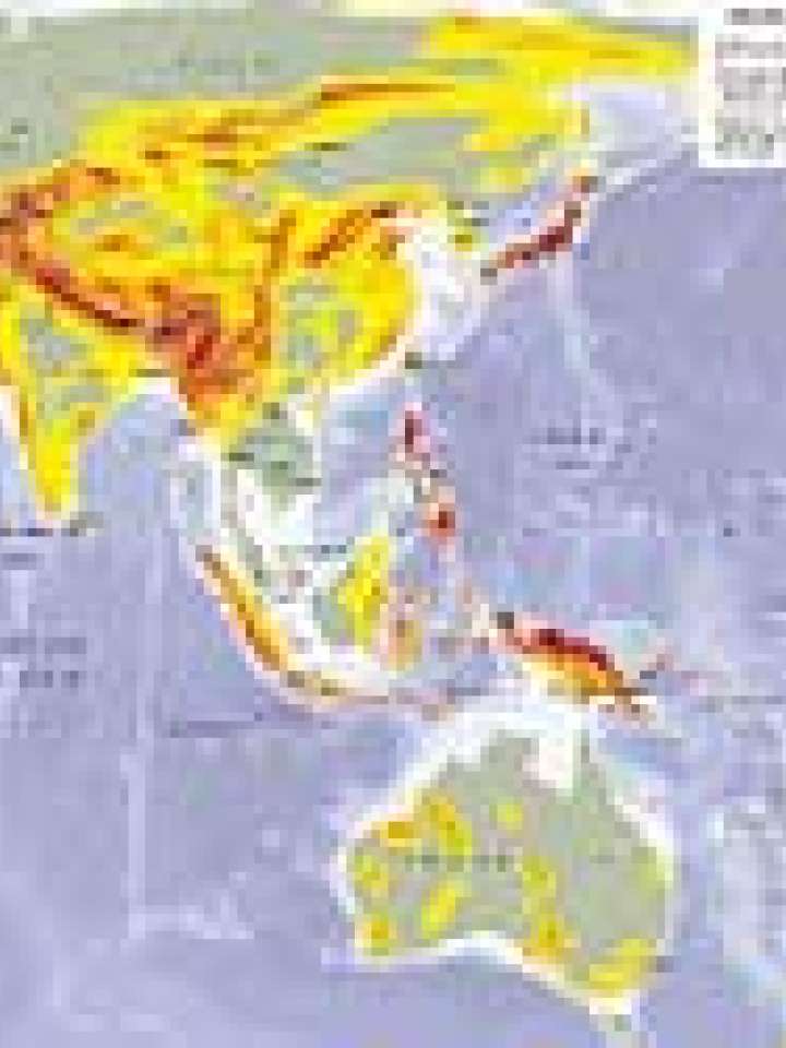
Earthquake intensity risk zones and presence of UNISDR
This map shows earthquake intensity zones in accordance with the 1956 version of the Modified Mercalli Scale (MMS), describing the effects of an earthquake on the surface of the earth and integrating numerous parameters such as ground acceleration, duration of an earthquake, and subsoil effects. It also includes historical earthquake reports.
The zones indicate where there is a probability of 20 percent that degrees of intensity shown on the map will be exceeded in 50 years. This probability figure varies with time; i.e. it is lower for shorter periods and higher for longer periods.
Data from UNEP/GRID and the Pacific Disaster Centre.
Explore further
Hazards
Earthquake
Publication year
2008