Global Assessment Report on Disaster Risk Reduction 2015
Making development sustainable: The future of disaster risk management |
Global Assessment Report on Disaster Risk Reduction 2015
Making development sustainable: The future of disaster risk management |
|
|
217
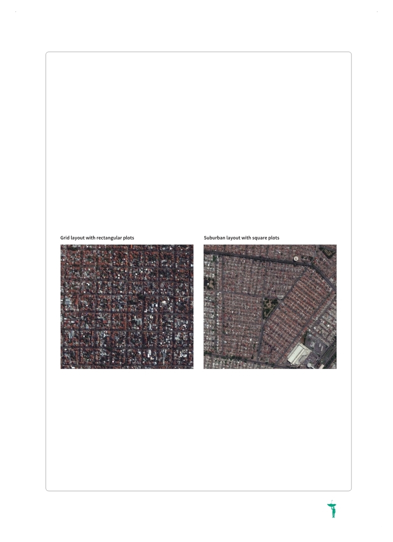
Box 11.2 The influence of urban layout on sustainability and flood risk
For any given set of social and economic requirements, there is always an optimum urban layout. Different urban layouts have vastly different percentages of land utilization and unit circulation lengths (Caminos and Goethert, 1978
Caminos, Horacio and Reinhard Goethert. 1978,Urbanization Primer: Project assessment, site analysis, design criteria for site and services of similar dwelling environments in developing areas, Collection of photographs on urbanization. MIT Press.. . Studies have found that the cost of infrastructure networks per hectare, including storm drainage in a typical modern suburban layout with square plots (see Figure 11.4), is approximately double the cost of an efficient grid layout with rectangular plots. At the same time, the proportion of land required for roads in the suburban layout is 38 per cent, compared to 21 per cent in the grid layout. Thus the suburban layout nearly doubles the area of impermeable paved surfaces, which in turn has critical implications for storm run-off. The length of roads per hectare in the suburban layout is approximately double that in the grid layout, meaning that services such as waste disposal and product delivery have to travel twice the distance to achieve the same result, increasing both costs and carbon emissions. In addition, the wasteful use of land means that there is less safe, well-located land that could be made available for low-income housing. The implication is that an efficient layout reduces the cost of land per inhabitant by making more efficient use of that land. It also dramatically lowers the cost of installing and maintaining infrastructure, particularly storm drainage, which has a critical impact on the capacity of local governments and utility providers to provide such infrastructure. Moreover, efficient layouts decrease the impermeable paved area, mitigating flood hazard, and they shorten the distance that vehicles have to travel to provide basic services. Unfortunately, the influence of urban layout on these factors is too often ignored, even in low-income countries. This increases costs for both residents and their local governments, reduces sustainability, increases flood risks and contributes to climate change.
Figure 11.4 Urban layouts
(Source: Google Earth.)
|
 
Page 1Page 10Page 20Page 30Page 40Page 50Page 60Page 70Page 80Page 90Page 100Page 110Page 120Page 130Page 140Page 150Page 160Page 170Page 180Page 190Page 200Page 207Page 208Page 209Page 210Page 211Page 212Page 213Page 214Page 215Page 216Page 217Page 218->Page 219Page 220Page 221Page 222Page 223Page 224Page 225Page 226Page 227Page 228Page 229Page 230Page 231Page 240Page 250Page 260Page 270Page 280Page 290Page 300Page 310
|
|
 
|
 
|